Archaeologists Discover Medieval Cities Hidden Beneath Cambodian Jungle
With the help of lasers fired at the ground from helicopters, archaeologists have revealed medieval cities hidden beneath dense jungle near the ancient temple city of Angkor Wat.


With the help of lasers fired at the ground from helicopters, archaeologists have revealed medieval cities hidden beneath dense jungle near the ancient temple city of Angkor Wat. The previously undocumented cities range from 900 to 1,400 years old; the largest rivals the Cambodian capital, Phnom Penh, in size. Archaeologists deemed the discovery, which calls into question basic assumptions about Southeast Asian history, the most significant in recent years, the Guardian reported. Together, the cities could have made the Khmer Empire the world’s biggest during the 12th century.
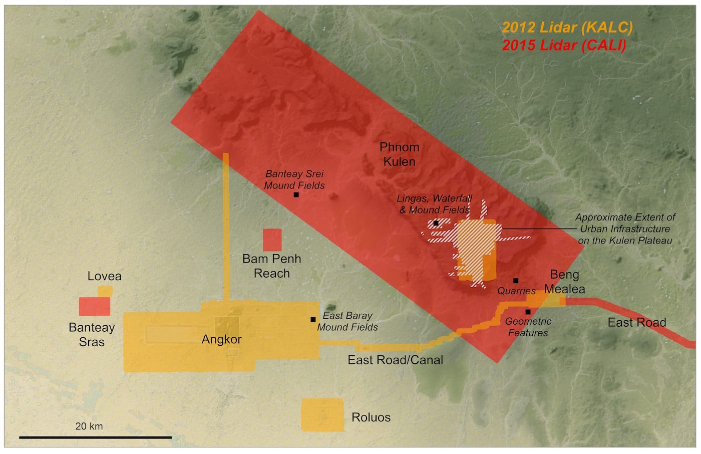
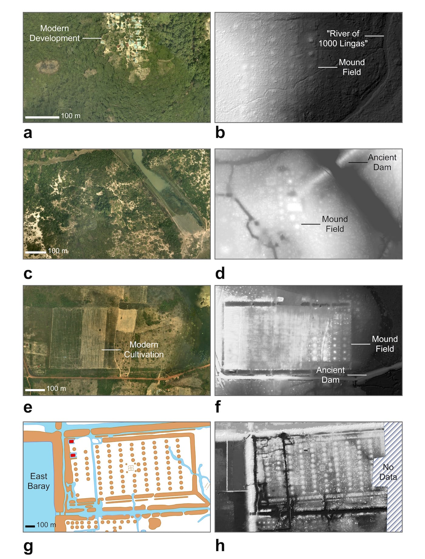
In place of shovels and machetes, cutting-edge light detection and ranging technology, called lidar, allowed researchers to “see through” thick vegetation. With laser scans taken from helicopters, they created hyper-detailed images of the earth’s surface. The scans revealed the remains of extensive roadways and water channels connecting Cambodian city centers. The study, led by Australian archaeologist Dr. Damian Evans, was recently published in the Journal of Archaeological Science.
The findings confirm what some archaeologists long suspected: That there was more to the ancient landscape surrounding Angkor Wat, a UNESCO World Heritage site, than met the eye. “We always imagined that [the Khmer’s] great cities surrounded the monuments in antiquity,” Evans told AFP. “But now we can see them with incredible precision and detail, in some places for the very first time, but in most places where we already had a vague idea that cities must be there.”
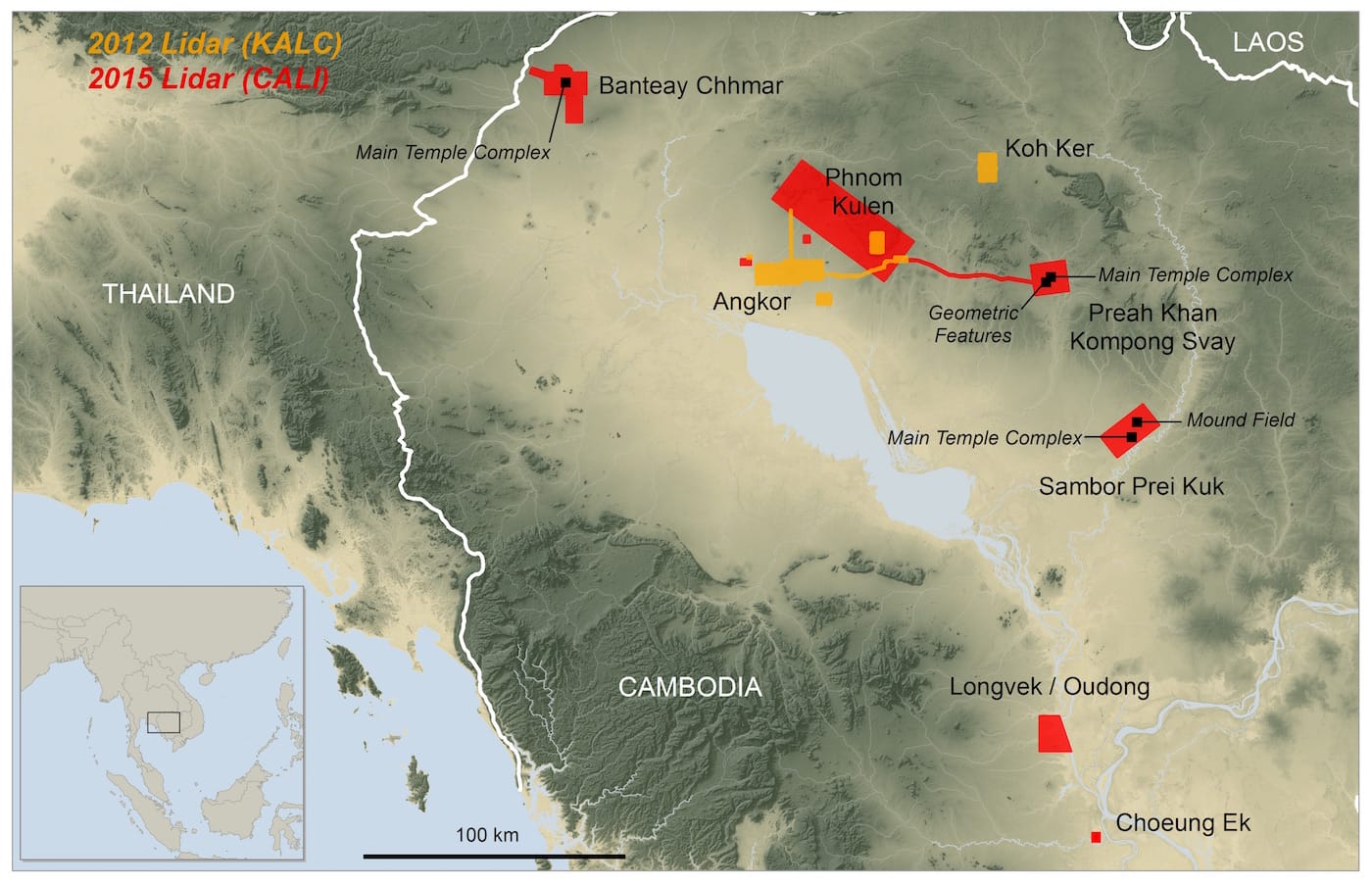
Covering 734 square miles, the lidar survey, conducted in 2015, was the most extensive airborne archaeological study ever done. It expanded on a 2012 lidar survey that confirmed the existence of Mahendraparvata, an ancient temple city, and uncovered an urban landscape connecting other medieval temple-cities, like Beng Mealea and Koh Ker, to Angkor. But it’s only now that the sheer size of the network has been revealed.
“What we had [in 2012] was basically a scatter of disconnected points on the map denoting temple sites. Now it’s like having a detailed street map of the entire city,” Evans said. “The lidar quite suddenly revealed an entire cityscape there with astonishing complexity. It turned out we’d been walking and flying right over the top of this stuff for ten years and not even noticing it because of the vegetation.”
The new data will lead historians to revise their understanding of the Khmer Empire. It may offer clues about what led to the collapse of the empire in the 15th century. “There’s an idea that somehow the Thais invaded and everyone fled down south — that didn’t happen, there are no cities [revealed by the aerial survey] that they fled to,” Evans said. “It calls into question the whole notion of an Angkorian collapse.”
To see the results of the study, visit the official website of the Cambodian Archaeological Lidar Initiative (CALI) at angkorlidar.org.
h/t The Guardian