The Library of Congress Acquires and Digitizes a Rare Mesoamerican Codex
The Library of Congress has acquired and digitized the 16th-century Codex Quetzalecatzin, a rare Mesoamerican record of early European contact.

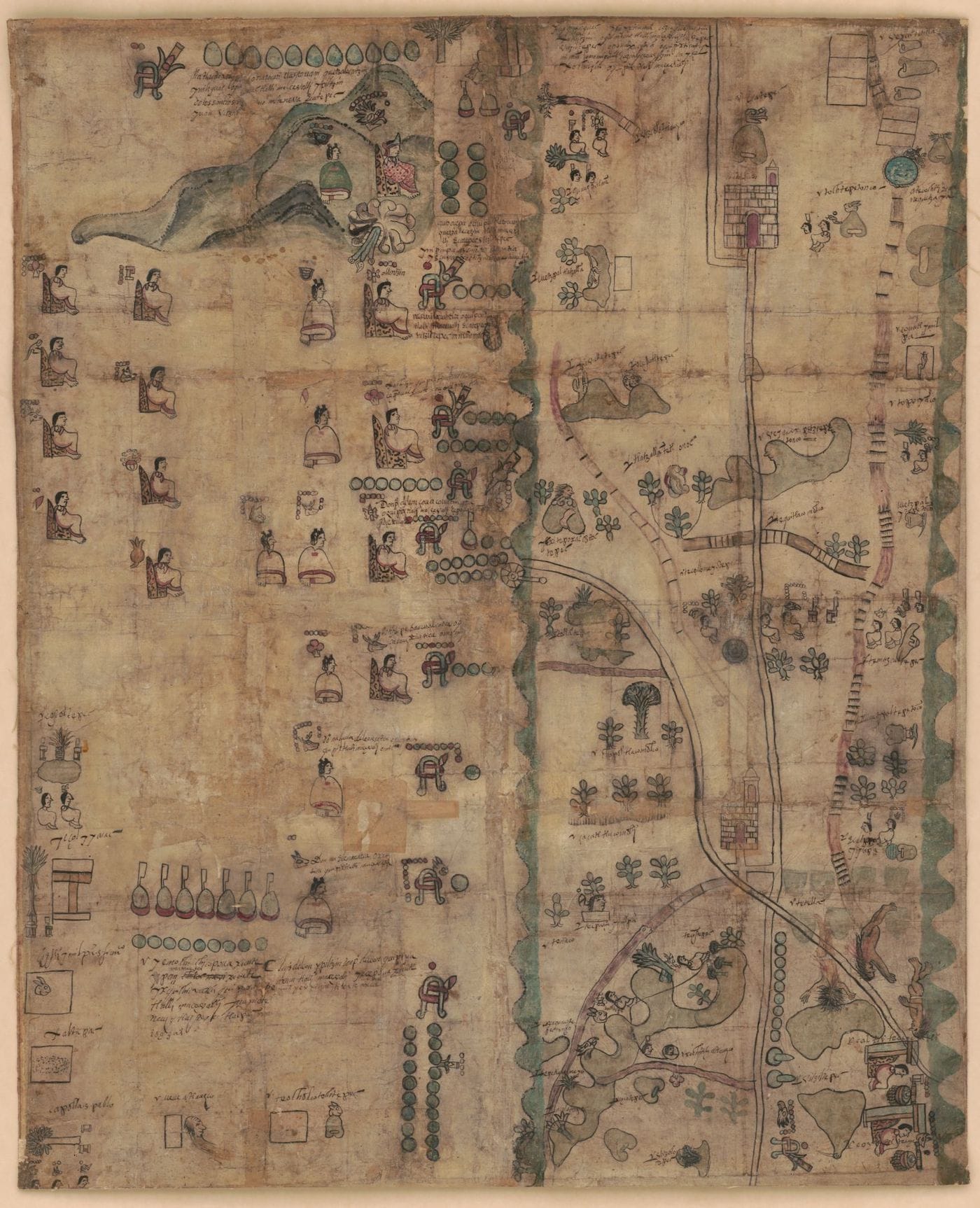
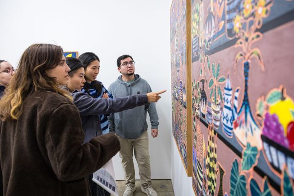
The Library of Congress (LOC) announced this week that it had acquired and digitized an incredibly rare 16th-century Mesoamerican manuscript. Known as the Codex Quetzalecatzin, it dates from between 1570 and 1595, and was created during a moment of Spanish royal investigation into the resources of their colonies. This era of maps were mostly painted by indigenous artists, and the detailed cartography of the manuscript includes local symbols for geographic features like rivers, roads, and paths.
The Codex, also called the Mapa de Ecatepec-Huitziltepec, has been in private collections for over 100 years. It is now available to the public online for the first time. In a post for LOC’s Worlds Revealed blog, John Hessler, curator of the LOC’s Jay I. Kislak Collection for the archaeology of the early Americas, describes the Codex, which shows “the de Leon family presiding over a large region of territory that extends from slightly north of Mexico City, to just south of Puebla”:
As is typical for an Aztec, or Nahuatl, codex of this early date, it relates the extent of land ownership and properties of a family line known as “de Leon,” most of the members of which are depicted on the manuscript. With Nahuatl stylized graphics and hieroglyphs, it illustrates the family’s genealogy and their descent from Lord-11 Quetzalecatzin, who in 1480, was the major political leader of the region. It is from him the Codex derives one of its many names.
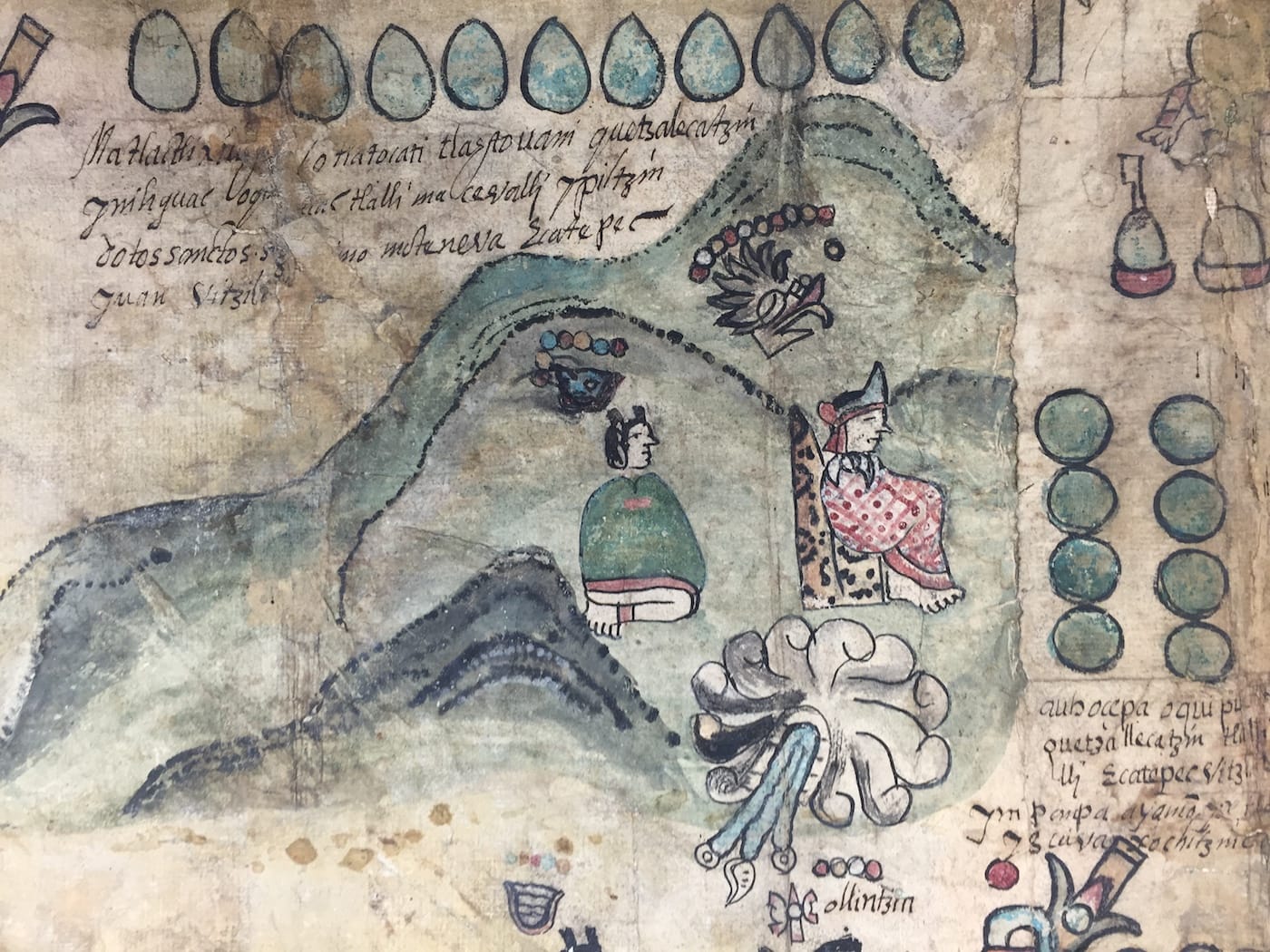
Hessler adds that “only around 450 Mesoamerican pictorial manuscripts survive to the present day, and less than 100 pre-date 1600.” Thus it’s an important record of early European contact in the Americas, and indigenous artistry. Natural pigments, such as Maya Blue and cochineal red, give the illustrations of people and places their still-vibrant hues. Included among the drawings is Lord-11 Quetzalecatzin, seated on a throne, as well as churches and Spanish place names.
Significantly, its notations list members of the indigenous elite, including “don Alonso” and “don Matheo,” indicating a colonial period for the map through their use of Spanish titles and Christian names. In this Thanksgiving week, when the European arrival in the Americas is marked as part of the holiday in the United States, it’s a valuable reminder of a long history of erasing indigenous heritage.