Ancient Maya City Discovered in Southeastern Mexico
Archaeologists derived the findings from data collected in 2013 as part of a forest-monitoring survey.

Archaeologists say they have found evidence of thousands of previously unknown Maya structures in southeastern Mexico, including an entire city.
The findings, which were published yesterday, October 29, in the peer-reviewed archaeology journal Antiquity, were derived from data gathered in 2013 via airborne light detection and ranging (LiDAR) technology as part of a forest-monitoring survey measuring carbon emissions.
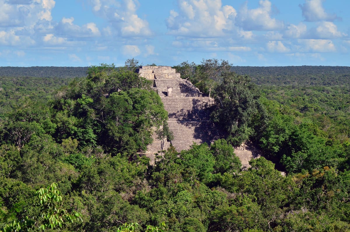
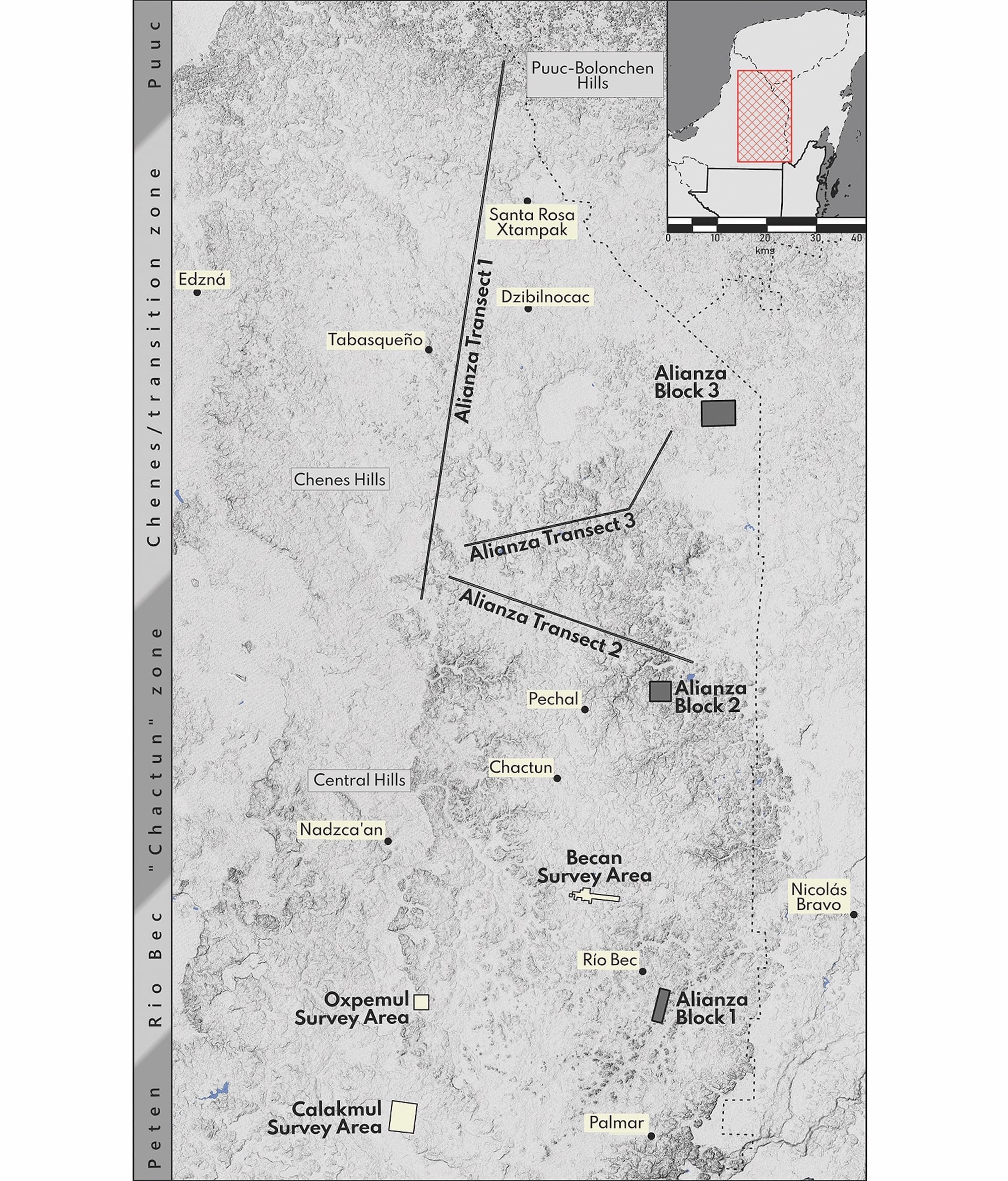
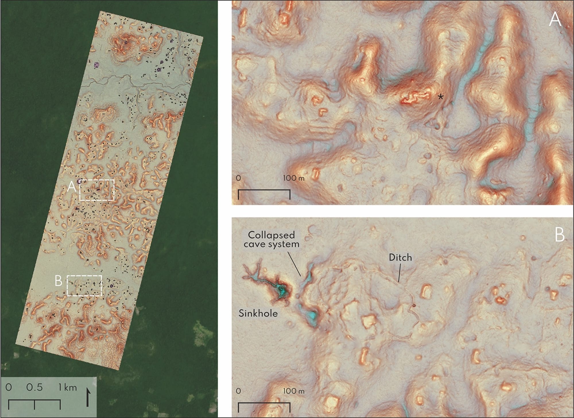
According to the report, researchers uncovered a dense array of 6,674 completely unstudied structures in the state of Campeche, including sports fields, amphitheaters, and monumental pyramids, located in close proximity to an active farming community. The dataset also showed a previously unknown city, which the archaeologists have named "Valeriana" after a nearby freshwater lagoon.
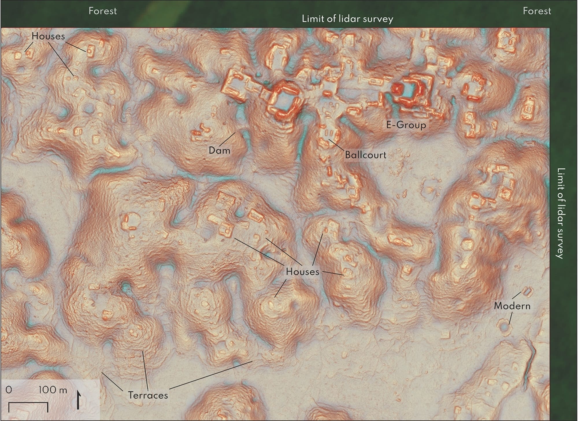
Researchers believe it could be the second-densest known ancient Maya site in that region, surpassed only by Calakmul, which is located about 20 miles (~32 km) from the Guatemalan border. Valeriana features several enclosed plazas linked by a wide road, temple pyramids, a ballcourt, a reservoir, and what is likely an E Group, or a unique architectural assemblage frequently found in ancient Maya settlements established before 150 CE.
"The government never knew about it; the scientific community never knew about it. That really puts an exclamation point behind the statement that, no, we have not found everything, and yes, there’s a lot more to be discovered," said Luke Auld-Thomas, lead author of the report, in a press statement.
A PhD student at Louisiana's Tulane University, Auld-Thomas worked with other researchers from the college along with Mexico's Instituto Nacional de Antropología e Historia and the University of Houston's National Center for Airborne Laser Mapping to reach these findings.
In recent years, LiDAR laser scanning has allowed researchers to analyze large swaths of densely forested land in Mexico in their search for undiscovered ancient settlements and structures, as opposed to conducting the time-consuming, on-the-ground assessments previously required for archaeological surveys.
Last year, researchers uncovered hundreds of Preclassic and Classic Maya settlements using this laser-scanning method. Still, while LiDAR has quickened the pace of archaeological research, it is expensive, which can often deter grant-funding organizations from investing in survey assessments of completely unstudied areas that could potentially lack ancient Maya structures.
This obstacle led Auld-Thomas to look into preexisting non-archaeological LiDAR datasets that had been collected for ecological and civil engineering purposes. He came across the 2013 environmental survey while scouring the internet for publicly available data.
Because the researchers have not physically visited the site, Auld-Thomas told Hyperallergic that the next step will require formal on-the-ground investigations.
Currently, a team in Mexico led by Adriana Velázquez Morlet, a co-author of the report, is coordinating a trip to the site.
“The ancient world is full of examples of cities that are completely different than the cities we have today,” Auld-Thomas said in a statement. "Given the environmental and social challenges we’re facing from rapid population growth, it can only help to study ancient cities and expand our view of what urban living can look like."


