Art
Mo Kong Maps a Post-Climate Change Future
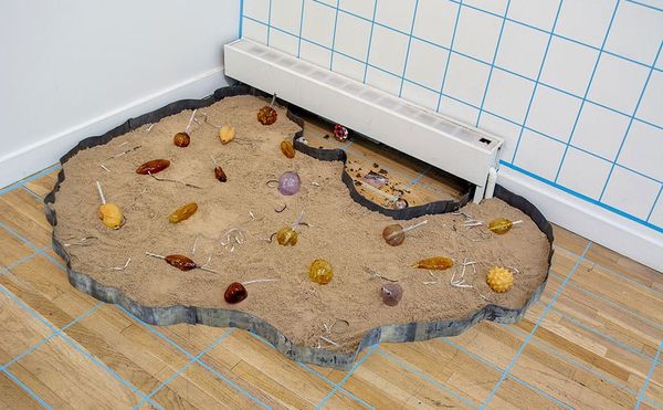
Kong’s background as a recent Chinese immigrant and, especially, a former investigative reporter help account for the exhibition’s methods and mood.
Art
Kong’s background as a recent Chinese immigrant and, especially, a former investigative reporter help account for the exhibition’s methods and mood.
Art
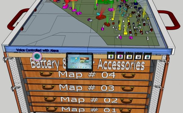
A mobile mapping station being developed by a team in the Master's Urban Planning department at Lawrence Technical University, wants to help residents of embattled neighborhoods.
Art
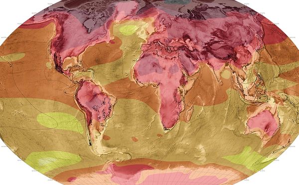
The Atlas for the End of the World maps the end of Earth as a biodiverse resource for human exploitation.
Art
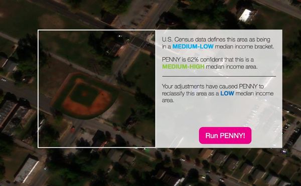
Penny is an experiment in what high and low income areas look like to an AI trained on satellite imagery and census data.
Art
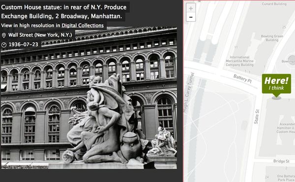
The New York Public Library has thousands of historical photographs and illustrations of NYC that you can help geotag with a new tool called "Surveyor."
Books
The Phantom Atlas chronicles centuries of fictional locations that were included on maps of the world.
News
To mark the 75th anniversary of its Cartography Center, the Central Intelligence Agency (CIA) shares decades of declassified maps.
Art
Some maps are not designed to chart geography, but to express a particular belief.
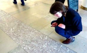
Art
The building blocks of urban landscapes are often riddled with fossils, with Jurassic reptile bones and Cretaceous sea creatures sometimes emerging from the stone surfaces.
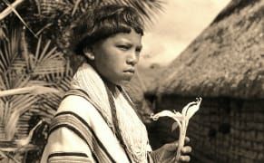
Art
Richard Evans Schultes took peyote with the Kiowa in Oklahoma in the 1930s, was the first scientist invited to a hallucinogenic yagé ceremony in the Amazon's Sibundoy Valley in the 1940s, and inadvertently helped launch the psychedelic era of the 1960s.
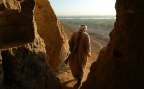
Art
Constructed from stacked rocks and carved into remote mountainsides, the desert hermitages of Egypt and Sudan are barely perceptible in the arid landscape.
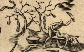
Art
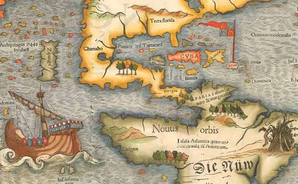
Many of the first European maps of the Americas included warnings of cannibalism, despite no proof of such activity.