
Books
A New Guide Maps the Overlooked Brutalism of Paris
The Brutalist Paris Map plots 40 sites of postwar architecture in Paris that are far off the well-trod tourist path.
Books
The Brutalist Paris Map plots 40 sites of postwar architecture in Paris that are far off the well-trod tourist path.

Art
The CIVICUS Monitor is an interactive map that gathers news about crackdowns on civil society in 134 countries.
Books
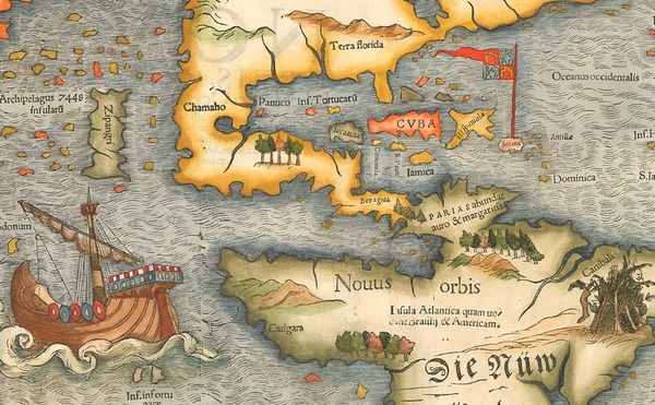
The Phantom Atlas chronicles centuries of fictional locations that were included on maps of the world.

Books
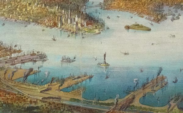
Rebecca Solnit and Joshua Jelly-Schapiro's book Nonstop Metropolis charts the overlooked geographic history of New York City.
News
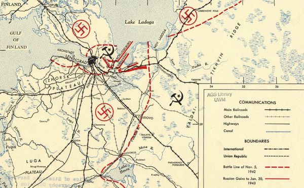
To mark the 75th anniversary of its Cartography Center, the Central Intelligence Agency (CIA) shares decades of declassified maps.

Art
The National Library of Scotland received a bundle found in a chimney, and six months of conservation revealed the rags to be a rare 17th-century map.

News
The Library of Congress has joined the Digital Public Library of America as a content hub and is sharing around 5,000 objects from its map collections.
Books
Artists and designers through the age have imposed their visions of the present and future on an always-changing New York.

Art
The National Park Service and the Cultural Landscape Foundation launch a guide to New York City's cultural landscapes as part of a series on urban design.

Art
Since the 1990s, collector David Rumsey has digitized and made freely available his thousands of historical maps; his site has long been one of the best resources for cartography.
Art
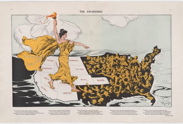
Some maps are not designed to chart geography, but to express a particular belief.

News
New York City has over 1,000 monuments across the five boroughs, and the new NYC Public Art Map and Guide plots them on an interactive map