Art
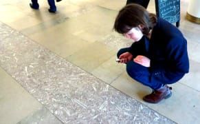
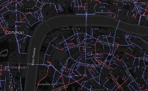
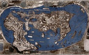
Mapping the Fossils and Meteorite Impacts in London's Architecture
The building blocks of urban landscapes are often riddled with fossils, with Jurassic reptile bones and Cretaceous sea creatures sometimes emerging from the stone surfaces.
Art
The building blocks of urban landscapes are often riddled with fossils, with Jurassic reptile bones and Cretaceous sea creatures sometimes emerging from the stone surfaces.
Art
Mounted on remnants of the old Ming Dynasty city wall, which once surrounded Beijing, are Western clocks and astronomical instruments for observing celestial bodies.
Books
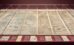
Originally intended purely as tools for navigation, maps have long branched off from this practical function to become an unexpected medium for visual expression.
Art
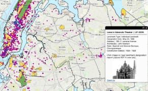
Last month, the New York City Landmarks Preservation Commission (LPC) voted to recommend 30 of the sites from its backlog of nearly 100 as potential landmarks.
Art
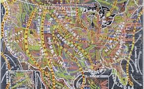
Paula Scher, the first female principal of Pentagram and designer of identities for the Public Theater and Tiffany's — not to mention hundreds of hit album covers — grew up surrounded by maps.
News
"Globes have a very low survival rate," explained Ian Fowler, director of the Osher Map Library (OML) at the University of Southern Maine.
Art
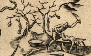
Many of the first European maps of the Americas included warnings of cannibalism, despite no proof of such activity.
Art
This August, activist group Osez le Féminisme (Dare to be Feminist) installed guerrilla signs in Paris to rename streets and parks after women like singer Nina Simone, sailor Florence Arthaud, and author Simone de Beauvoir.
Art
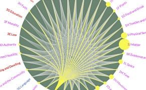
A three-year project from the University of Glasgow's School of Critical Studies mapped 13 centuries of metaphors in the English language.
In Brief
You might call Henricus Martellus's 1491 world map — which many believe Christopher Columbus consulted before setting out on his voyage — a symbol of the limits of human knowledge.
Art
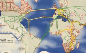
When aviation took off in the early 20th century, safety was still shaky and the public needed some convincing to get them soaring among the clouds in the noisy metal contraptions.
News
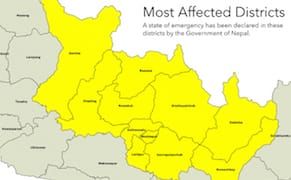
A crucial need in any rescue effort — perhaps just as important to saving lives as medical supplies, food, and tents — is an up-to-date map that humanitarian workers can use to more efficiently navigate the rubble.