Before Google Earth: A Rare Cartographic Compendium From Renaissance Europe
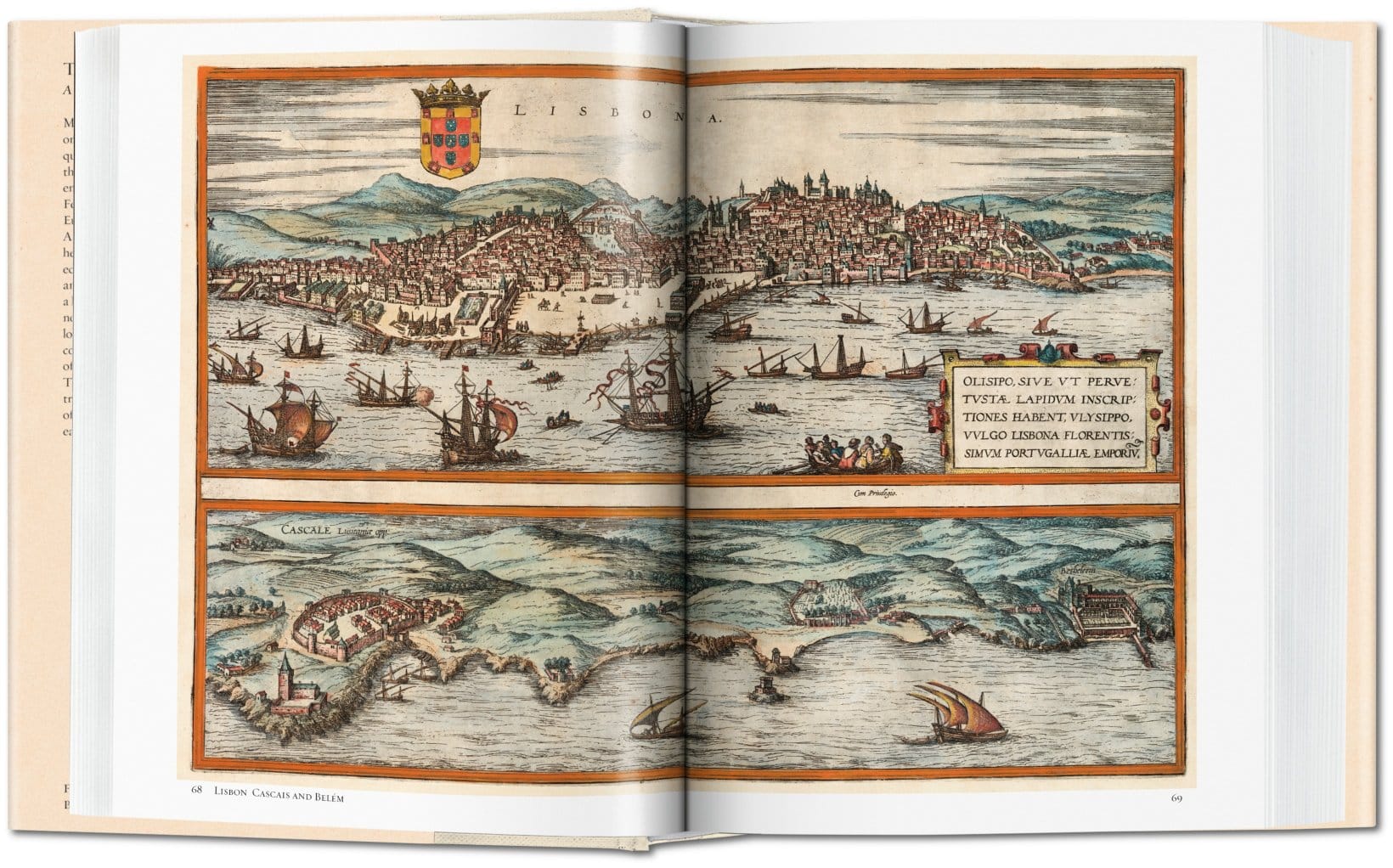
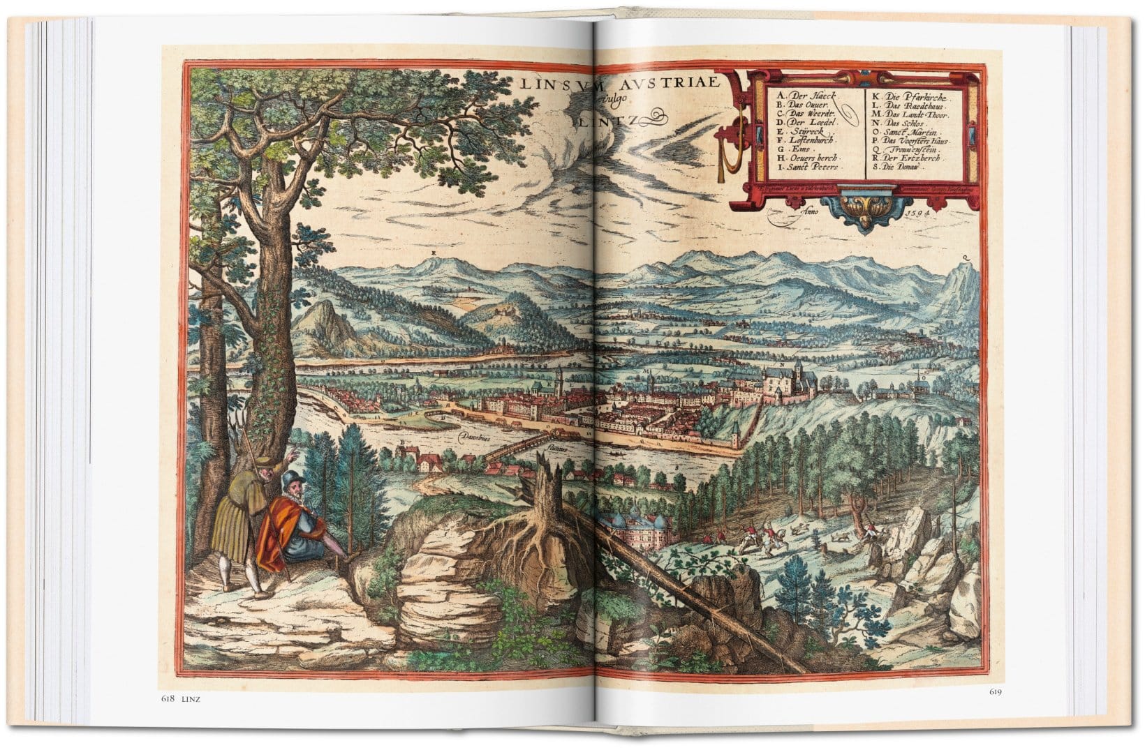
Long before the ubiquity of Google Maps, these colorful engravings, produced between 1572 and 1617, comprised the world's most accurate and elaborate collection of urban cartography ever made.

“Kindly and most esteemed reader, we hereby place on the market the next book of the most noble cities of the entire world, of which I hope that it will please you very much, because the first book was received with such great pleasure and was so highly sought-after that not a single copy still remains nor is available to buy,” wrote editor and publisher Georg Braun in the preface to the 1576 German-language edition of Civitates orbis terrarum, his sprawling atlas of cities of the world.
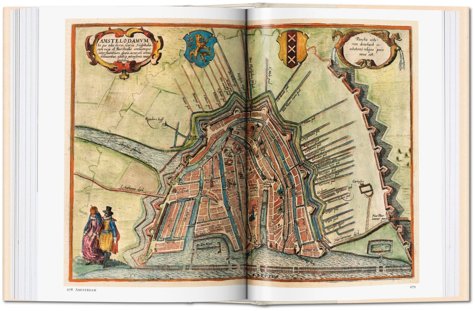
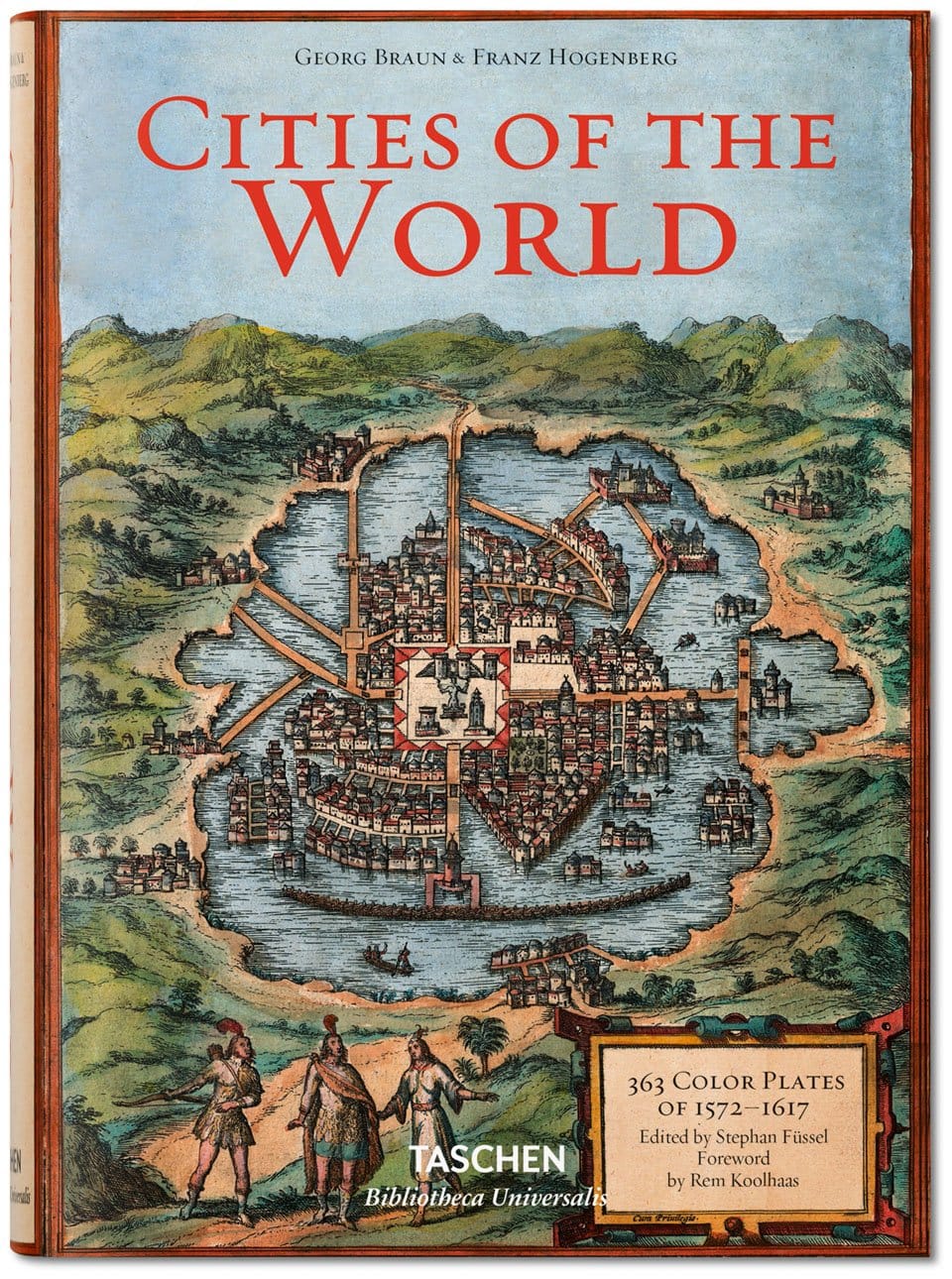
Long before the ubiquity of Google Maps, these colorful engravings, produced between 1572 and 1617, comprised the world’s most accurate and elaborate collection of urban cartography ever made. Now, more than four centuries after Civitates orbis terrarum‘s first publication, Taschen has published a reprint of 363 of its most intricate town map engravings, making this gorgeous early cartography accessible to the digital age.
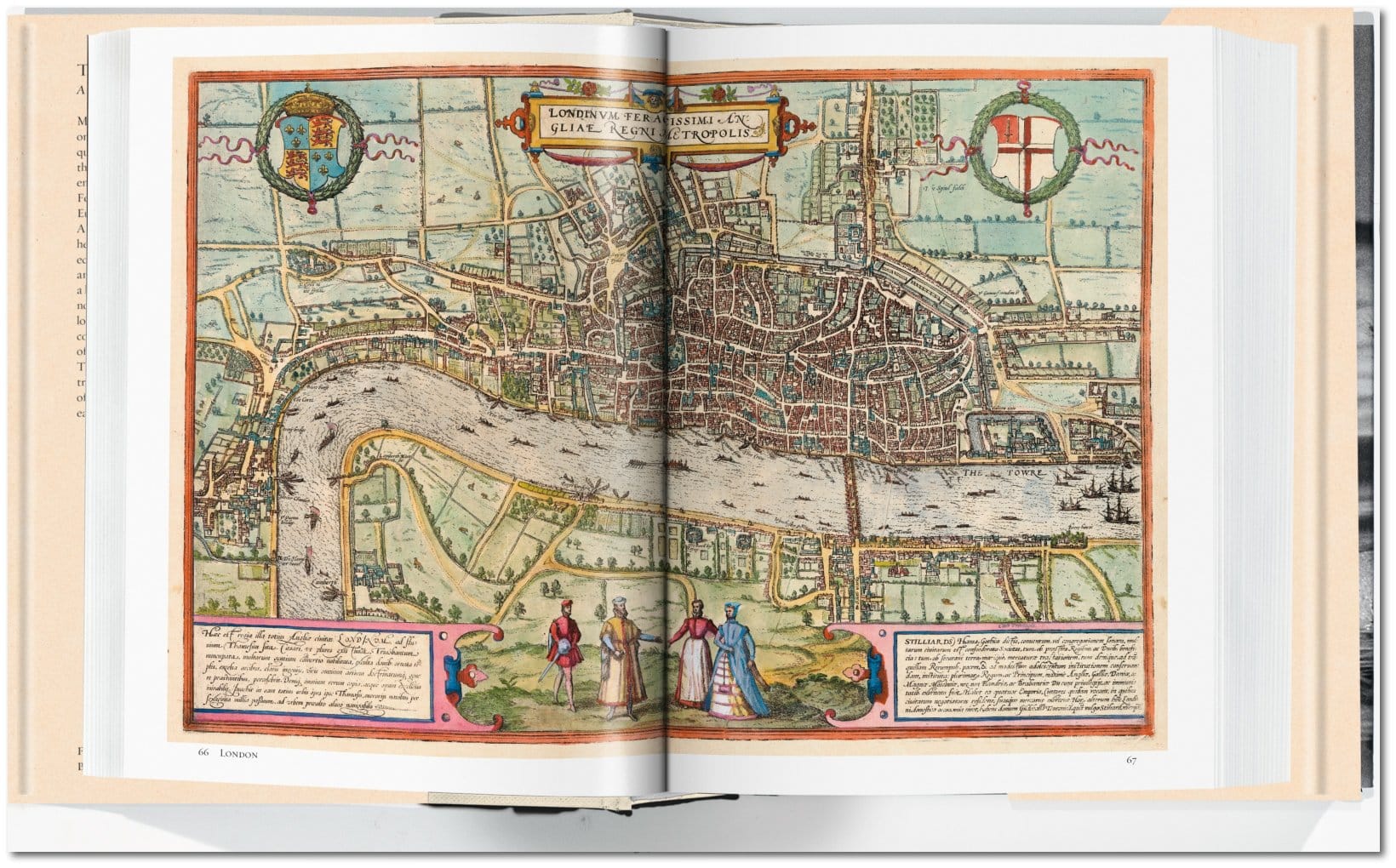
Though current digital mapping projects, like the Missing Maps Project, use cutting-edge technology, they do share one thing in common with Braun’s technique: crowdsourcing. Braun drew on more than 100 artists and cartographers around the world to contribute maps and engravings to the project, creating a comprehensive portrait of the world in just six volumes. Together, they compiled the book’s 546 prospects, bird’s-eye views, and maps of all major cities in Europe, plus major urban centers in Latin America, Africa, and Asia. “Should anyone not find their home town or native city in either of these first two books, I would kindly invite them to draw it from life and send it to me,” Braun wrote in the book’s preface. “Then I will have it faithfully copied by the skilled Franz Hogenberg,” the collection’s principle engraver. Most maps included not just geographic visual data, but also images of local fashions, courtroom scenes, and daily life, providing a complete picture of each city’s local culture at the turn of the 17th century.
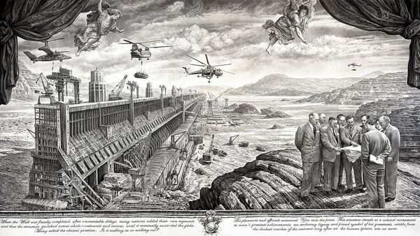
At the time of its publication, Civitates orbis terrarum was a blockbuster hit. For readers throughout Renaissance Europe, its maps brought an outsized globe down to a manageable human scale. Now, the collection is a portal back to a pre-globalized world, a historical relic that sparks reflections on change. The engravings are illustrated with generic pictorial representations of houses, alleys, streets, squares, churches, palaces, and fortifications. “Every portrait effortlessly reveals the unique qualities of each of these settlements with an artless efficiency that has become unthinkable,” writes architect Rem Koolhaas in the book’s foreword. “Half a millennium later, our cities have become monstrous: too endless to represent, endlessly complicated, largely dysfunctional.” The idea of drawing every building in, say, today’s New York City is overwhelming, though one artist is trying his best.
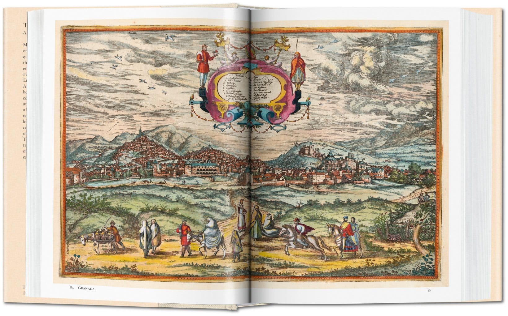
The images are largely rendered in three coded colors: green for land, red for city, and blue for water. “Five hundred years later,” Koolhaas writes, after rampant globalization in many areas, “red would be the only color left.”
Half a millennium later, digital maps let us virtually travel nearly anywhere in the world without leaving our desk chairs. As cool as Google Earth is, this old school map collection reminds us of what’s lost with technology’s convenience. “The accumulated insight and knowledge that these volumes represent stand in stark contrast to the current virtual ubiquity of information,” says Koolhaas. “Our navigation systems make the world tangible and incredibly concrete; they enable us not to know and to forget.”
Georg Braun and Franz Hogenberg’s Cities of the World is available from Taschen.