How an Imaginary Island Stayed on Maps for Five Centuries
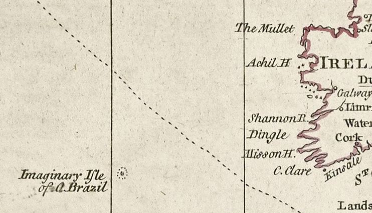
A tiny blot of a landmass off the western coast of Ireland is curiously labeled "Imaginary Isle of O Brazil" on cartographer Thomas Jefferys's 1768 "Chart of the Atlantic Ocean." A 21st-century viewer might wonder: why include a fictional island on a map of the known world?

A tiny blot of a landmass off the western coast of Ireland is curiously labeled “Imaginary Isle of O Brazil” on cartographer Thomas Jefferys’s 1768 “Chart of the Atlantic Ocean.” A 21st-century viewer might wonder: why include a fictional island on a map of the known world?
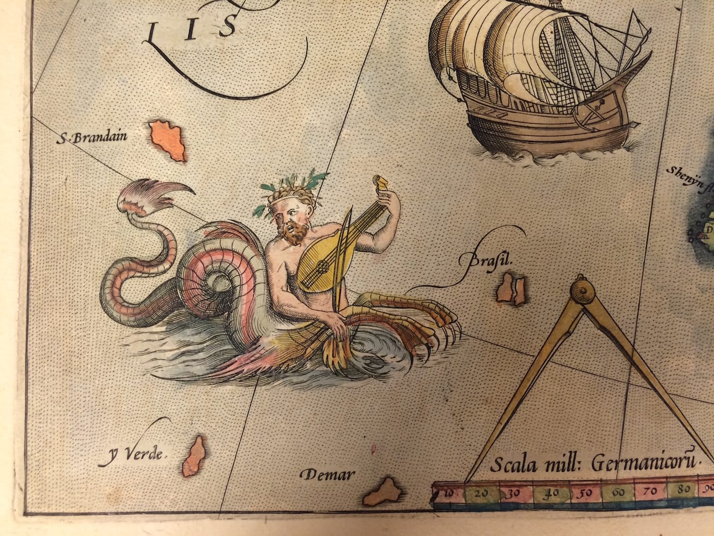
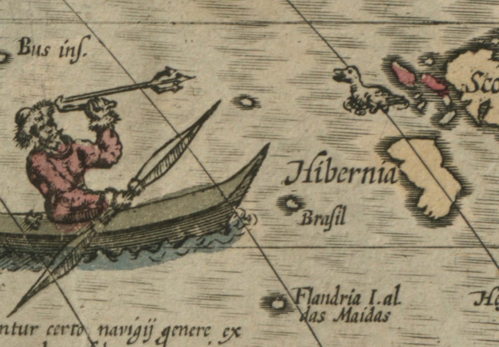
O Brazil, or Hy-Brasil as it was frequently was labeled, had haunted maps since the 14th century, first as a mistake, then as a mythological tribute. Its size and shape often morphed, its location wandered from Ireland to North America, and its name varied, but for five centuries it endured in Western cartography.
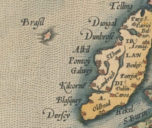
“There were a number of mythical or imaginary places that appeared on maps, beginning in the early 14th century,” Stephanie Cyr, assistant curator in the Norman B. Leventhal Map Center at the Boston Public Library, told Hyperallergic. “In the north Atlantic Ocean, the islands of St. Brendan, Hy-Brasil, Maida, and Bus all appear on early maps. Local legends and oral folklore spread to merchants and seafarers, and folk stories gave way to accounts of actual sightings of these places, which accounted for their appearance on maps. After a number of failed attempts at finding islands like Hy-Brasil, and disputed reports, these places were eventually removed from maps.”
Hy-Brasil: Mapping a Mythical Island, a small display in Boston’s Norman B. Leventhal Map Center, explores this history through archival material and contemporary art by Caoimhghin Ó Fraithile. A larger online component includes 40 maps from the 14th to 19th centuries charting Hy-Brasil. Recently a floating sculpture by Ó Fraithile called “South of Hy-Brasil” was installed in the Fenway section of Boston’s Emerald Necklace park system (aka the Fens). Bobbing behind Museum of Fine Arts, Boston, the temporary island is on view through mid-October as part of Medicine Wheel Productions’s Tír na nÓg, or Otherworld, series in collaboration with the Fenway Alliance’s Public by Design Initiative. The exhibition and art installation are in conjunction with a greater commemoration project for the anniversary of the 1916 Easter Rising insurrection.
“Caoimhghin Ó Fraithile’s public art piece focuses on the island, so we took a look at our oldest maps in the collection, and discovered that we have dozens of maps that feature not only Hy-Brasil, but other imaginary islands,” Cyr said. “We consider the online exhibition an ongoing project, and as we continue to find appearances of Hy-Brasil on maps in atlases, we will add those to the overall online experience.”

There are all sorts of legends attached to Hy-Brasil, including giant black rabbits that lived with a sorcerer, gods hidden by the mists, lost civilizations, and, more recently, UFOs. However, its greatest connection is to Irish folklore, particularly the belief in the “Otherworld” and its Elysium, a “Land of Youth.”
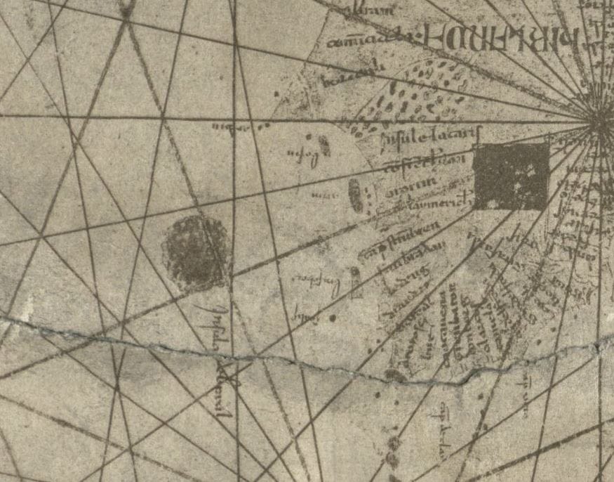
When it first was illustrated on a 1325 map, Hy-Brasil was considered to only be visible once every seven years due to the heavy mists, its land housing an immortal race of people. The earliest example in Mapping a Mythical Island is a nautical chart from 1339 (presented in an 1890 facsimile), where Hy-Brasil seems to seep into the sea like a dab of ink.
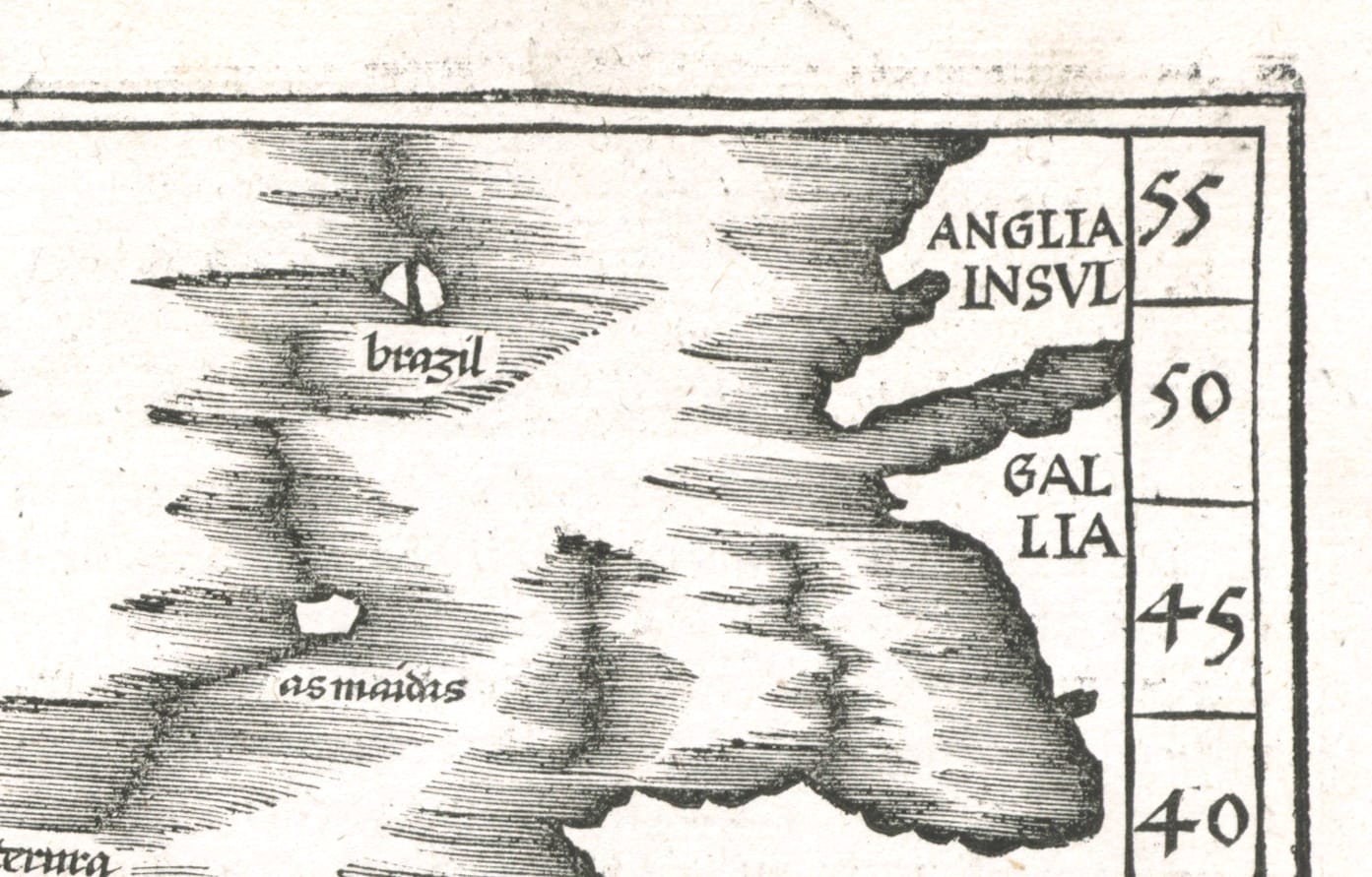
Hy-Brasil is among numerous phantom islands that populated early maps, resulting from optical illusions, misinformation, or just a lack of exploration. And like Hy-Brasil, they were often considered realms of unbelievable terrors and wonders, such as the Isle of Demons charted in the 16th and 17th centuries near Newfoundland, Canada, which was believed to be populated by devilish horrors. In other instances, phantom islands were intentional mistakes; one of the more infamous errors being Robert E. Peary’s Crocker Land, which the early 20th-century explorer employed as a hoax to gain further backing from his financial supporter George Crocker. Even our more recent cartography sometimes includes “trap streets,” where mapmakers embed a fictional thoroughfare to catch people who may be copying their work.
Yet Hy-Brasil is interesting in being a myth that was for a time treated as reality, and a land that remained on maps beyond when it was identified as purely legend by sailors. The final example in the exhibition is James Imary and Son’s 1859 chart of the Atlantic Ocean, published just before Hy-Brasil was removed by the British Admiralty from their navigational charts in 1873.
“With these pieces, visitors will be introduced to Hy-Brasil as it existed on early maps, and how the legendary island is interpreted by a 21st century artist,” Cyr said. “The fact that the legend has lasted this long and that it is still being interpreted through art is testament to its power, and the story’s resonation with people.”
Hy-Brasil: Mapping a Mythical Island continues through October 23 in the Norman B. Leventhal Map Center of the Boston Public Library (700 Boylston Street, Copley Square, Boston).