Learn to Spot Unknown Archaeological Sites from Space
GlobalXplorer relies on crowdsourcing and high-resolution satellite imagery to protect and identify archaeological sites around the world that are currently unknown.

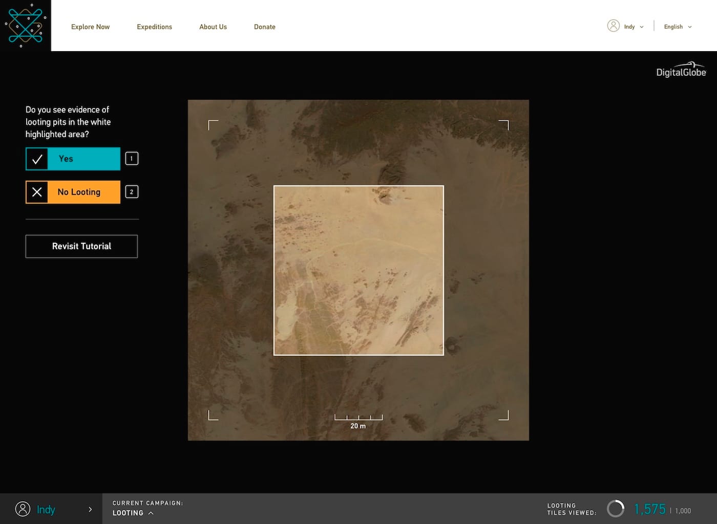
A recently launched website is inviting you to become a citizen archaeologist. GlobalXplorer, self-described as an “Indiana Jones Meets Google Earth” platform, relies on crowdsourcing and high-resolution satellite imagery to protect and identify archaeological sites around the world that are currently unknown. Open to anyone with internet access, it trains users to spot tell-tale signs left by man — from shapes indicative of ancient structures to scars marked by looters — and flag areas potentially in need of exploration.
GlobalXplorer is the brainchild of Dr. Sarah Parcak, who describes her work as “space archaeology,” as she spends much of her time closely examining satellite imagery for clues of forgotten civilizations. Parcak won the TED Prize last year for her work, and the $1 million she received went into launching her project, which also partners with National Geographic, satellite imagery provider DigitalGlobe, and Sustainable Preservation Initiative (SPI) to form a large coalition that engages both remotely and locally with the surveyed countries.
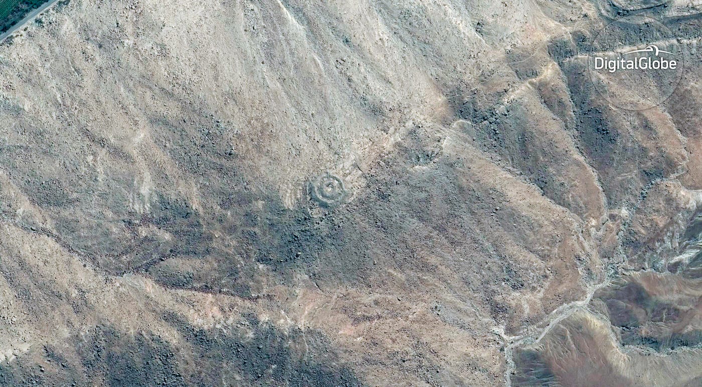
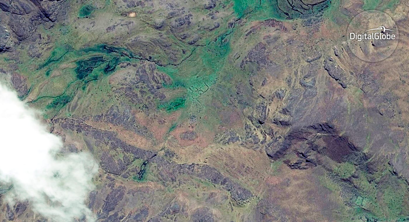
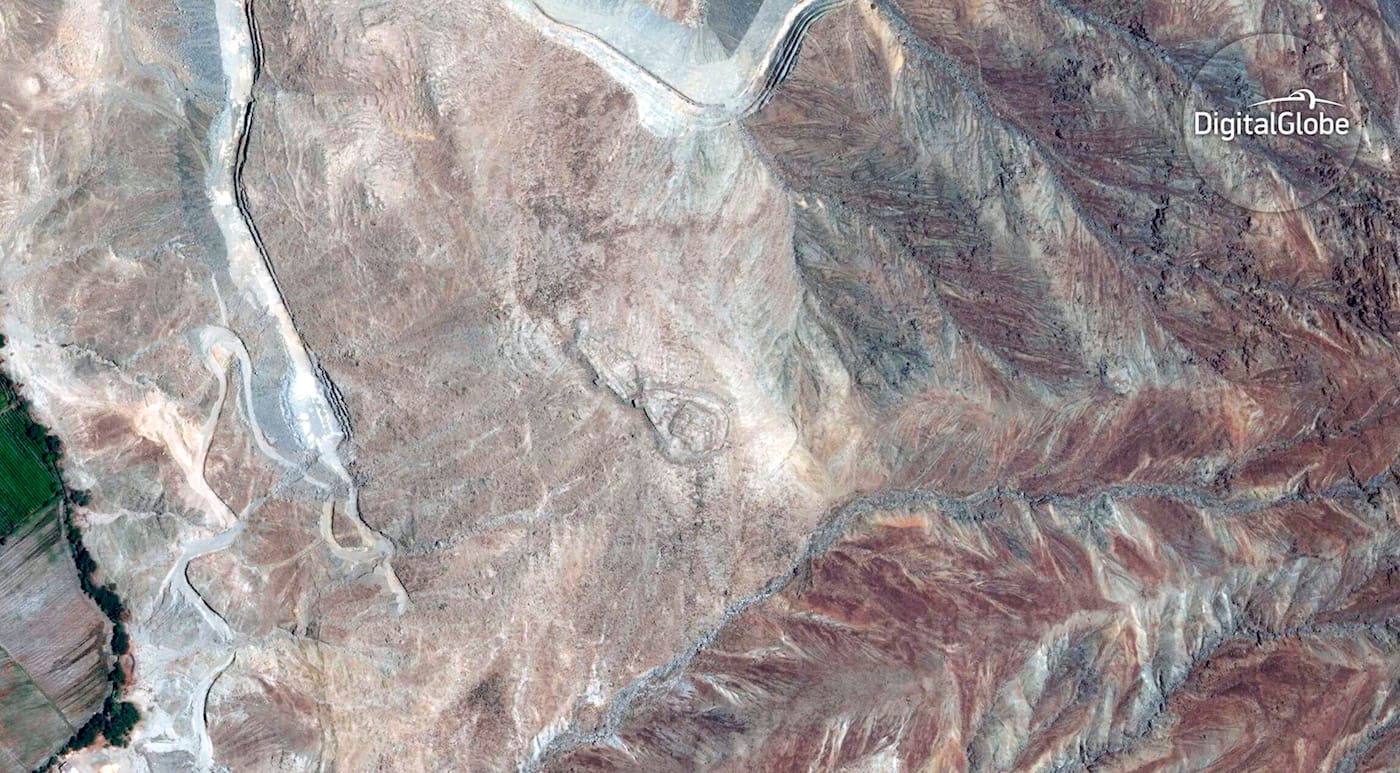
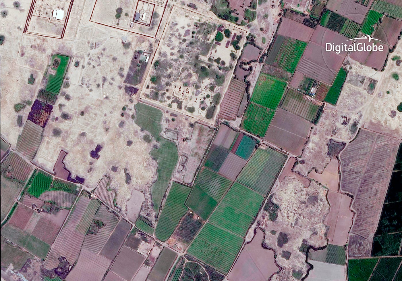
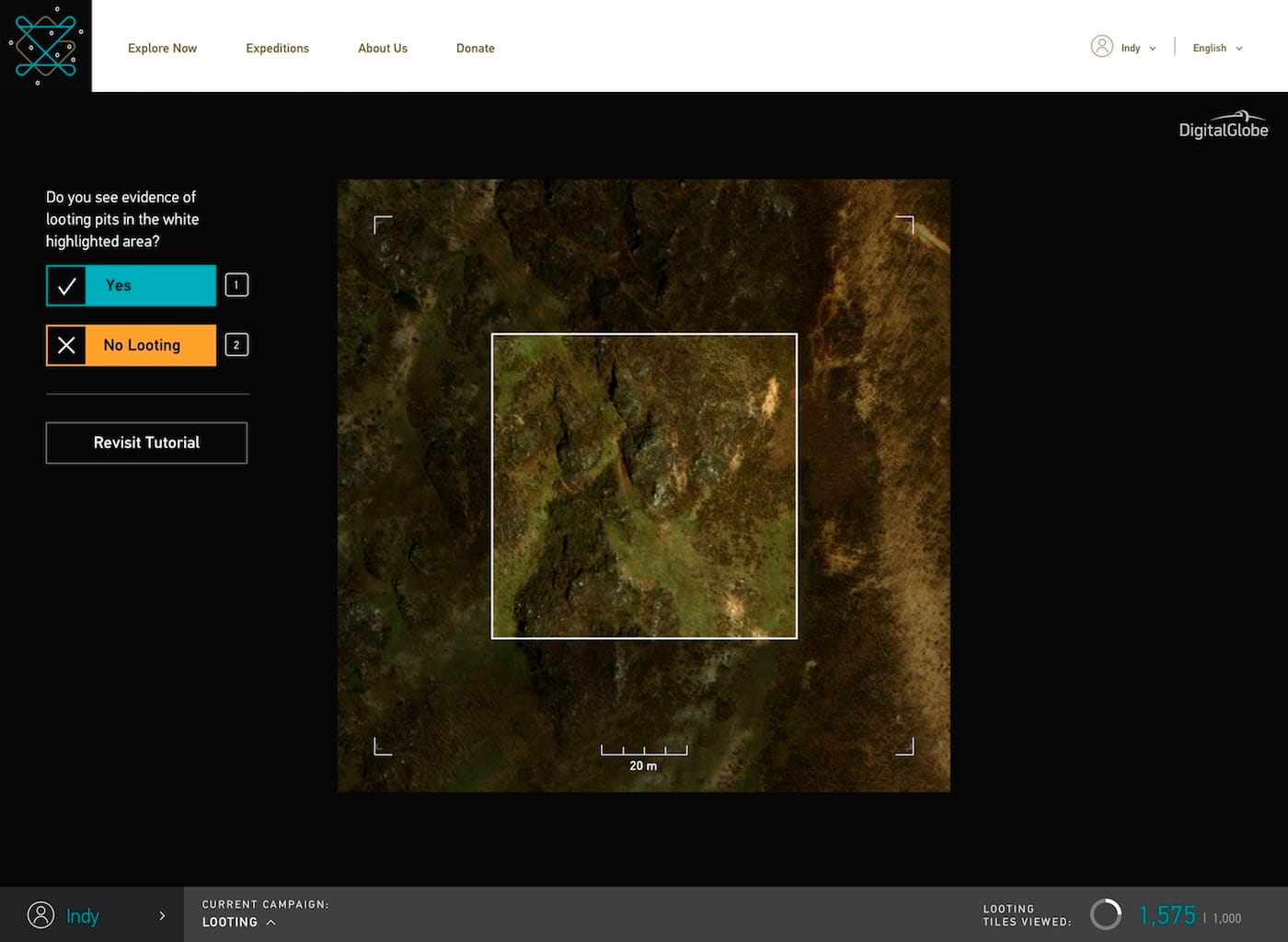
The task given to users is relatively easy: You’re presented with tiles that capture a sample region of Earth’s surface in high-resolution; after examining each one, you click buttons indicating whether signs of looting, illegal construction, or a potential ancient structure are present. GlobalXplorer’s tutorial video teaches you how to analyze these images, going over the common characteristics of looters, from the tell-tale clusters of deep pits to the tracks left by bulldozers used to ram through large areas. Ancient ruins may also be identified by perfectly linear and circular shapes or by certain shades of vegetation. The exploration also feels similar to a game: You receive rewards for clicking through more tiles, including an opportunity to virtually join archaeologists on an on-the-ground dig. Like in a video game, you also level up as you complete tiles, working your way up from amateur Wanderer to expert Space Archaeologist.
Parcak and a team of archaeologists review all the tiles classified by the community, and ones flagged as potential archaeological sites may eventually be explored and protected. To measure accuracy, every user has a consensus score that is earned and adjusted based on whether people who’ve reviewed the same tiles have arrived at the same conclusion. A low score likely means you should revisit the tutorial video.
This open access, of course, means looters themselves may dig into the resource, but GlobalXplorer is built to ensure land anonymity to prevent any malicious acts: there are tens of millions of small tiles, broken up from DigitalGlobe’s satellite images, and each is displayed to users at random, with no option to zoom or navigate. The tiles are also void of any data relaying their location or coordinates, instead assigned a unique ID that allows GlobalXplorer’s team alone to rematch them with their location information.
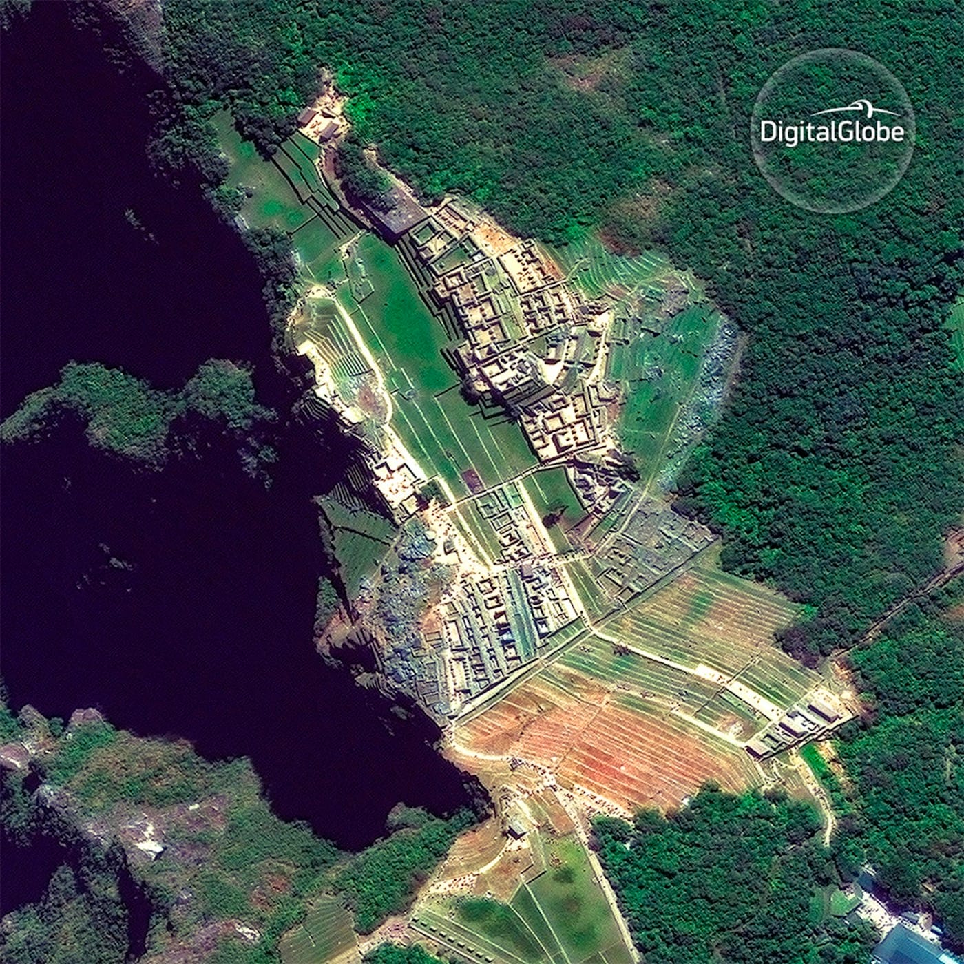
Eventually, Parcak hopes to map sites around the world using this platform, but she has launched GlobalXplorer in Peru first, as it is home to a vast number of archaeological sites from different cultures and time periods. Her team is partnering with Peru’s Ministry of Culture to help preserve sites identified from space, while SPI will work with communities living around them to ensure the sites are fully self-sustaining. SPI already has projects at nine Peruvian sites, four of which have reached economic stability and are essentially free of looting and encroachment practices. GlobalXplorer will slowly integrate countries one by one and plans to announce its second destination next year.
According to the project’s numbers, barely one percent of the world’s estimated wealth of archaeological sites has been identified or explored. With Parcak’s novel approach, we can all partake in the mission to ensure that experts reach these first, before looters strike, cause irreparable damage, and feed the blackmarket.