This Is What the World's First Travel Guide Looks Like
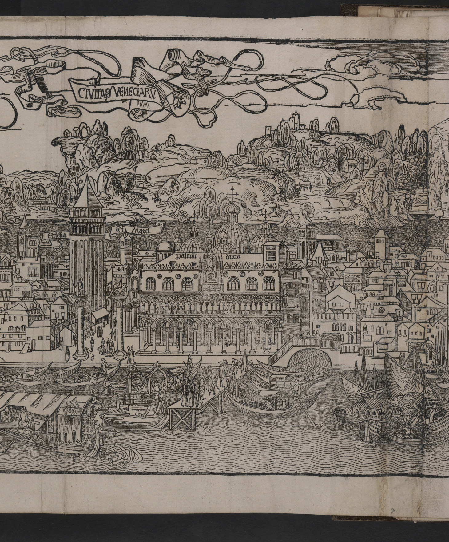
This first edition of the 15th-century book Peregrinatio in Terram Sanctam features the first accurate printed illustrations of Jerusalem and Venice, among other cities.

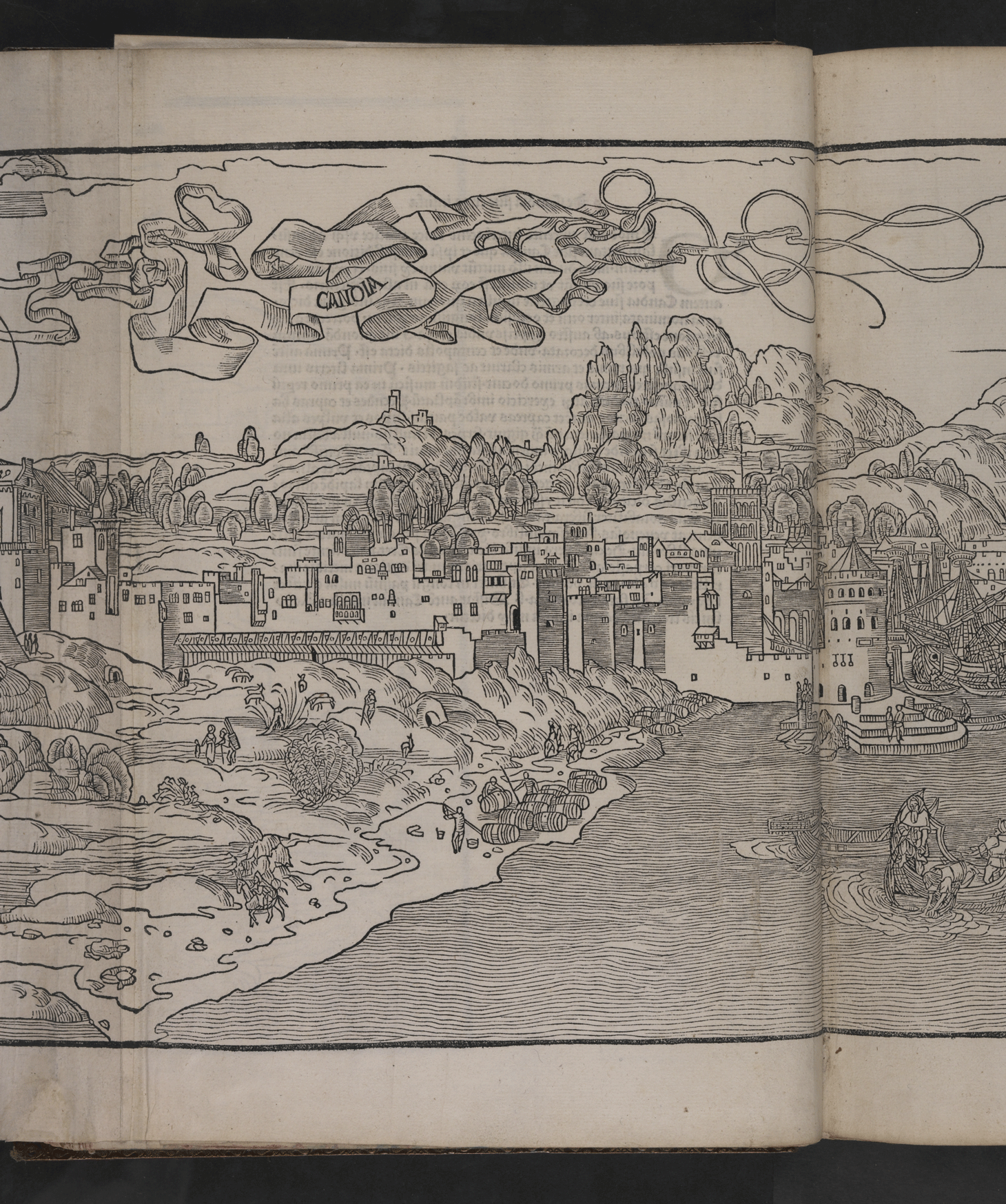
What did Jerusalem or Venice look like in the late 15th century? Visitors to the British Museum can now see for themselves in a new exhibition that includes the world’s first published travel guide. Peregrinatio in Terram Sanctam (which translates to “A Pilgrimage to the Holy Land“), written by the German politician and traveler Bernhard von Breydenbach in 1486, features the first accurate printed illustrations of these famous cities and Mediterranean islands like Crete and Rhodes.
The rare book is currently on view at the British Museum as part of Inspired by the east: how the Islamic world influenced western art, an exhibition that “chart[s] the fascinating history of cultural and artistic interactions between East and West.”
Written in Latin, Breydenbach’s travel guide depicts his pilgrimage to sacred sites in historical Palestine from 1483-1484. The book’s illustrations were made by the Dutch artist Erhard Reuwich, who accompanied Breydenbach in his travels. The book was printed in Mainz, Germany, where the printing press machine was invented earlier that century.
The book became an immediate sensation in Europe, according to the British Museum, as it was the first to provide realistic depictions of sites that the average Western European could not see at the time.
“Before this book, most of the depictions of places such as Jerusalem or Venice were totally made up,” Giulia Bartrum, curator of German prints at the British Museum, said in a statement. “Very few people in Europe had ever visited these places so they had no realistic idea of what they looked like until this wonderfully detailed guidebook came along.”
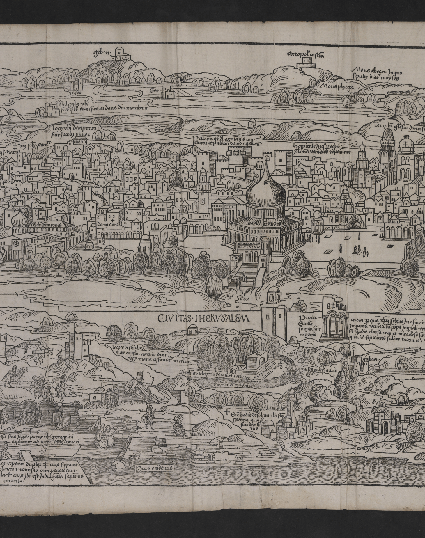
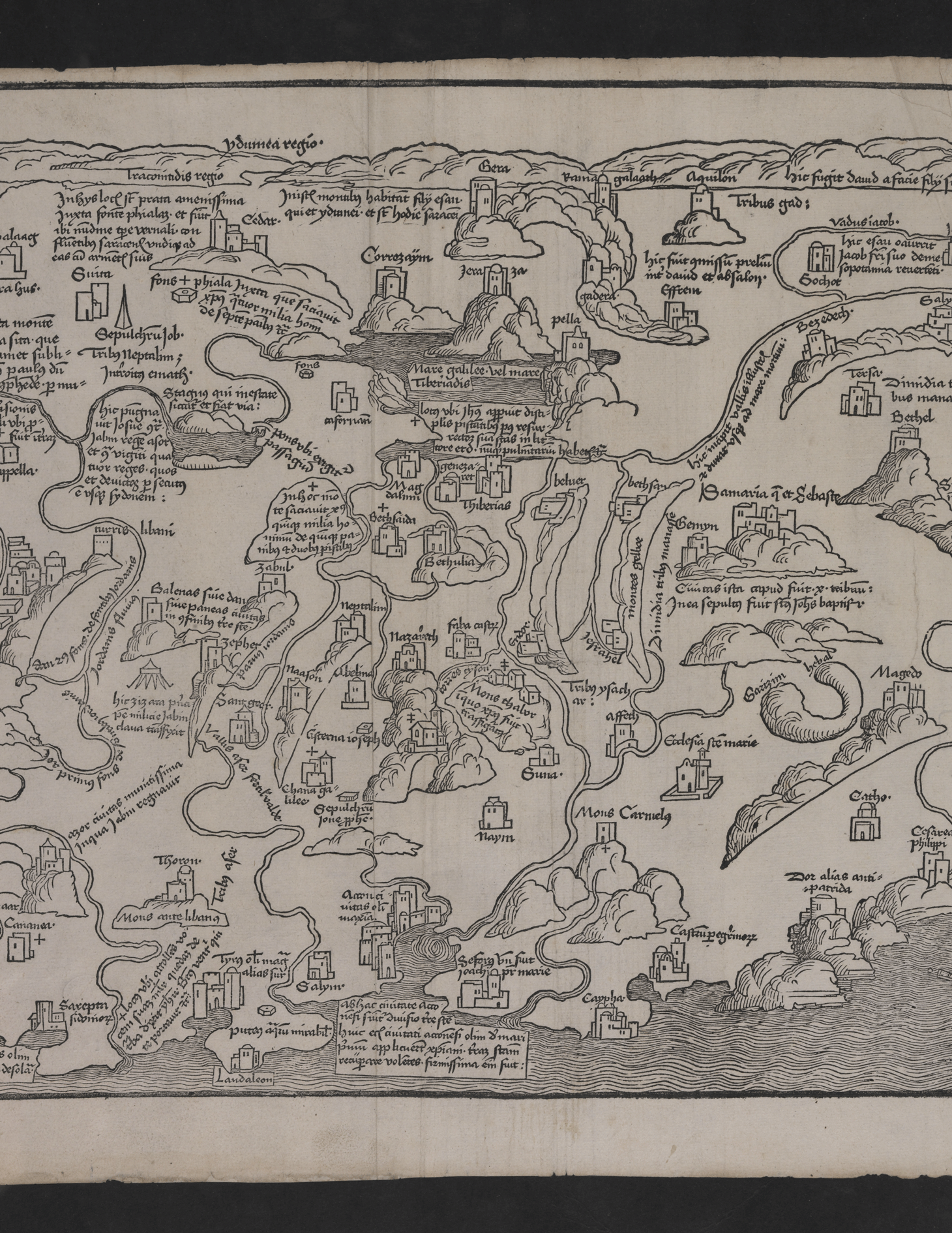
The 500-year-old book is composed of “pull-out” maps that fold out of the book. A detailed map of Jerusalem, still recognizable to the contemporary beholder, is believed to be the first-ever printed map of the city.
The map shows the Dome of the Rock at the center, depicted from the vantage point of the Mount of Olives to the east. The Jerusalem of the time was ruled by the Egyptian Mamluk Sultanate until it was conquered by the Ottoman Empire in 1517.
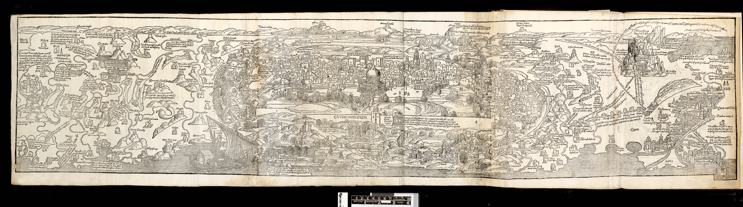
This particular map of Jerusalem made the book a smash hit among pilgrims and was reprinted in new editions for decades. “The large panoramas of famous cities are what make this book so remarkable, and are what made it a 15th-century ‘bestseller’,” Bartrum said.
The version on display at the British Museum, which belongs to the Museum’s collection, is a rare first-edition copy. Only a few have survived through the centuries. Original copies are rarely displayed due to the book’s high sensitivity to light.
The book’s popularity has led to an increase of travel to the Holy Land in the 15th century [how do we know this? “according to the museum”? or to the curator?]. Orientalist travel guides to the region continued to be in high demand in the centuries to come and reached their peak popularity during the 19th century.
“In some ways, you can trace all the familiar visual trappings that tempt us to travel today, such as Rough Guide or Lonely Planet guides, Tripadvisor and even Instagram, back to this book as they all offer tantalising glimpses of what wonderful places are out there in the world to see,” said Bartrum. “But Peregrinatio in Terram Sanctam did it first.”