
Art
Historical Maps to the Heart Help Chart Your Way to Love
Why bother with the so-called Gulf of America when you can dip in the Bay of Bliss or Cape Content?
Art
Why bother with the so-called Gulf of America when you can dip in the Bay of Bliss or Cape Content?
Art
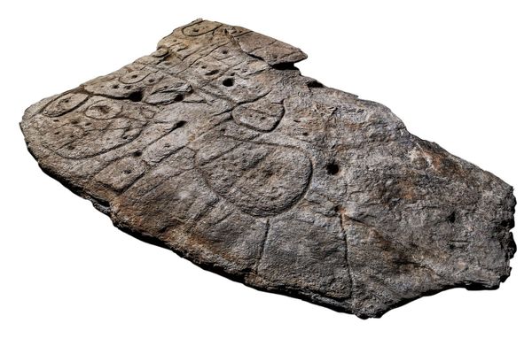
Researchers believe the Bronze Age stone bears a crude map of an area in France’s Brittany region.
Art
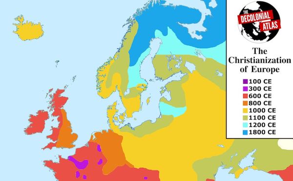
Founded by Jordan Engel in 2014, Decolonial Atlas is working to undo settler colonialism, one map at a time.
Art
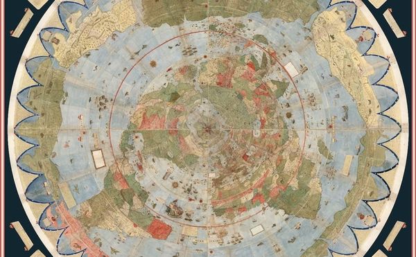
A 60 sheet manuscript world map made in 1587 by Urbano Monte has been acquired by the David Rumsey Map Center at Stanford Libraries, which scanned the sheets, then digitally stitched them together.

Art
MIT's project Treepedia maps the protective green canopy of trees in cities around the world, and the places where this nature is missing.
Art
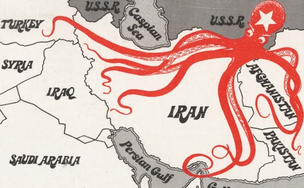
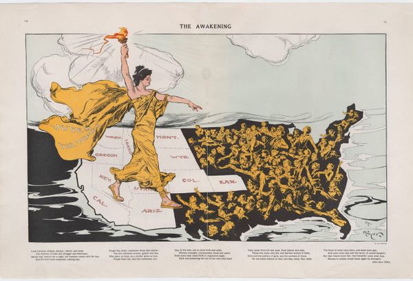
Since the 19th century, the motif of an octopus on propaganda maps has represented the inhuman spread of evil, its tentacles grasping for land and power.
Books
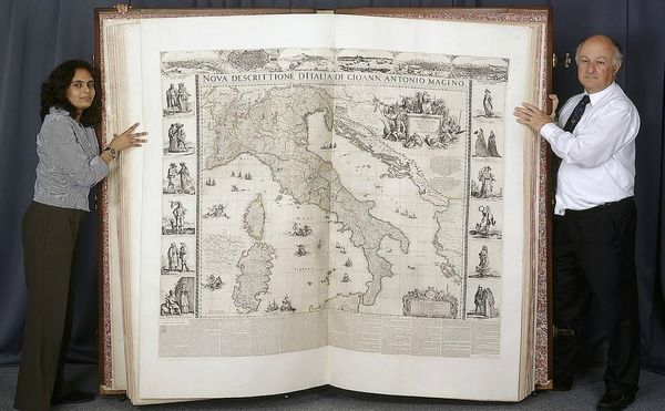
The 1660 Klencke Atlas is taller than most people, and now its rare maps are easily accessible online.
Art
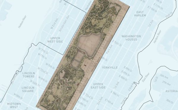
The New York Public Library's NYC Space/Time Directory launched a project that plots 5,000 digitized street maps across the five boroughs, organized by decade from 1850 to 1950.
Books
The Phantom Atlas chronicles centuries of fictional locations that were included on maps of the world.
News
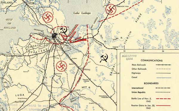
To mark the 75th anniversary of its Cartography Center, the Central Intelligence Agency (CIA) shares decades of declassified maps.
Art
Since the 1990s, collector David Rumsey has digitized and made freely available his thousands of historical maps; his site has long been one of the best resources for cartography.
Art
Some maps are not designed to chart geography, but to express a particular belief.