
Art
The Latin American History of Pop Art
Featuring works from artists in Latin America and its diasporas, Pop América intervenes in long-held conceptions of Pop Art’s geographic consolidations in the US and UK.
Art
Featuring works from artists in Latin America and its diasporas, Pop América intervenes in long-held conceptions of Pop Art’s geographic consolidations in the US and UK.
Art
A concise show of photographs printed for impact, at an enlarged scale and in color, magnifies questions about race in the United States.
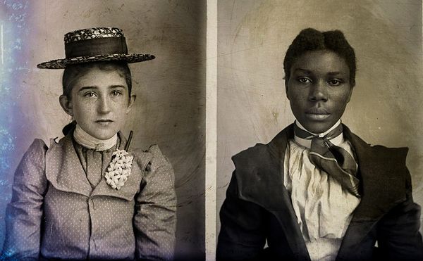
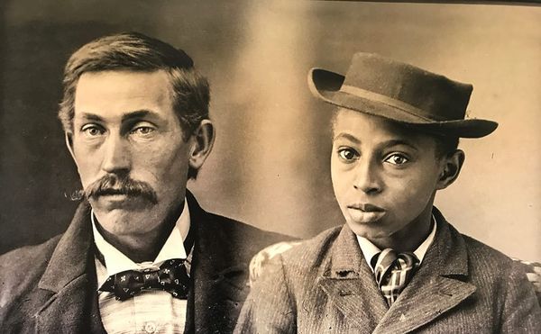
Art
The Nasher Museum of Art exhibits the portrait photography of Hugh Mangum, whose glass plate negatives were salvaged from a North Carolina barn.
Art
As a lifelong resident of the South who often has cause to talk to people from elsewhere, I find that my accent is a recurring topic of conversation. Someone will wonder why I don’t have one, and seem astonished. Someone else will retort, “What are you talking about? He totally has one!” and seem am
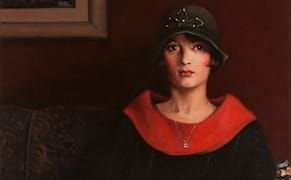
Art
Against the backdrop of belated examples of race-related “progress,” it is illuminating to flip through the pages of American cultural history and discover that almost a century ago, a black, classically trained modern artist, Archibald J. Motley, Jr., was using paint on canvas to address such nuanc

Art
Through subtle portraiture and roaring scenes of the Jazz Age, painter Archibald J. Motley Jr. chronicled the diversity and dynamism of the African-American community during the early decades of the 20th century.
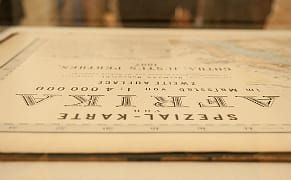
Art
If you want to claim a territory, it's good to have a map to show what's yours. Defining Lines: Cartography in the Age of Empire at the Nasher Museum of Art at Duke University examines how maps were a form of political control and public perception by Western colonial powers from the 16th and 20th c