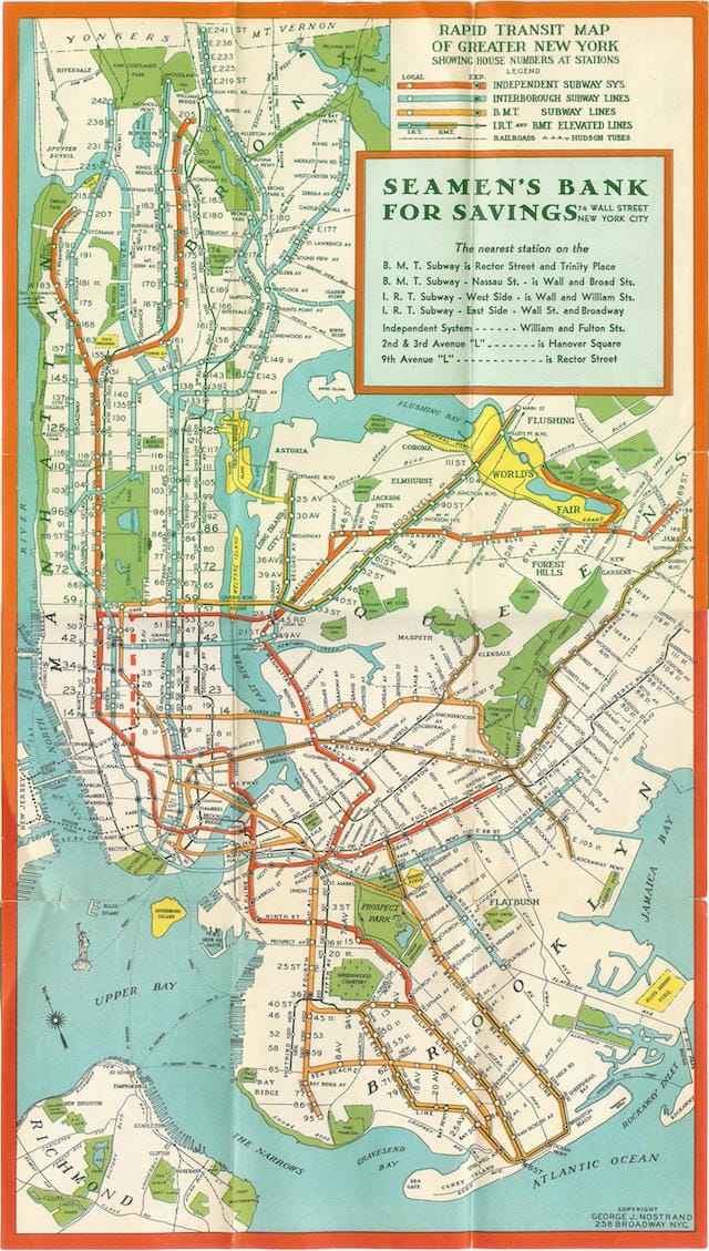
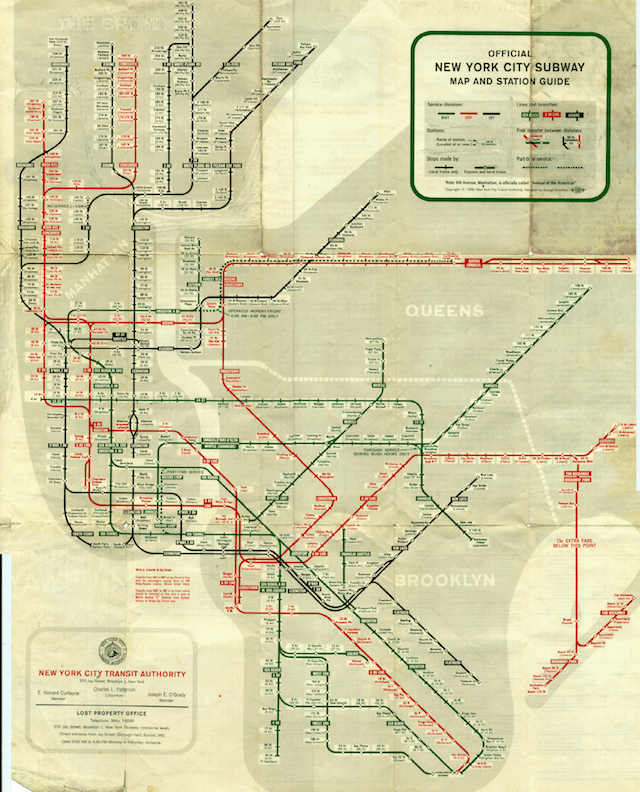
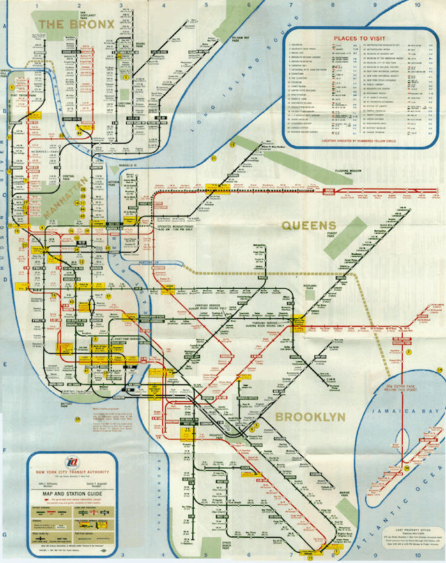
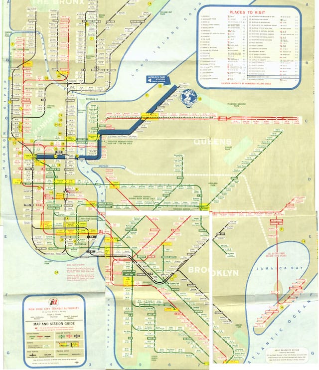
New York City Subway Maps Across Time
Municipal signage and schematics, as design firm Pentagram's recent work on New York's beach and parking signage attests, can play a significant role in (re)defining the character of urban space.

Municipal signage and schematics, as design firm Pentagram’s recent work on New York’s beach and parking signage attests, can play a significant role in (re)defining the character of urban space. Subway maps similarly develop an aesthetic character that transcends their function, as in the London Underground pamphlet released last week designed by the artist Rachel Whiteread.
Though ultimately utilitarian, these textual and visual signs, symbols, and graphics form a vernacular urban directory, a tangible expression of the city’s identity. Over time, such artifacts can serve to document a collision of disparate forces at the intersection of geography, politics, and sensibility.
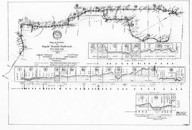
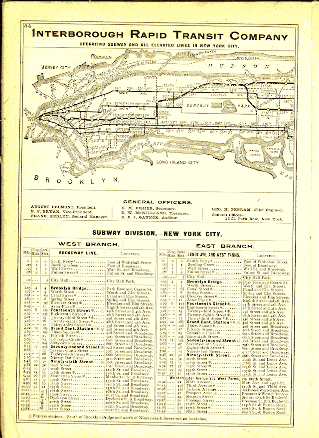
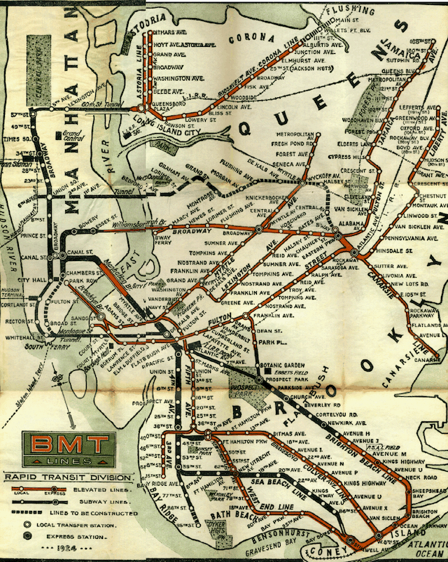
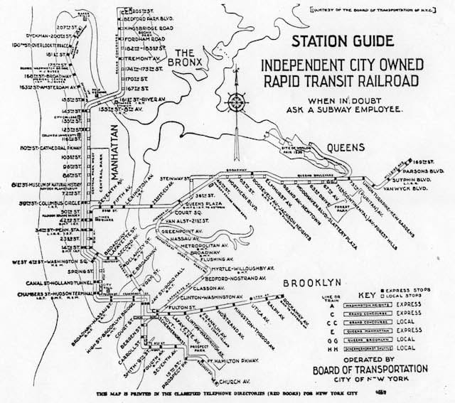
Fortunately, an independent online repository called nycsubway.org collects New York’s historical transit maps and schedules, offering a collection ranging from the late 19th century to the present. Here are a few highlights.
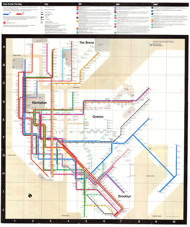
More maps can be viewed on the Historical Maps page at nycsubway.org.