Revisiting a Midcentury Map Marvel of NYC's Water System
For infrastructure started in the 19th century, the New York City water system is remarkably equipped to support the metropolis of the 21st century.

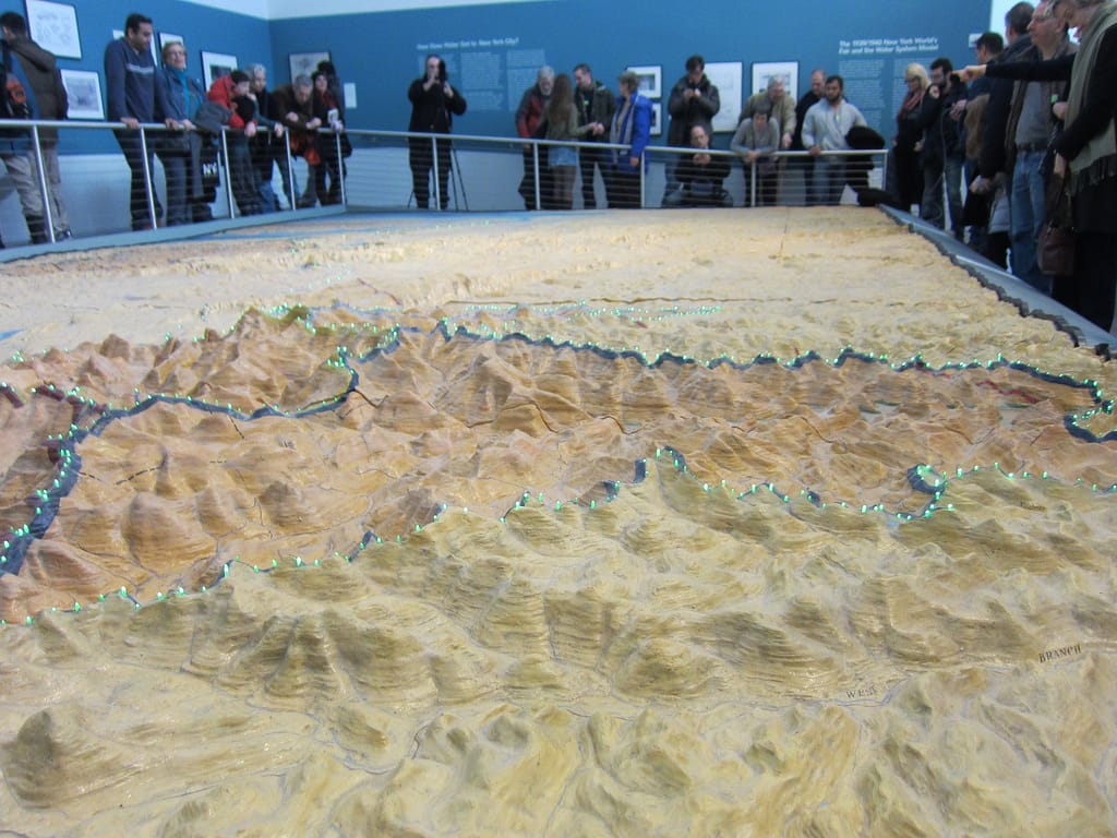
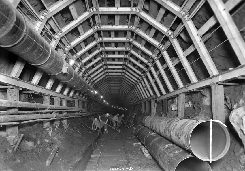
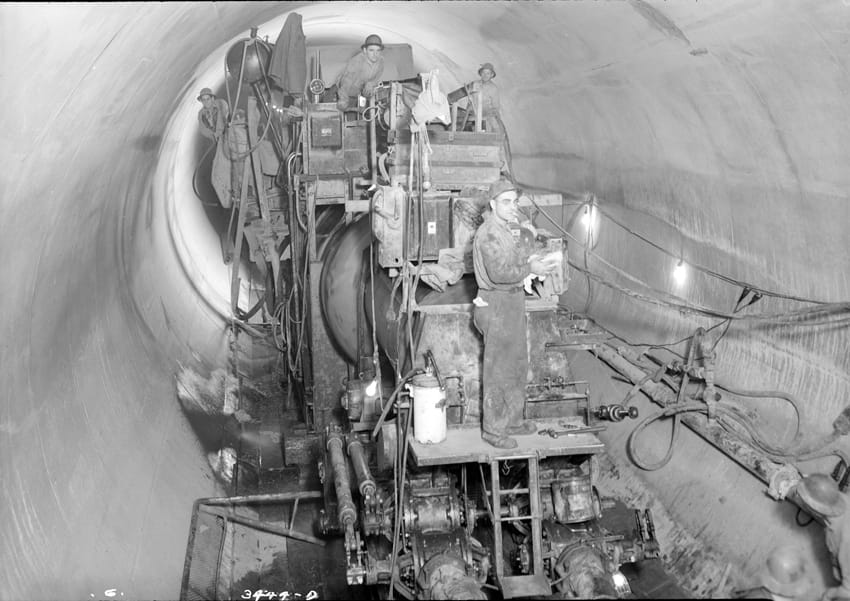
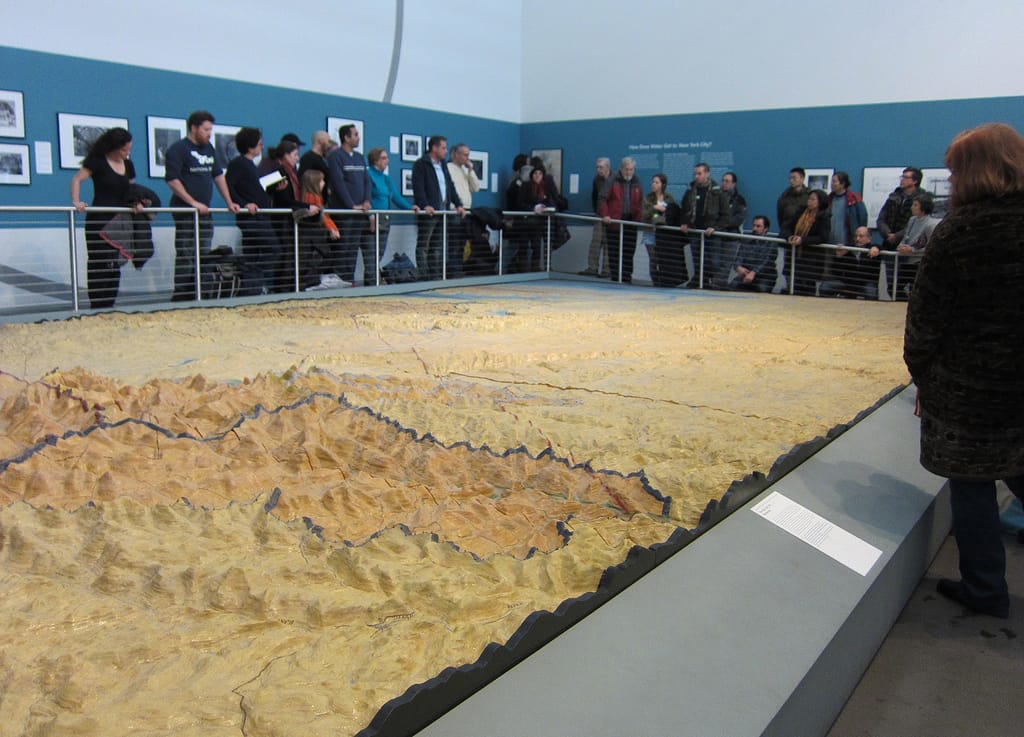
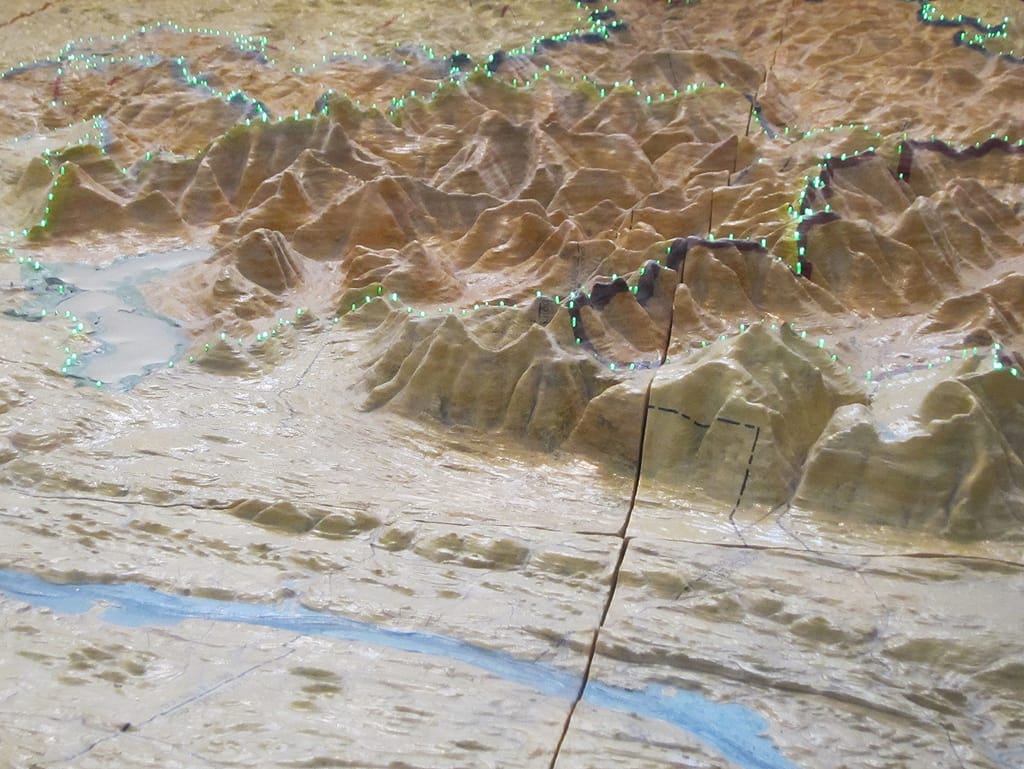
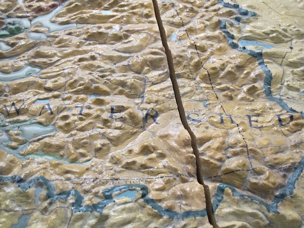
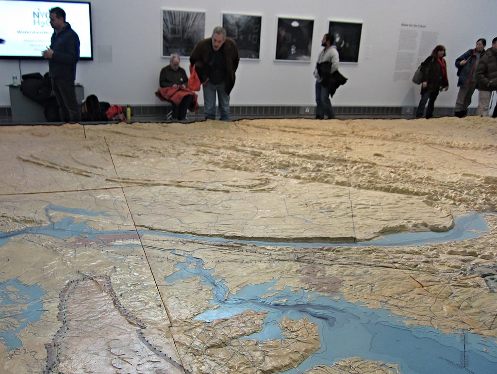
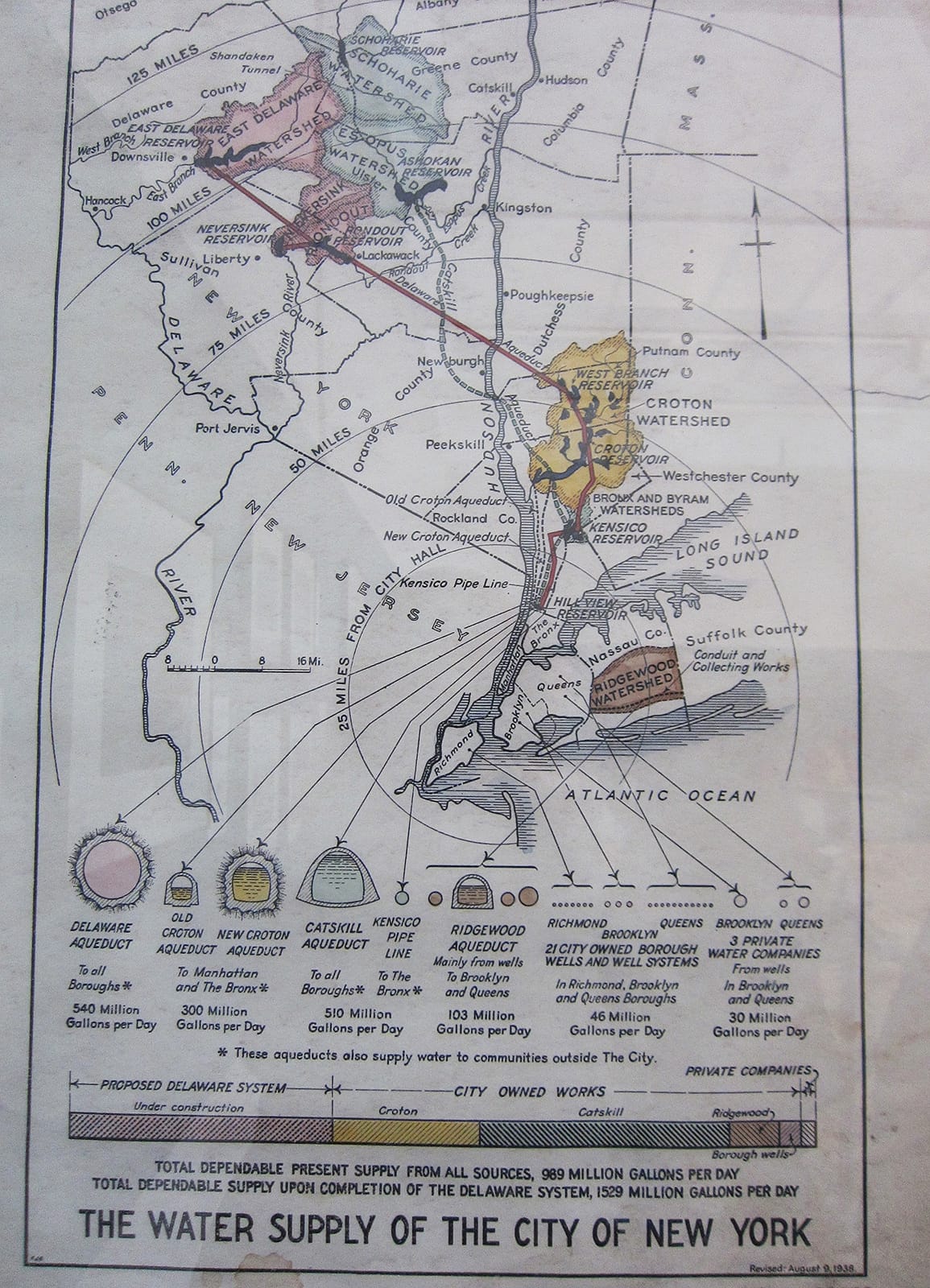
For infrastructure started in the 19th century, the New York City water system is remarkably equipped to support the metropolis of the 21st century. The massive system of aqueducts, reservoirs, and one of the largest tunnels in the world — all gravity-fed instead of pumped — brings a billion gallons of water a day 125 miles from upstate down to the five boroughs. It’s hard to appreciate the engineering when the unfiltered water just cleanly comes out of the tap, but the 1939 Watershed Relief Map at the Queens Museum meticulously charts the topography of the water system to scale.
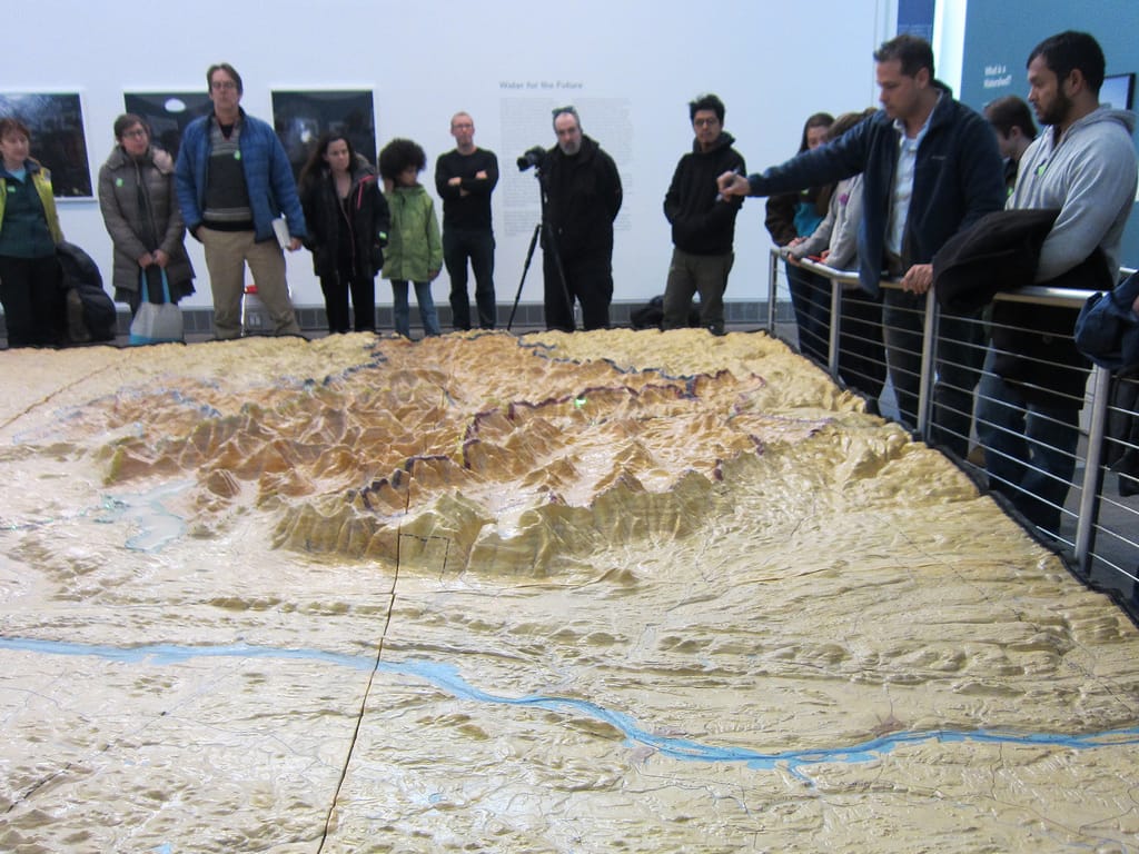
Earlier this month, the nonprofit NYC H2O, which regularly organizes educational programs about the city’s water and ecology, hosted a presentation at the Queens Museum. NYC H2O Director Matt Malina explored the history of the map; Brian Diffley, a project manager with Schiavone Construction Co. LLC that’s focused on the rehabilitation of the High Bridge and Peter Dispensa, a security project manager at the NYC Department of Environmental Protection, discussed the current water system and answered questions about its operation.
The map was born in 1939, when all of New York City’s agencies were invited to create exhibits for the World’s Fair. The Department of Water Supply, Gas, and Electricity made an incredible relief map of plaster and plywood. At a cost of $100,000, it included lights to illuminate the reservoirs and underground tunnels, and broke up into 27 portable parts. Unfortunately for the cartographers, it never went on display. One explanation is that it was too large, at 540 square feet; the other that in a pre–World War II environment it seemed too sensitive to security to show publicly. German saboteurs had, after all, blown up a major munitions depot during World War I, damaging the Statue of Liberty, so the threat of a domestic attack was not so far off.
In 1948, the map was finally seen by the public at the Golden Anniversary Exposition, held in honor of the 50th anniversary of the city’s consolidation at the Grand Central Palace (itself torn down in 1964). After that, it remained forgotten in storage until 1991, when a Department of Environmental Protection architect came upon it in the Jerome Avenue Pumping Station. Sent for restoration in 2006, it was finally revealed in all its intended mid-century glory in 2008. And with the reopening of the Queens Museum in 2013 following a major renovation, it now has its own exhibition, called From Watersheds to Faucets: The Marvel of New York City’s Water Supply System.
For the next World’s Fair in New York, in 1964, the city was yet again inspired to map out its urban landscape. Robert Moses commissioned the Panorama of the City of New York, spanning 9,335 square feet. It’s also housed at the Queens Museum, which is hosting an intervention by the community organization 596 Acres that plots around 155 urban renewal plans proposed but never adopted by the city on the panorama. Programming every Sunday concentrates on topics like eminent domain, the Mitchell-Lama affordable housing program, and the past and future of development in Manhattan, Brooklyn, and Queens. Along with the recent programming around the Watershed Relief Map, it’s exciting to see these incredible 20th-century cartography projects serving as hosts for conversations on the contemporary landscape of New York, and to see community-driven groups celebrating them as resources for understanding the complexity of the city.
From Watersheds to Faucets: The Marvel of New York City’s Water Supply System is ongoing at the Queens Museum (New York City Building, Flushing Meadows Corona Park, Queens). Reviewing Renewal, presented by 596 Acres, continues at the Queens Museum through February 8.