Creating an Atlas of Overlooked Cartography for New York City
Rebecca Solnit and Joshua Jelly-Schapiro's book Nonstop Metropolis charts the overlooked geographic history of New York City.

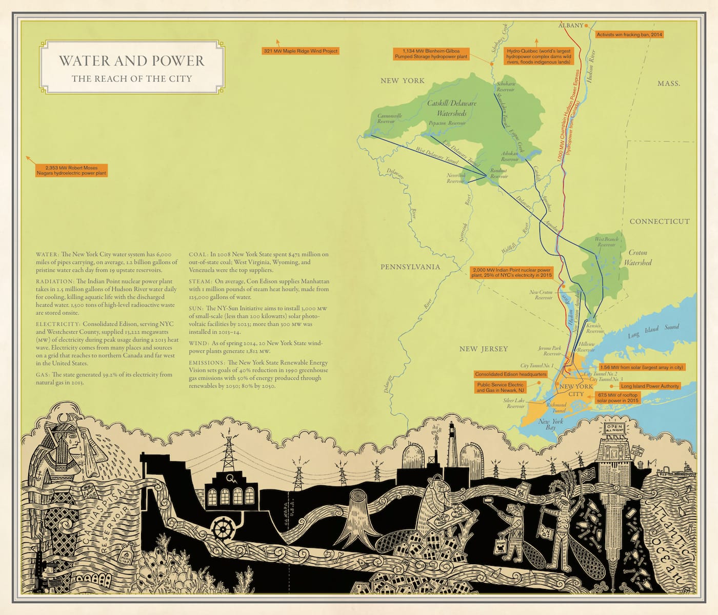
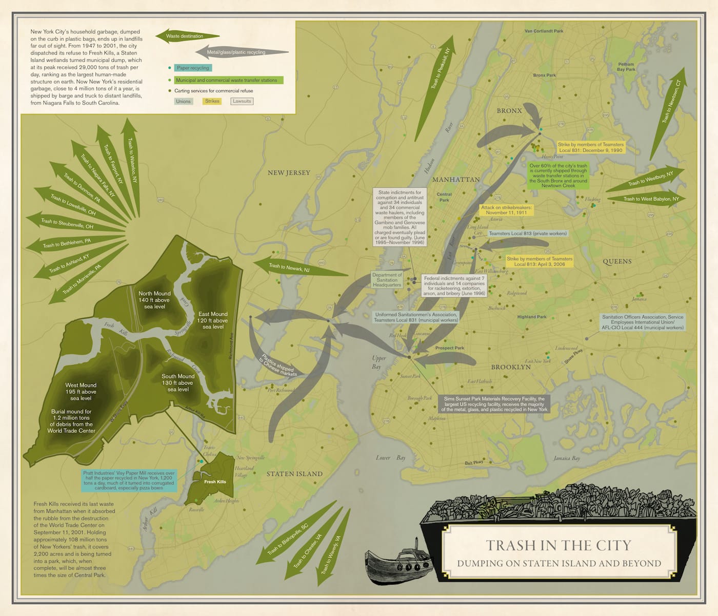
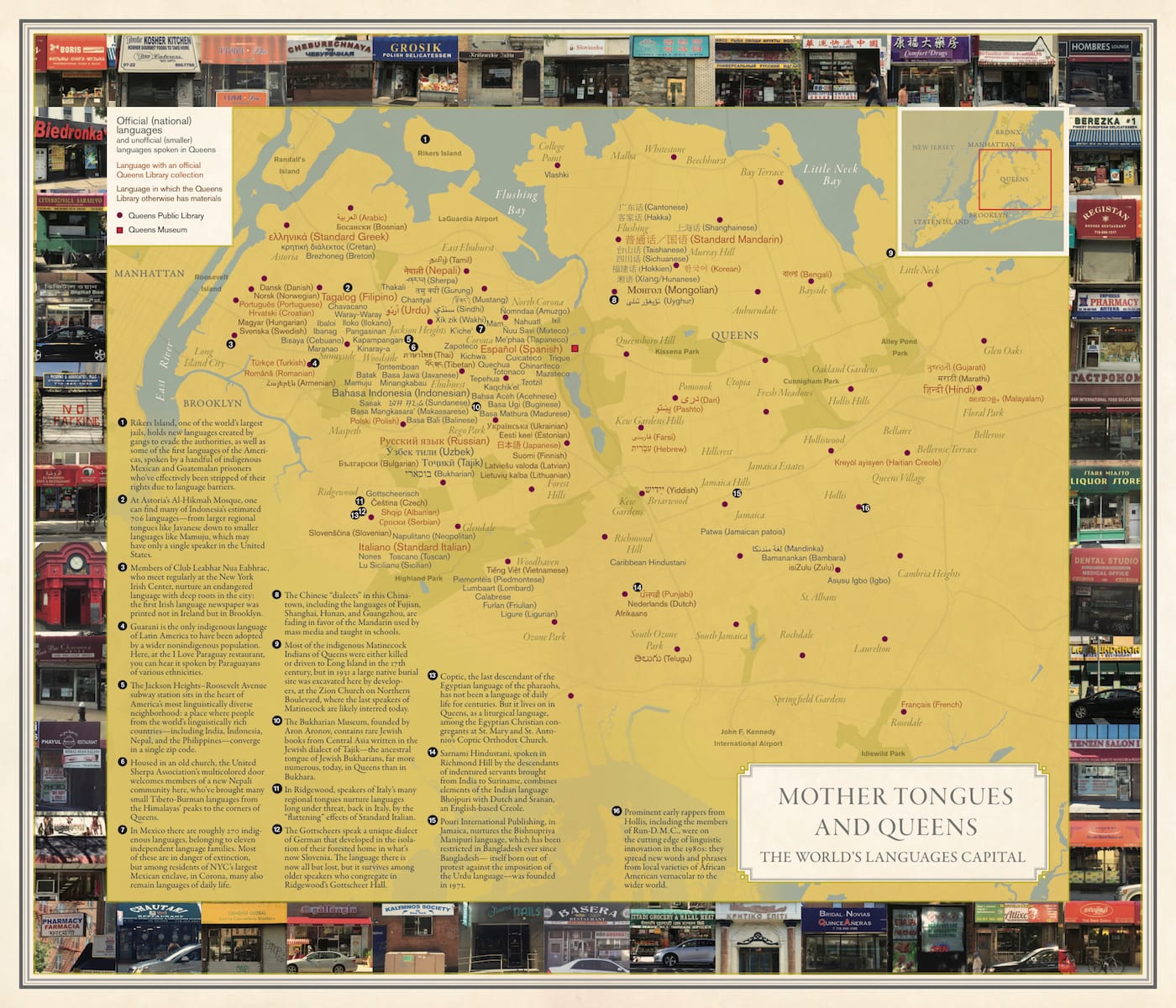
As Joshua Jelly-Schapiro, co-author with Rebeca Solnit of Nonstop Metropolis: A New York City Atlas, told Hyperallergic, “everyone who lives in a city could map it in their own way.” For New York City, that means a possible eight million distinct geographies for each of its diverse residents. Nonstop Metropolis, recently released by University of California Press as the third in Solnit’s trilogy of American city atlases, features a few of these experiential charts of New York, from “Brooklyn Villages” on the Native American settlements, Dutch villages, and contemporary ethnic enclaves of the borough, to “Mother Tongues and Queens” on that borough’s 800 languages.
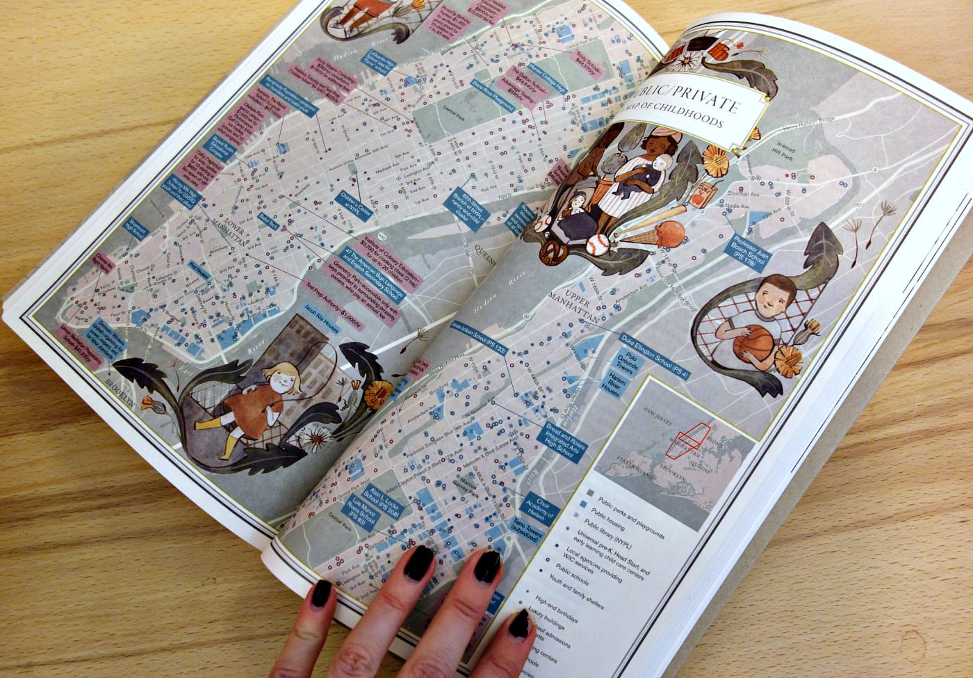
“We couldn’t do eight million maps in this book, but we did do 26 maps, which all try, with inspiration from the beautiful paper maps and atlases of old, from the days before we all started getting around with Garmin devices and glowing phone-screens, to show all the ways that a great map can not only organize information, and tell a story, but help us deepen our understanding of place, and of where we are,” Jelly-Schapiro explained.
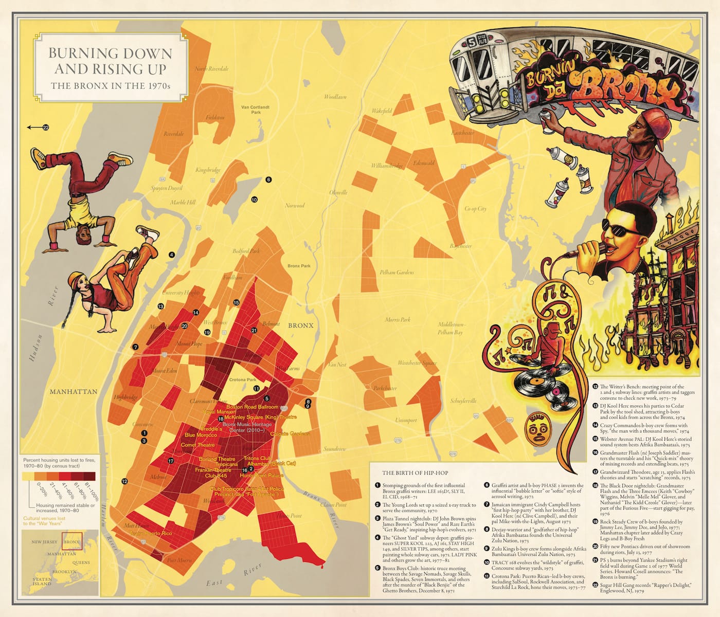
Every map is an intense act of creative collaboration, with essays and illustrations in Nonstop Metropolis from over 30 artists and writers. Alongside, the Queens Museum is currently hosting the complementary Nonstop Metropolis: The Remix, which features related public programming and commissioned installations by artists and book contributors Mariam Ghani and Duke Riley. Six “broadside” maps from the publication are freely available to museum visitors and in nearby communities.
Nonstop Metropolis follows Solnit’s 2010 Infinite City: A San Francisco Atlas, and the 2013 Unfathomable City: A New Orleans Atlas, co-authored with Rebecca Snedeker. New York, San Francisco, and New Orleans are on three different American coasts, making them historic ports, with deep histories of international exchange, and longstanding roles as havens for people who felt like outsiders elsewhere. “And they are also the places, par excellence, that give the lie to the idea that America belongs only to one people or race or creed, and that show how America’s ‘greatness,’ from the start, has been inseparable from its past, and its present, as a nation of immigrants,” Jelly-Schapiro stated.
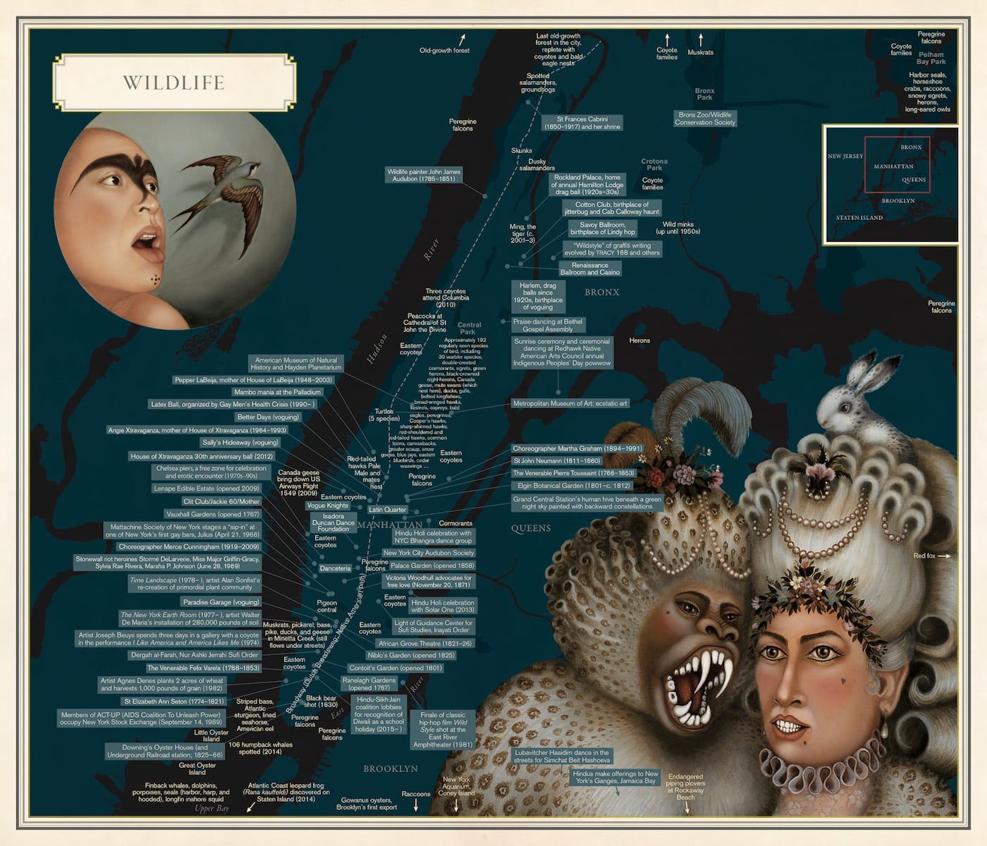
Solnit, in an open letter to Donald Trump on Literary Hub, wrote to the President-elect: “I wonder if you have ever actually explored the New York City you claim to live in,” a city of immigrants, of 285 mosques, of wildly popular Latin radio stations. This diversity is affirmed in each Nonstop Metropolis map, such as “Mysterious Land of Shaolin: The Wu-Tang Clan’s Staten Island,” which juxtaposes the lives of the East Asian-influenced hip-hop group’s members with Staten Island sites like the Chinese Scholar’s Garden at Snug Harbor and the Shaolin Kung Fu Temple.
And the maps emphasize that this city’s character is often missing from our more official cartography. In her essay for the “City of Women” map, which adds the names of women to subway stops spatially connected to their lives — from actress Sarah Bernhardt at Times Square and suffragist Victoria Woodhull at Wall Street — Solnit notes that scant places here are named for women. The city itself, for instance, is a tribute to the Duke of York. And even its monuments almost exclusively honor men; Solnit references my Hyperallergic article on the five sole statues of historic women in the city. She concludes: “Many women were never allowed to be someone; many heroes of any gender live quiet lives. But some rose up; some became visible; and here they are by the hundreds. This map is their memorial and their celebration.”
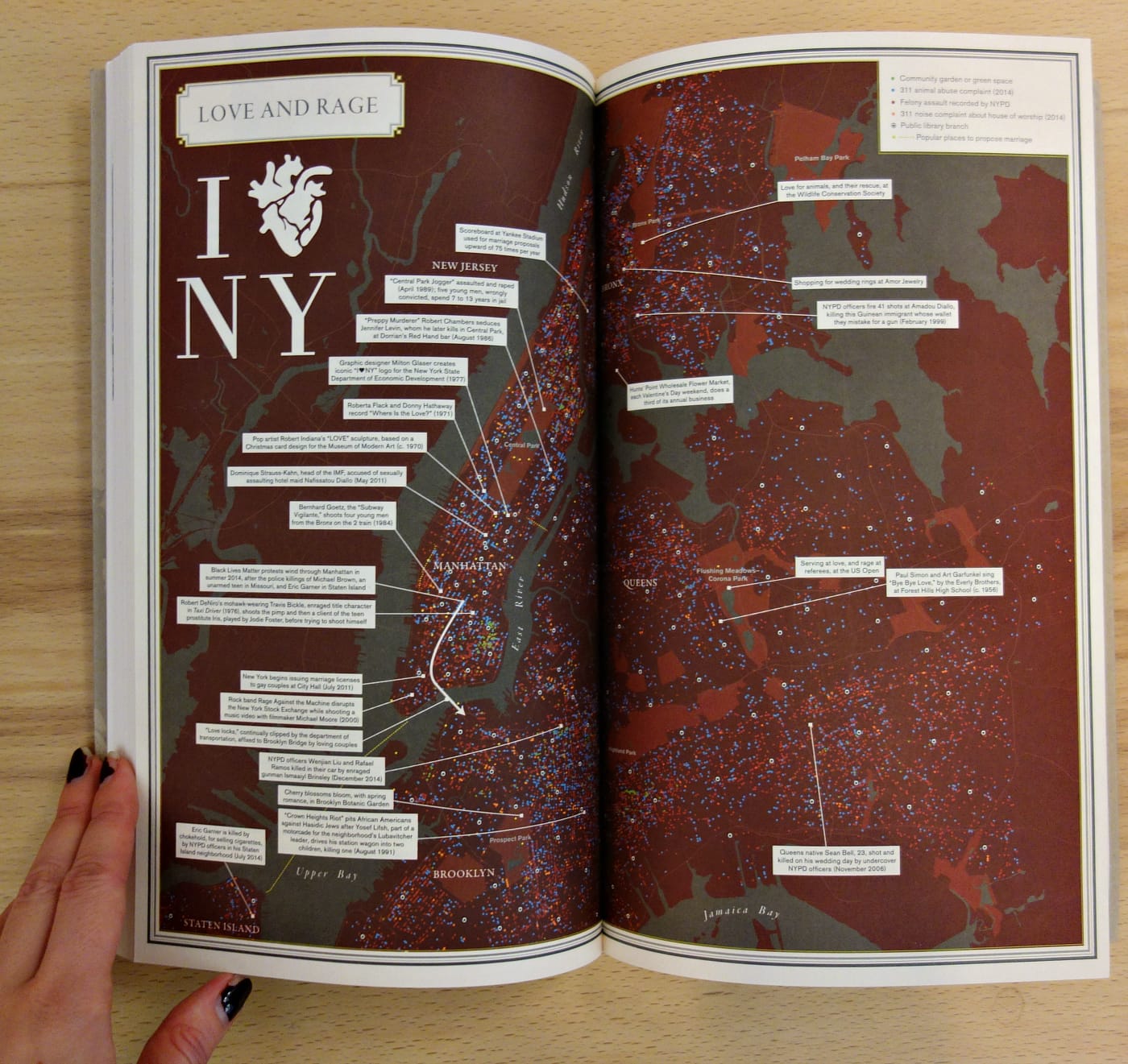
Another map, “Love and Rage,” plots community gardens, 311 complaints, felony assaults, public libraries, and favored locales to propose marriage, while “Riot” focuses on mass eruptions, including the Blackout Riots of 1977, or the Hog Riots, whose participants rallied to keep pigs in the city streets in 1825, 1826, 1830, and 1832. “Harper’s and Harpooners” looks at Lower Manhattan through the life of Moby-Dick author Herman Melville, connecting its publishing industry to its whaling hubs.
“According to the electronic maps many of us now use to get around, there’s just one map of the city, composed of its streets, and landmarks, and places to shop or eat or spend money,” Jelly-Schapiro said. “But there’s a hell of a lot more to the city than that — and it’s all the other things you can map here, and that we’ve tried to, that make it interesting.”
Nonstop Metropolis: A New York City Atlas by Rebecca Solnit and Joshua Jelly-Schapiro is out now from University of California Press.