How Trompe-L’Oeil Added Information and Ornamentation to Maps
Look But Don't Touch: Tactile Illusions on Maps at the Harvard Map Collection explores how cartographers have used trompe l'oeil illustrations on maps.

Cartographers have often added ornamental flourishes to their maps, whether sea monsters in the Medieval and Renaissance eras that attempted to describe ocean life, or octopuses in more modern maps that suggested a spreading evil. In the 18th century, philosophers were considering the connection between sight and touch, an idea that made its way into the world of mapmaking. Look But Don’t Touch: Tactile Illusions on Maps from the Harvard Map Collection explores this emergence of illusions on cartography.
Look But Don’t Touch involves both an extensive online exhibition, and a display at the Map Collection in Harvard University’s Pusey Library. David Weimer, librarian for cartographic collections and learning at the Map Collection, told Hyperallergic that the exhibition was inspired in part by his research on embossed atlases for the blind, which got him thinking about how cartographers expressed space as something visual.
“This exhibition is working backwards from that into some 18th-century philosophical debates about whether spatial knowledge — phenomena like size and depth — are fundamentally tactile or visual,” Weimer explained. “I had first noticed these illusions in 18th-century maps, which fit into this trajectory. But then I found way more than I expected back into the 16th century and well into the 20th.”
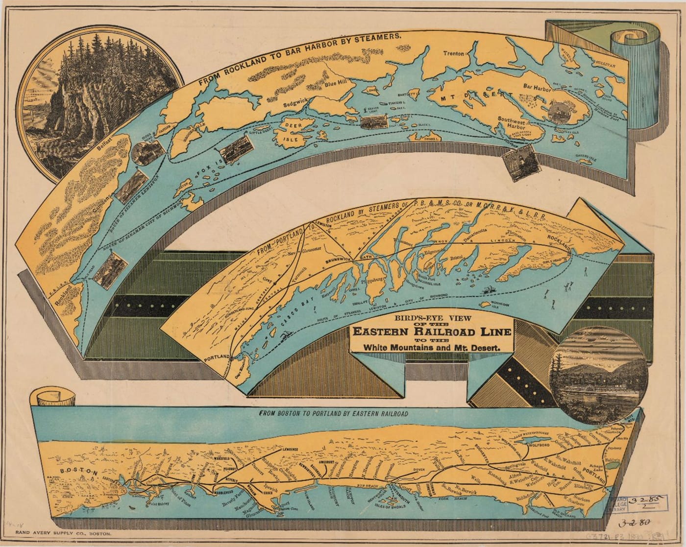
The objects range from 18th-century maps of England with illustrations that appear tacked on the page, to a 1777 plan of Boston that features a surveying compass that seems to rest on the paper. An 1890 “Bird’s-eye View of the Eastern Railroad Line to the White Mountains and Mt. Desert” is visualized like a single strip of paper, chronicling the path of the railroad and steamships between Boston and Bar Harbor, Maine, while Abraham Ortelius’s 1584 map from Theatrvm Orbis Terrarvm (1584) has the illusion of an older map by Paolo Giovio of Lake Como pinned on his newer atlas.
“As maps become commodities, they, of course, are trying to entice you to buy this map instead of that unadorned or less beautiful map,” Weimer stated. “But, as I hope you can see in this exhibition, they also help teach viewers how to understand the cartographic content and also try to justify the authority of the mapmakers themselves.”
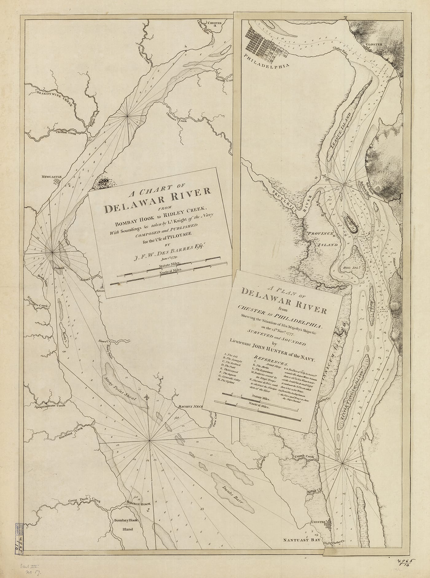
Weimer pointed out two maps in particular that are powerful in their relationship between the tactile and visual senses. One is Joseph F. W. Des Barres’s 1780 chart of the Delaware River, which illustrates four levels of information as literal layers.
“All Des Barres’s maps have these layered illusions where it looks like you have multiple nautical charts or harbor views stacked on top of one another,” Weimer said. “But the chart of the Delaware is even trickier. Near the bottom, Des Barres depicts a rip in one of the sheets. And that rip is almost indistinguishable from the rivers that intersect with it. So the visual language of those lines is identical, but Des Barres differentiates them by alluding to an imagined tactility.”
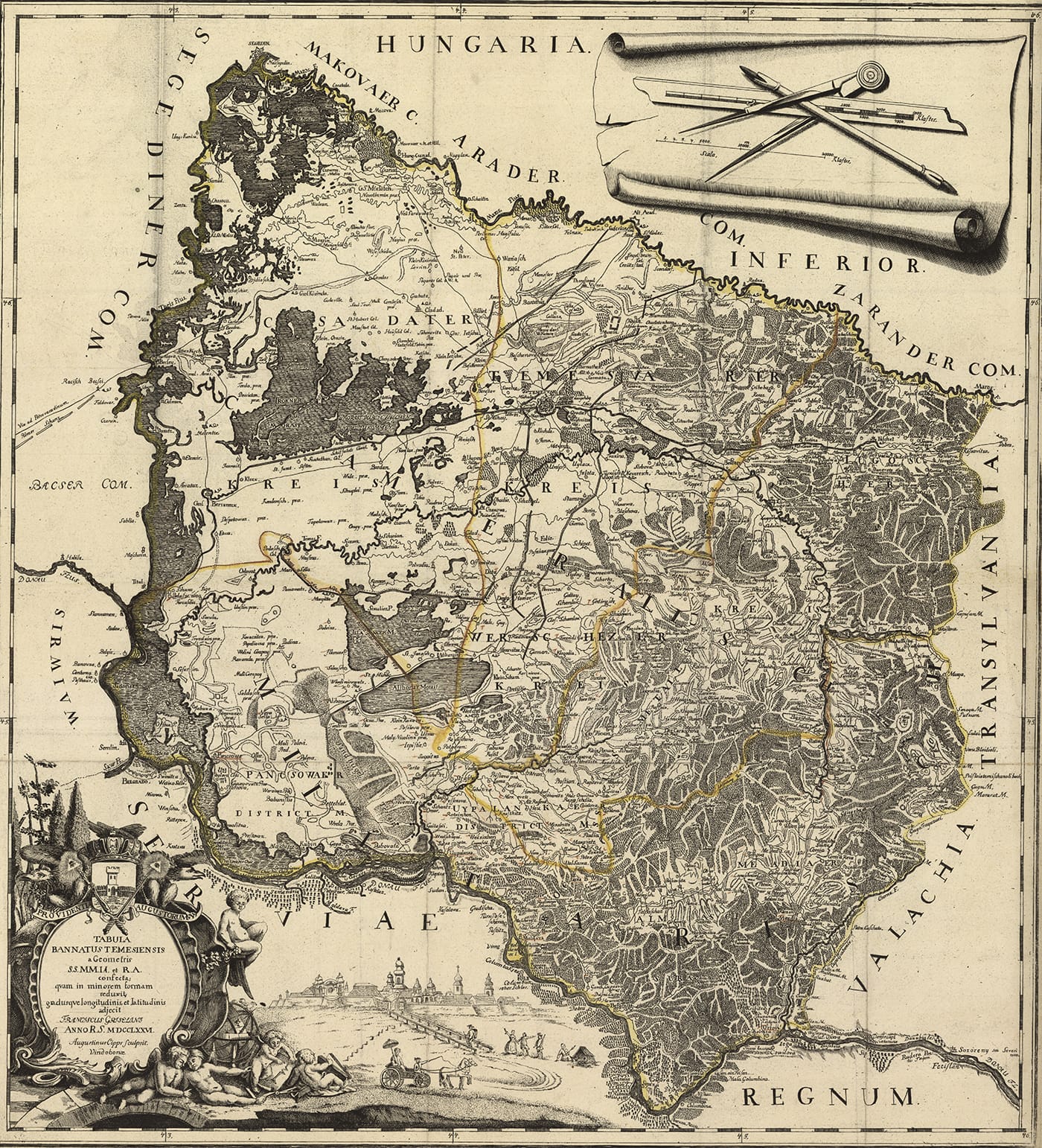
The other is Francesco Griselini’s 1776 “Tabula bannatus Temesiensis” that includes a trompe l’oeil of the mapmaker’s tools in an upper corner
“You have actual-size instruments for making a map — a compass, an 18-century mechanical pencil, a ruler — next to the actual map: this abstracted and scaled depiction of space,” Weimer described. “Griselini and his engraver, Augustinus Cipps, are playing with the flexibility of vision even as they tap into some of the philosophical debates that say that we need touch to understand the actual size of objects.”
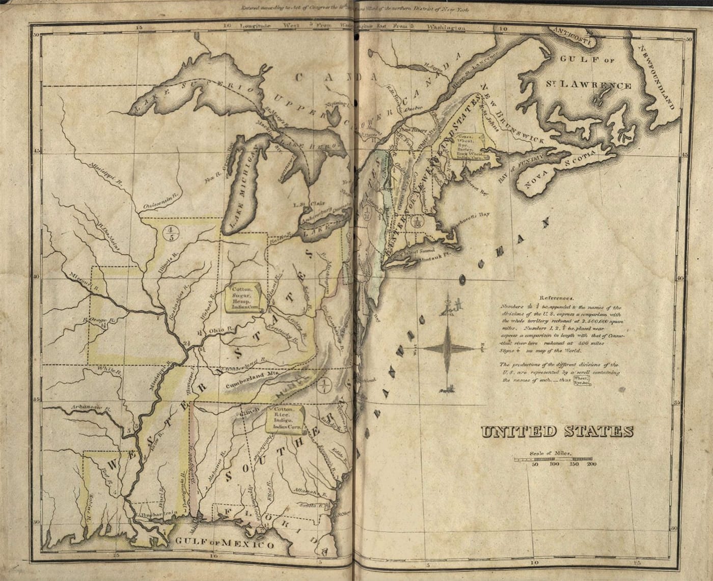
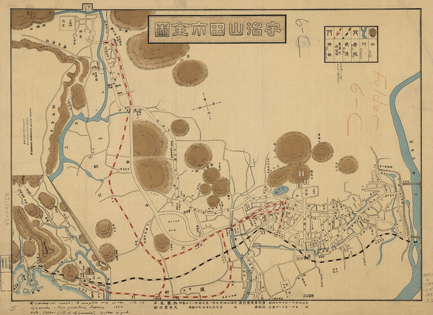
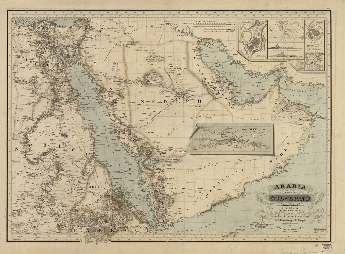
Many of the Look But Don’t Touch maps have tiny scroll elements, adding supplemental information or emphasizing the separation of ideas. Emma Willard, who was a pioneer in women’s education, created the 1826 Geography for Beginners with little tactile illusions that indicated agricultural production around the United States. The details supported, as she put it, the “principle of teaching by the eye.” Meanwhile, for his 1835 map of “Arabia und das Nil-Land,” Heinrich Karl Wilhelm Berghaus positioned a scroll detailing an itinerary linking Jeddah, Mecca, and Tarife, rather than filling the sandy space with animals, as a mapmaker may have in the 17th century. The 19th-century was about exploration through the imagination, not just marveling at these “exotic” lands. Look But Don’t Touch further chronicles how these illusions, developed in Europe, were eventually adopted in Japan and China by the 1860s.
“From what I’ve found, these illusions really only start to appear on East Asian maps in the late 19th century when they begin to adapt to globalization,” Weimer stated. “I understand these illusions, therefore, as an icon that associates the style of the map with Western cartography, and also alerts viewers to their new cartographic and visual logic.”
Look But Don’t Touch: Tactile Illusions on Maps continues through February 28 at the Harvard Map Collection (Pusey Library, 15 Quincy Street, Cambridge, Massachusetts).