Explore the Largest Known Early Map of the World, Assembled for the First Time
A 60 sheet manuscript world map made in 1587 by Urbano Monte has been acquired by the David Rumsey Map Center at Stanford Libraries, which scanned the sheets, then digitally stitched them together.

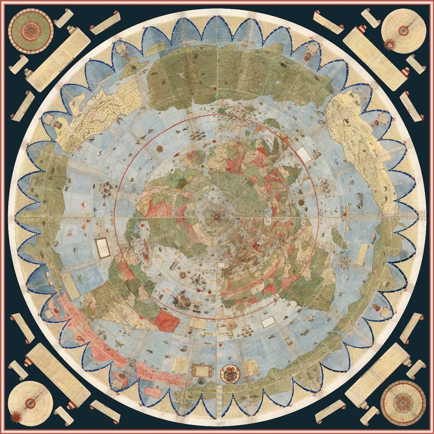
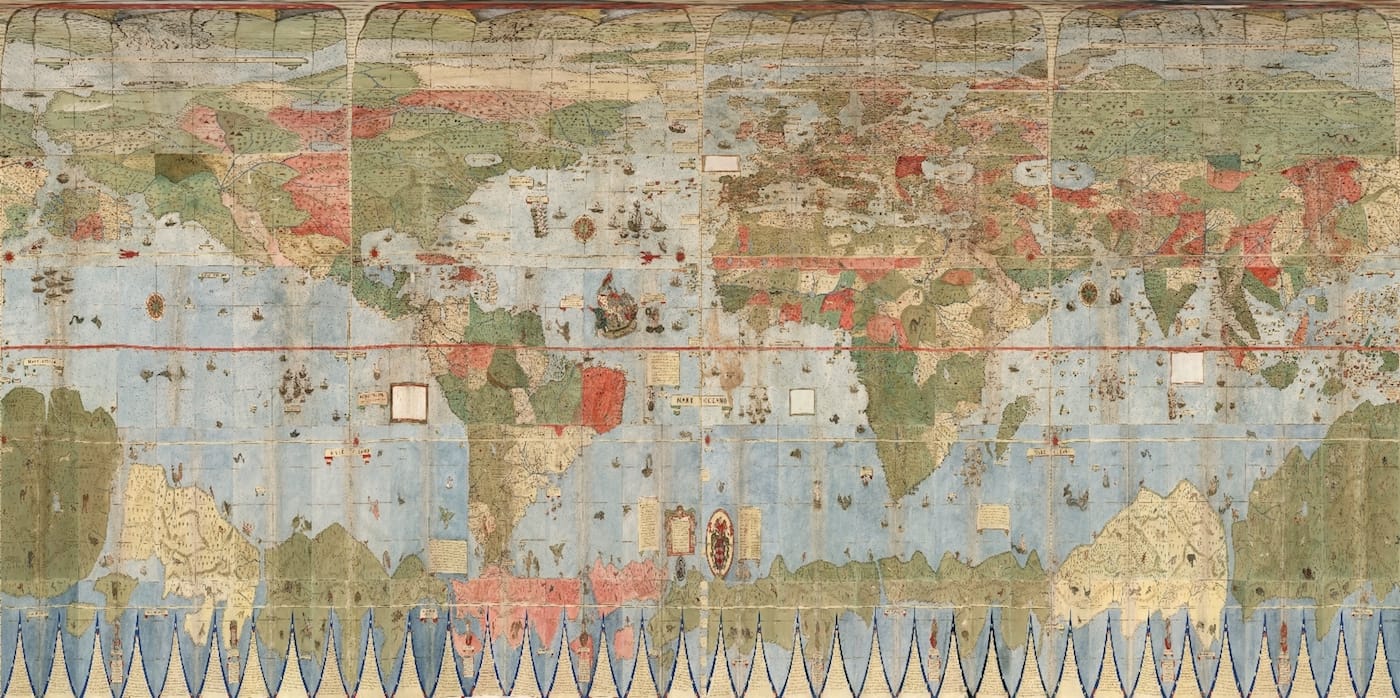
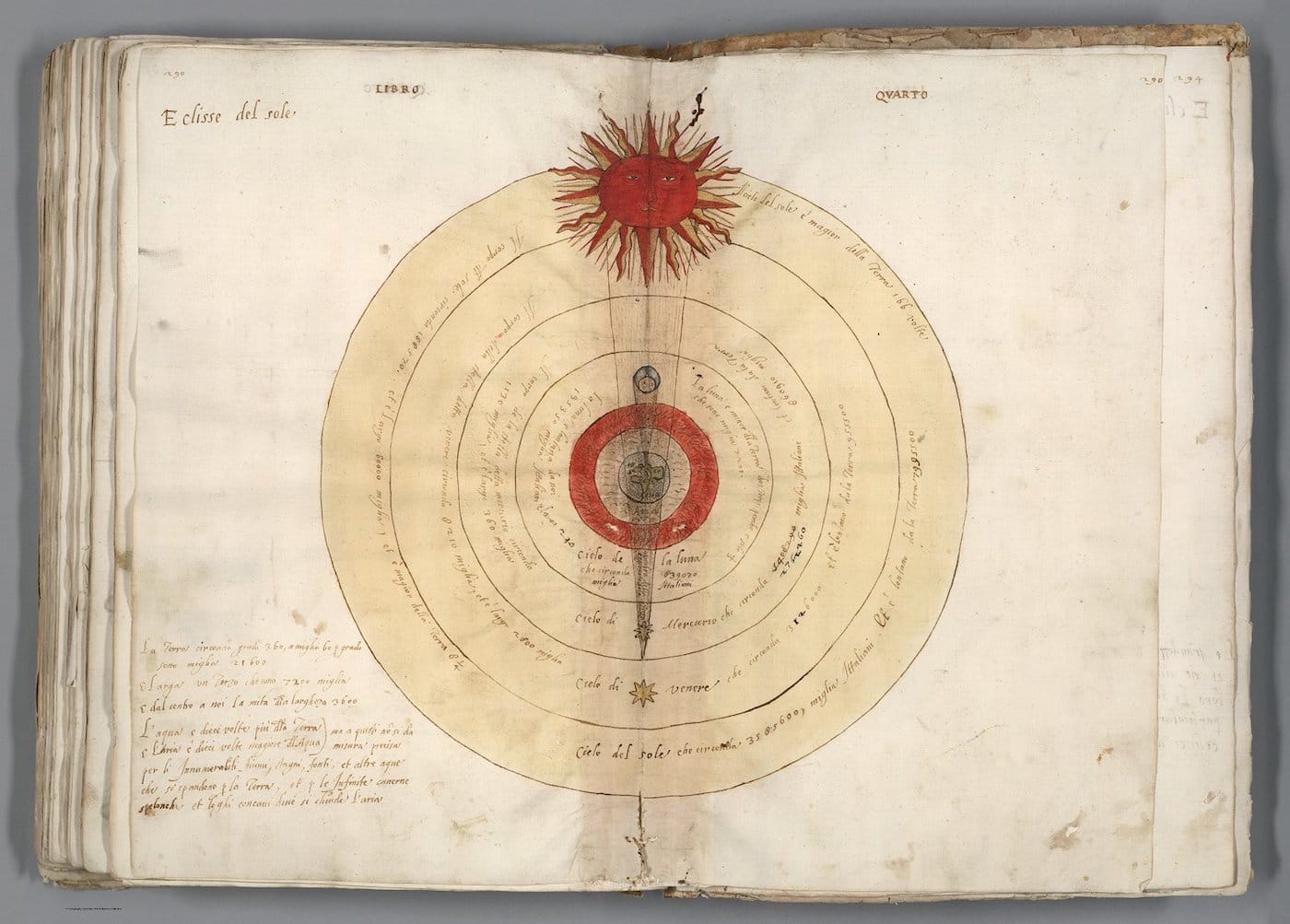
Urbano Monte, born in 1544, was a wealthy scholar from Milan who dedicated much of his later life to studying the earth’s geographies. In addition to publishing a voluminous treatise detailing our planet’s physical complexities, the nobleman also designed three planispheres that laid out the wonders of the world in rich, colorful illustrations. His first, completed in 1587, represents the largest known, early modern map of Earth, and includes scientific information such as regional climates and lengths of days. Spanning over nine feet in diameter, it is made up of 60 sheets that capture our continents and waters in stunning, handdrawn detail.
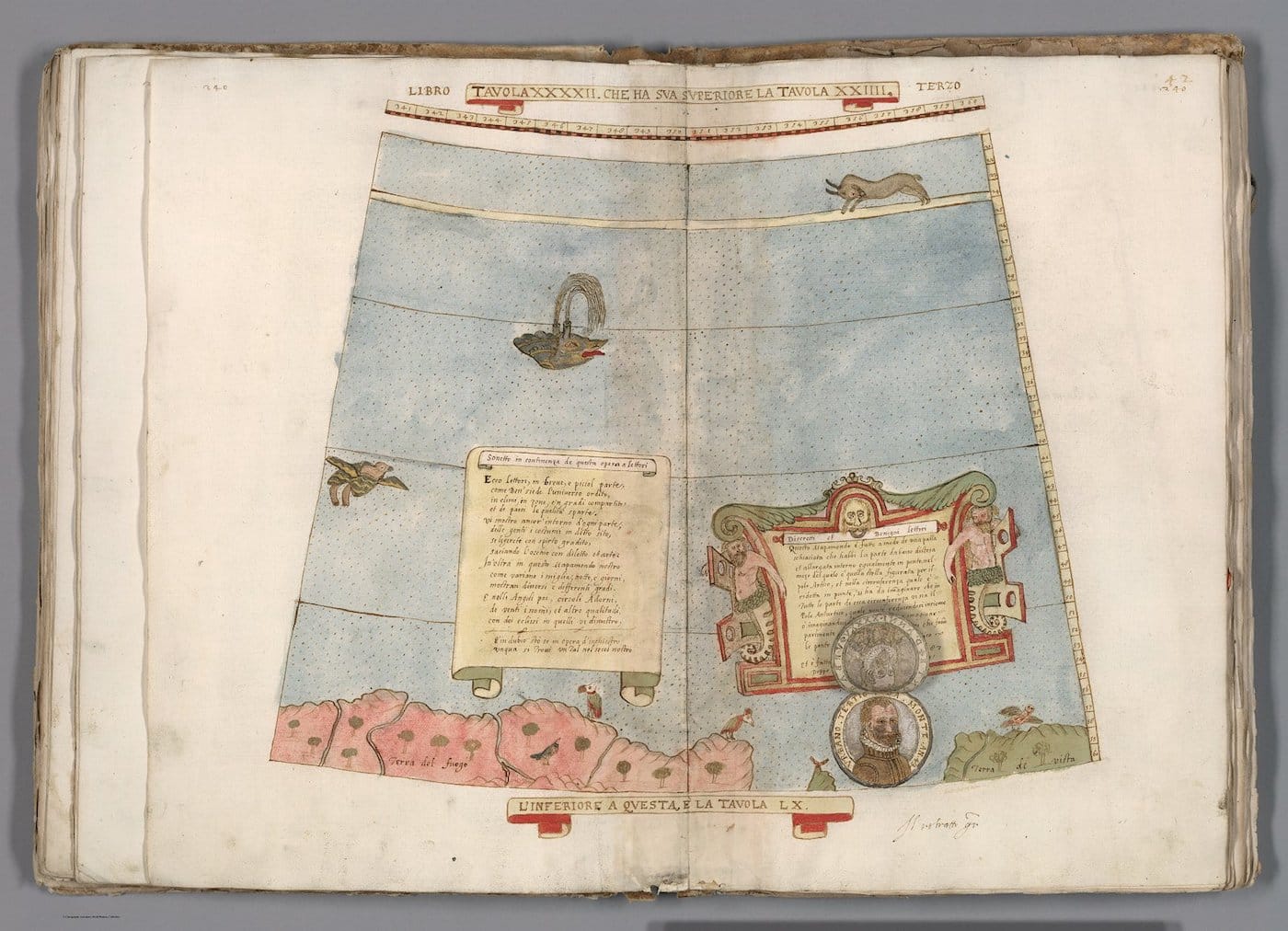
Monte had left a note in one section explaining that the sheets were to be arranged so that the map could be placed on a wooden panel and revolved around a central pivot. Long bound as an atlas, the 60 manuscripts have been assembled for the first time as Monte intended, into a massive plan. Recently, the David Rumsey Map Center at Stanford Libraries acquired and scanned the sheets, then digitally stitched them together. (Only two sets exist; the other is held at the Biblioteca del Seminario Arcivescovile di Milano.) The team created a simulation of a revolving map, and individual reproductions of the sheets are all available to browse online.

As the elaborate, resulting assemblage shows, Monte settled on an unusual solution to the problem of depicting a globe on a flat surface: although designed after the introduction of the Mercator projection — the presentation most commonly used today — the nobleman elected for a polar azimuthal projection, which situates the North Pole at the center, with all other land masses radiating around it. The same projection is found on the logo of the United Nations.
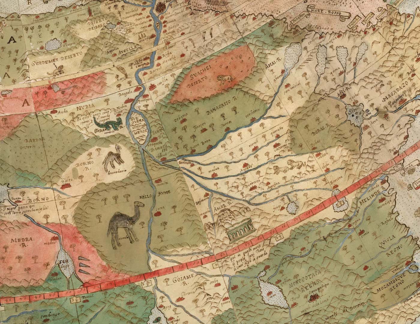
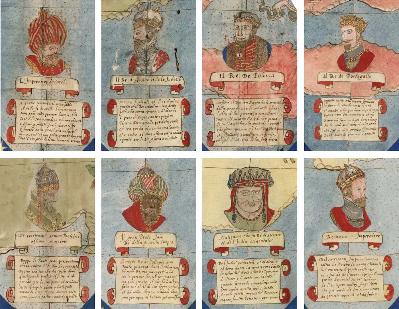
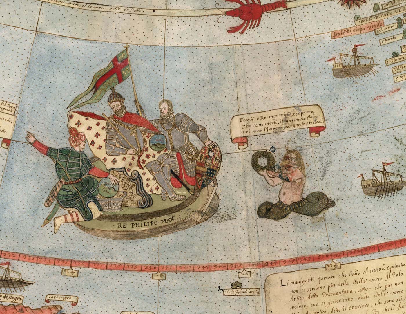
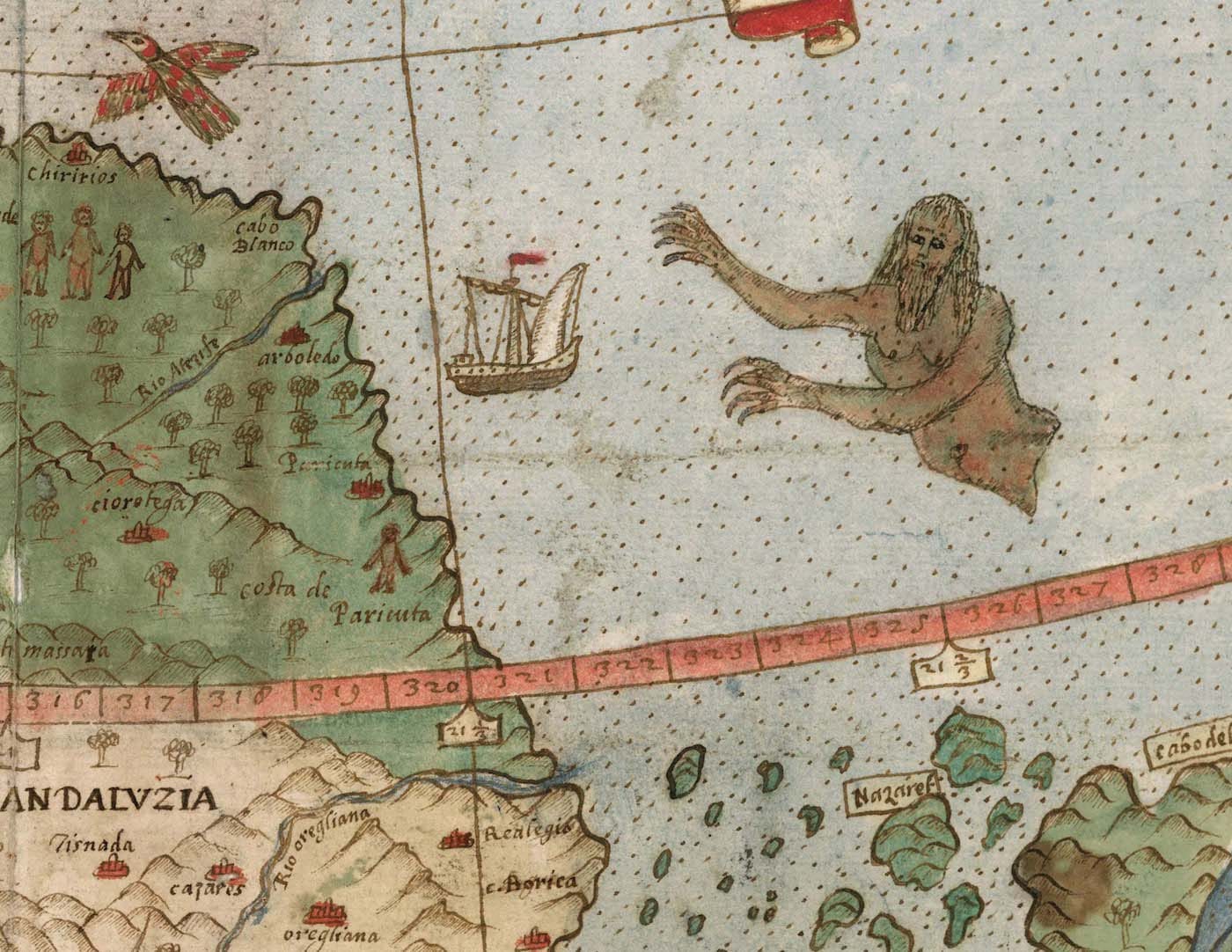
Monte’s map stands out for this uncommon choice of perspective, but like many Renaissance-era maps, it is eye-catching for its illustrations that fill nearly every blank space. The relationship between land masses and waters is fairly accurate, considering the map’s time period, but its maker also includes many fantastical beasts that frolic on land and sea, from reptilian beasts to griffins to unicorns. Other pictures are more faithful to reality, such as portraits of Monte himself and of King Philip II of Spain — the latter of which reminds of the Spanish empire’s power during that time.
Rumsey emphasizes how Monte’s document merges science, art, and history, writing, “The north polar projection of his planisphere uses the advanced scientific ideas of his time; the artistry in drawing and decorating the map embodies design at the highest level; and the view of the world then gives us a deep historical resource with the listing of places, the shape of spaces, and the commentary interwoven into the map.”
Although fascinated with the world, Monte was a homebody of sorts. Rather than venturing on explorations to gather firsthand knowledge of distant lands, he turned to libraries and relied on published texts — largely contemporary sources — to compile research. His early planisphere is a document worth study in its own right. Now that this significant primary source is fully digitized and freely accessible, scholars have an opportunity to better understand this thrilling age of discovery through the mind of one savvy and creative individual.