Google Maps Makes a Modest Attempt at Wheelchair Accessibility
For wheelchair users like myself, technology elicits both joy and skepticism: Can an app really change the way I experience architecture that wasn't designed for me?
Recently, Google Maps rolled out a “Wheelchair Accessible” travel feature, which sends users on alternate routes that account for necessities like ramps and elevators. (Google started collecting location-specific information from wheelchair users last year.) I use a wheelchair, which means that I often reroute my travel to avoid stairs and find accessible entrances. Any piece of new navigational technology immediately elicits equal parts joy and skepticism: will this actually work? Could it change the way I experience architecture that, too often, isn’t designed for me?
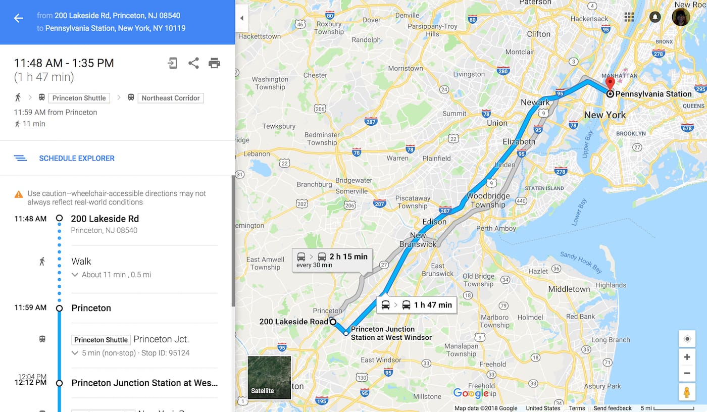
This month, I found out. I planned to rely solely on directions suggested by Google Maps on a trip from Princeton, New Jersey to Pennsylvania Station, in New York City. I started by typing in my destination from a Princeton University housing complex, and saw that the “Wheelchair Accessible” route wasn’t so different from the directions that others would see. I chose a route that was supposed to take one hour and 47 minutes. It came with a disclaimer: “Use caution — wheelchair-accessible directions may not always reflect real-world conditions.”
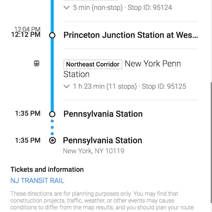
Google Maps suggested Amtrak’s Northeast Corridor train, but it was significantly more expensive than New Jersey Transit, so I chose the latter. (So much for going wherever Google sent me.) Either way, I was supposed to “walk” half a mile — strangely, the route even included an icon of a pedestrian — with an estimated travel time of 11 minutes. This was where the problems began. I know from personal experience that the route to the train station is almost entirely uphill. Half a mile, uphill, in 11 minutes? My shoulders did not deserve such abuse. I hopped onto a Princeton shuttle to get to the train station.
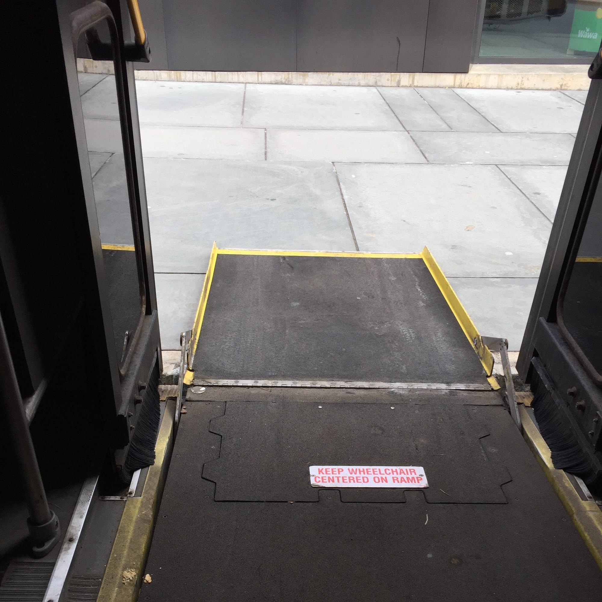
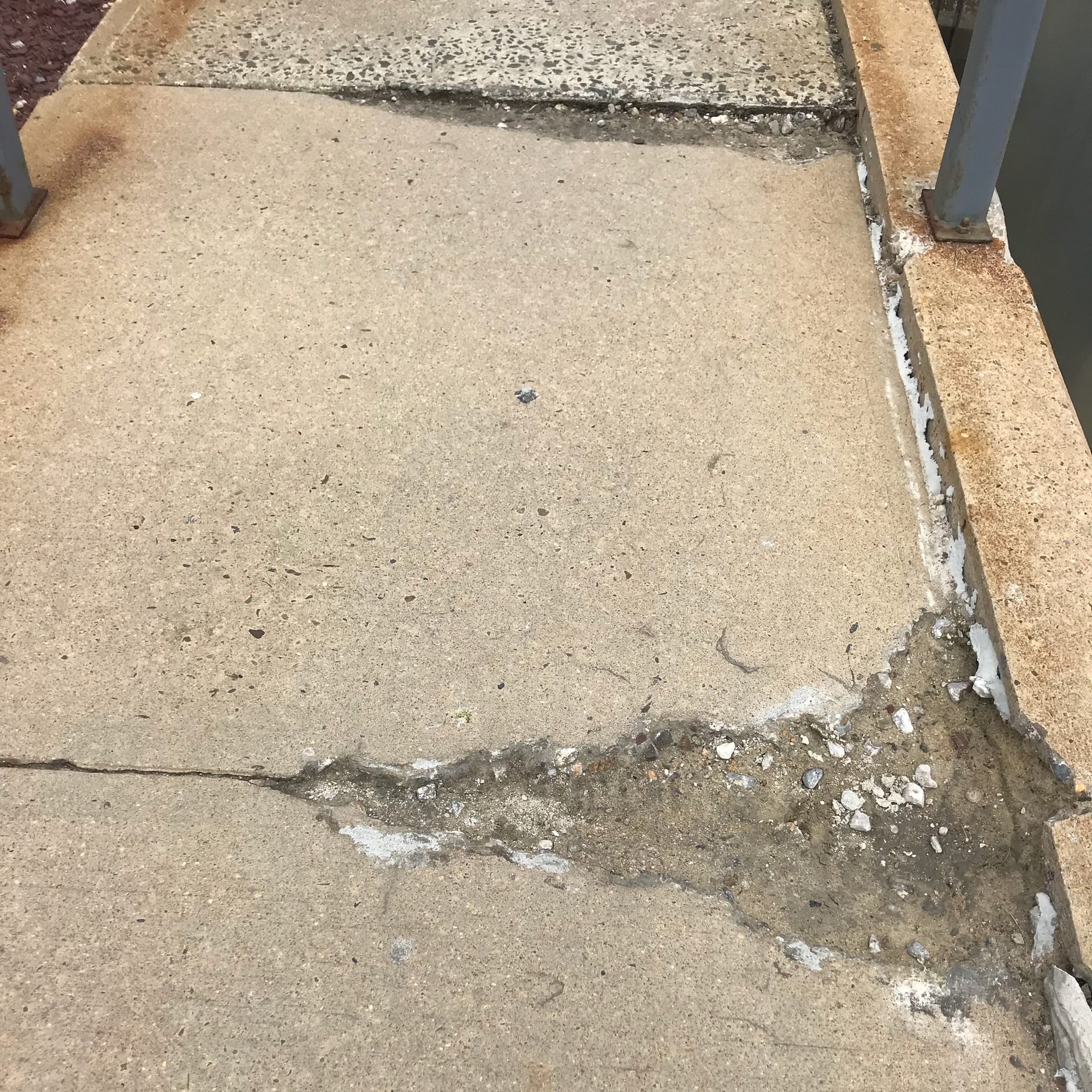
Traveling by train often requires an abundance of ramps, as any wheelchair user knows. I boarded and exited the shuttle with help from a movable ramp. At Princeton Junction, I managed to pass over the potholes in a couple concrete ramps in dire need of repair. But I found my train without too much trouble, and boarded it with yet another ramp.
For those who have not had the pleasure of visiting Penn Station, I want to point out one important detail: it is a labyrinth, in nearly the classical sense. It zigs and zags, sometimes veering into dim corners where you would expect a resident Minotaur to ingest weary travelers. There is minimal signage, and there are many hidden elevators.
The able-bodied tourist might be able to follow a crowd up a flight of stairs, or find a staircase that leads to a subway line and then a street exit. But the mobility-impaired traveler only can follow a crowd for so long before the search for a working elevator must begin. In the past, I have found an elevator behind a Krispy Kreme donut stand. But New Jersey Transit operates its own tracks and platforms within Penn Station. Can Google Maps help?
Not really. Google Maps told me how to get to Penn Station, but not how to get out. So I wandered around until I found an elevator, and — at long last — rode it from the train platform to freedom. Almost.
I wanted to follow a crowd of people into the main station lobby, but that would have been impossible. Eventually, I found a sign. I looked to the left, and there it was — a lonely hallway where a janitor had left some cleaning equipment. Surprisingly, the hallway gave me a lovely view and a fast route past the lobby, with minimal interactions with other humans (a New Yorker’s dream). Whether I wanted to or not, the route made me a people-watcher: I could stare at the lobby, but not wheel through it.
Architecture often gives wheelchair users a dramatically different view of architectural spaces. The main research library at my undergraduate institution had a grand staircase that led to an impressive-looking lobby. I had my own entrance: I wheeled around to the back, went in through a ground-level entrance, and wheeled through a long hallway in which I could only hear the echo of my wheelchair tires. I was alone, a floor below the sights that tourists loved to gawk at. I was vaguely aware of their existence, while they knew nothing of mine — until the elevator took me to their level, and they noticed a woman in a wheelchair, quietly saying “Excuse me” on the way to the circulation desk. My library entrance, and the route I had to take, seemed like a legally-mandated workaround, rather than an actual attempt at inclusion.
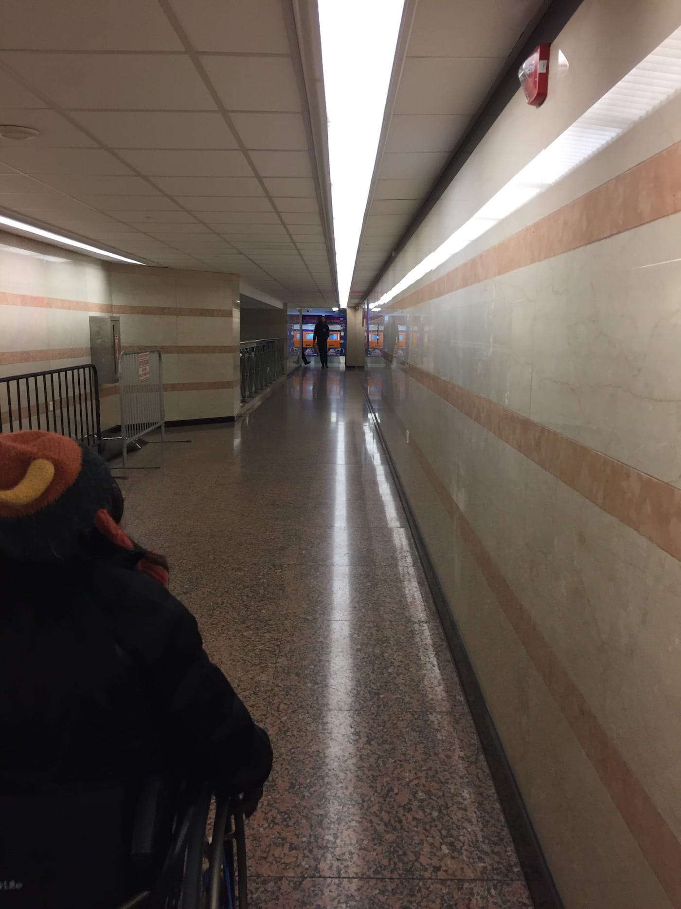
As I looked out at the crowd in Penn Station, I again felt detached from the flow of foot traffic. But this experience was not quite the same. The tourists and commuters only looked ahead at the next staircase, the next exit. They moved quickly, with purpose. To stall meant to interrupt the person behind them. But I had time to dawdle, and to look at the parts of the station where I was not meant to go. As always, the people in the main lobby were unaware of my existence, but perhaps this time it was not by design.
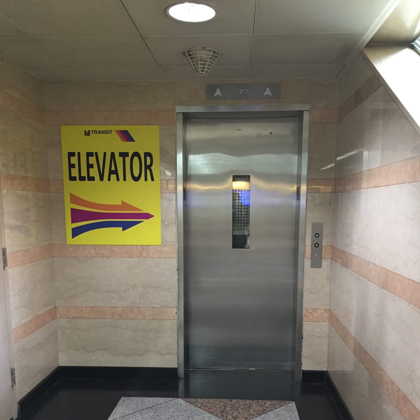
After the long hallway, I navigated past a small crowd before finding the elevator tucked away by the side of a large staircase, next to an uncharacteristically helpful sign.
This final elevator took me to street level. Including a train delay, the journey from wheelchair-accessible door to wheelchair-accessible door took about 2 hours and 38 minutes. As I exited the station, I felt some relief in that I had maintained my skepticism of Google Maps’ Wheelchair Accessible route feature. Technically, the route that Google Maps gave me was wheelchair-accessible. But was it wheelchair-friendly? Not exactly. A friendly set of directions would not have told me to “walk” — walk? really, Google? — half a mile uphill, and then find my own way out of the crowded Penn Station labyrinth.
To be fair, the Minotaur-infested maze that is Penn Station will not be fixed with any smart phone app. It would have helped to see a map of Penn Station, with the elevators marked, but I’m not sure Google Maps can direct users through indoor areas. Perhaps this new feature will be of greater assistance in outdoor areas separated by stairs, such as college campuses and public parks.