Celestial Art and Science in Albrecht Dürer's 1515 Star Charts
The same year that Albrecht Dürer created his famous rhinoceros woodcut, the German artist also collaborated on the first star charts printed in Europe.

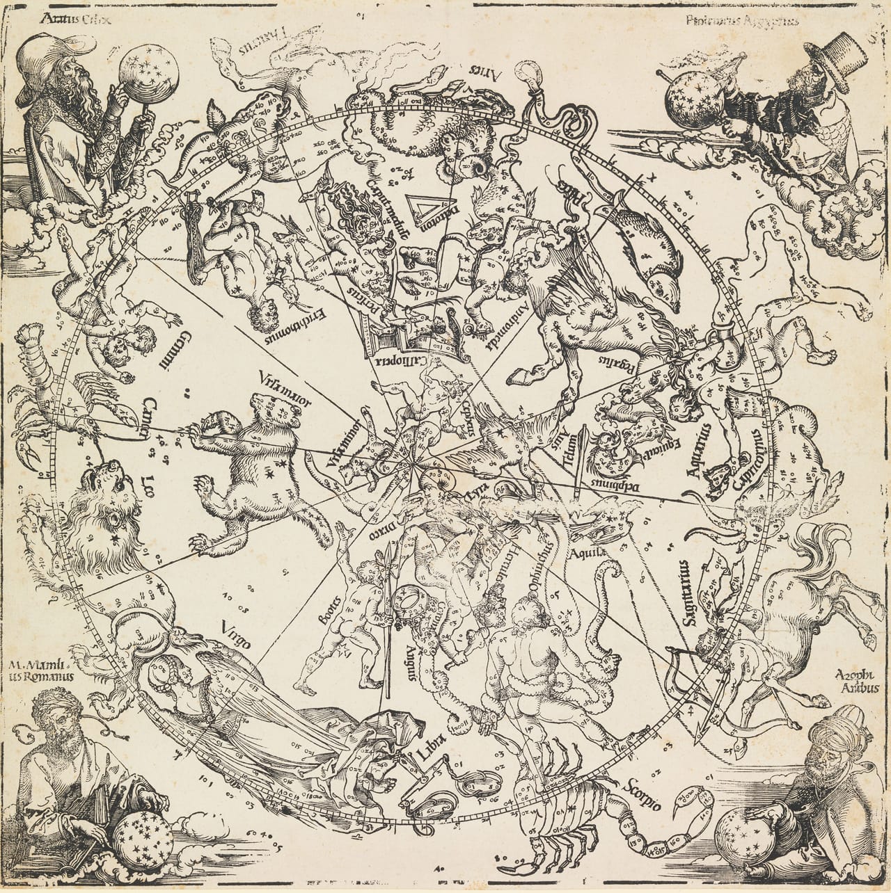
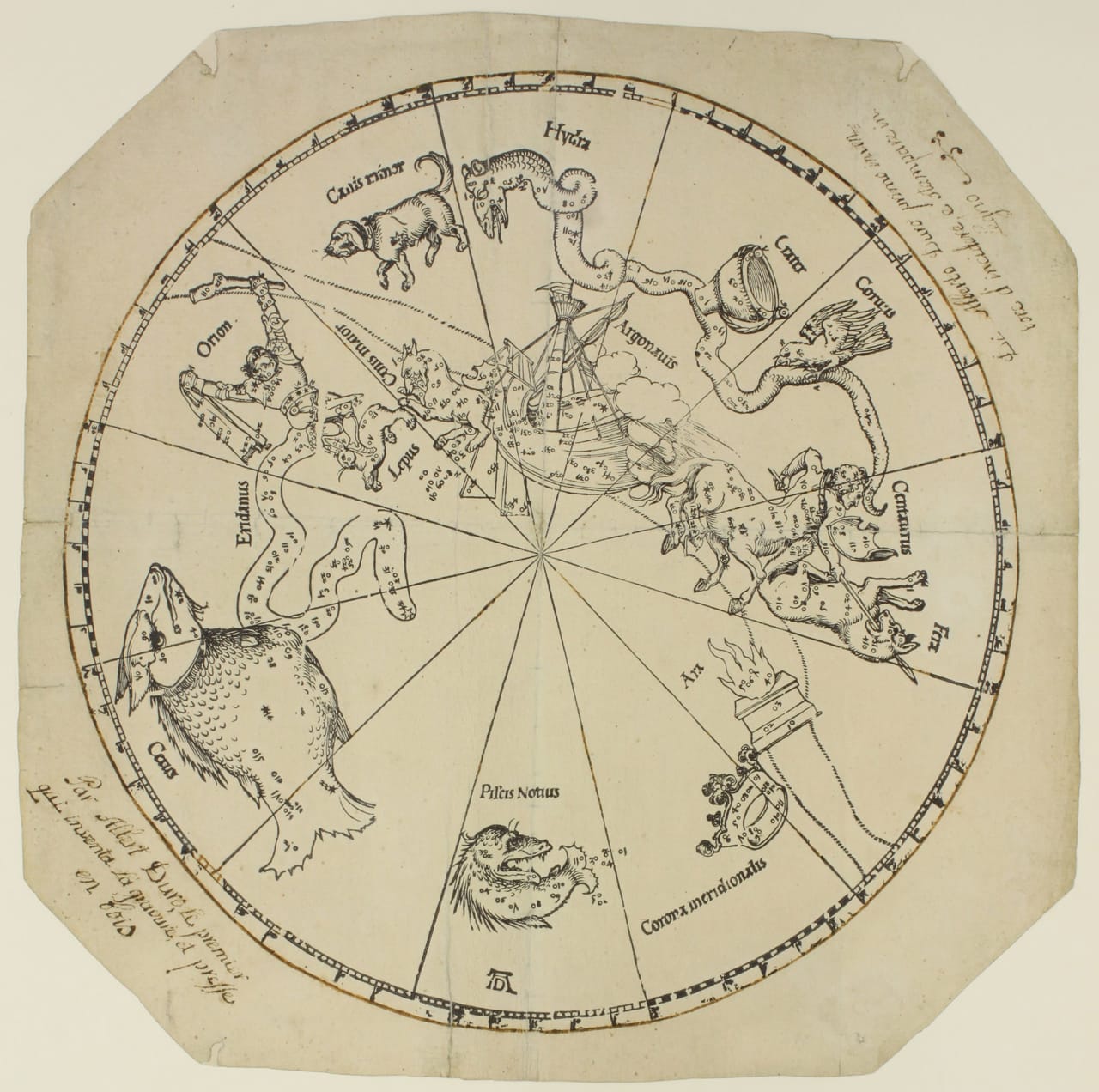
The same year that Albrecht Dürer created his famous rhinoceros woodcut, the German artist also collaborated on the first star charts printed in Europe. The 1515 maps of constellations from the Northern and Southern Hemispheres combined the scientific knowledge of the stars with Dürer’s illustrations.
Two of these woodcut maps are currently on view in The Nuremberg Sky: Dürer Star Maps of 1515 at Albrecht Dürer’s House, part of the Nuremberg Municipal Museums. The exhibition is in collaboration with the Nürnberger Astronomischen Gesellschaft (Nuremberg Astronomical Society), marking the 500th anniversary of the charts. In 2011, when another copy was auctioned by Sotheby’s, the Guardian reported that only 10 examples of the 1515 maps survive.
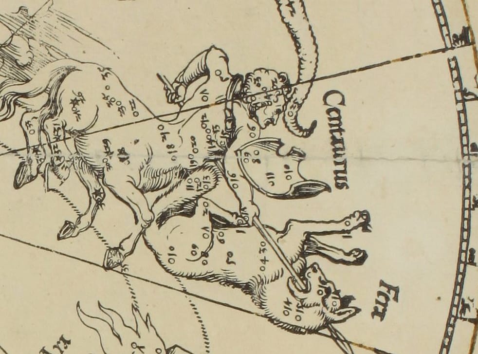
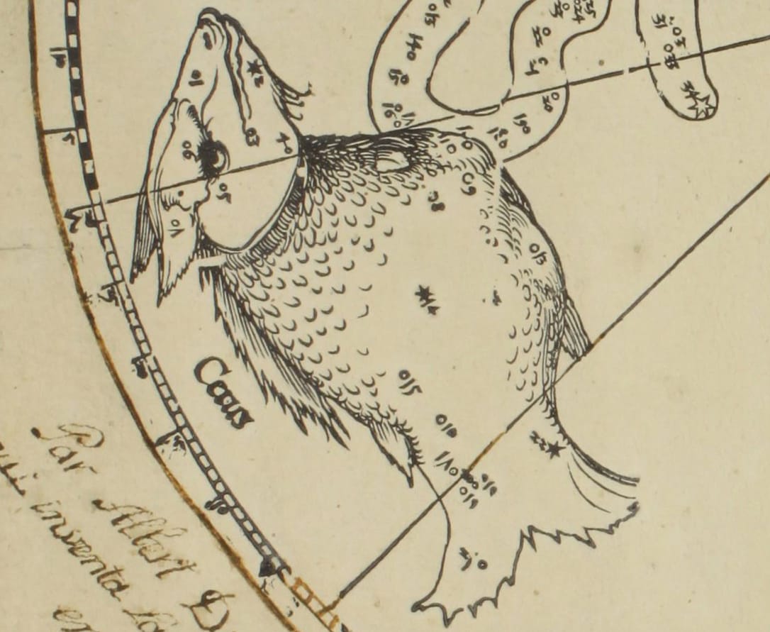
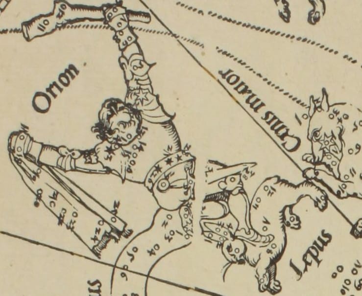
Even five centuries later, a modern viewer could pick out constellations from the sky based on the maps. Dürer created the charts with the cartographer and mathematician Johnannes Stabius, based on work by astronomer Conrad Heinfogel. The 48 constellations named by Ptolemy in the 2nd century appear, as do the 12 Zodiac signs. Some constellations, however, are obsolete, like Argo Navis, the Greek ship of Jason and the Argonauts plowing through the Southern Hemisphere. Most of the Southern Hemisphere is empty, as it hadn’t yet been plotted by Europeans.
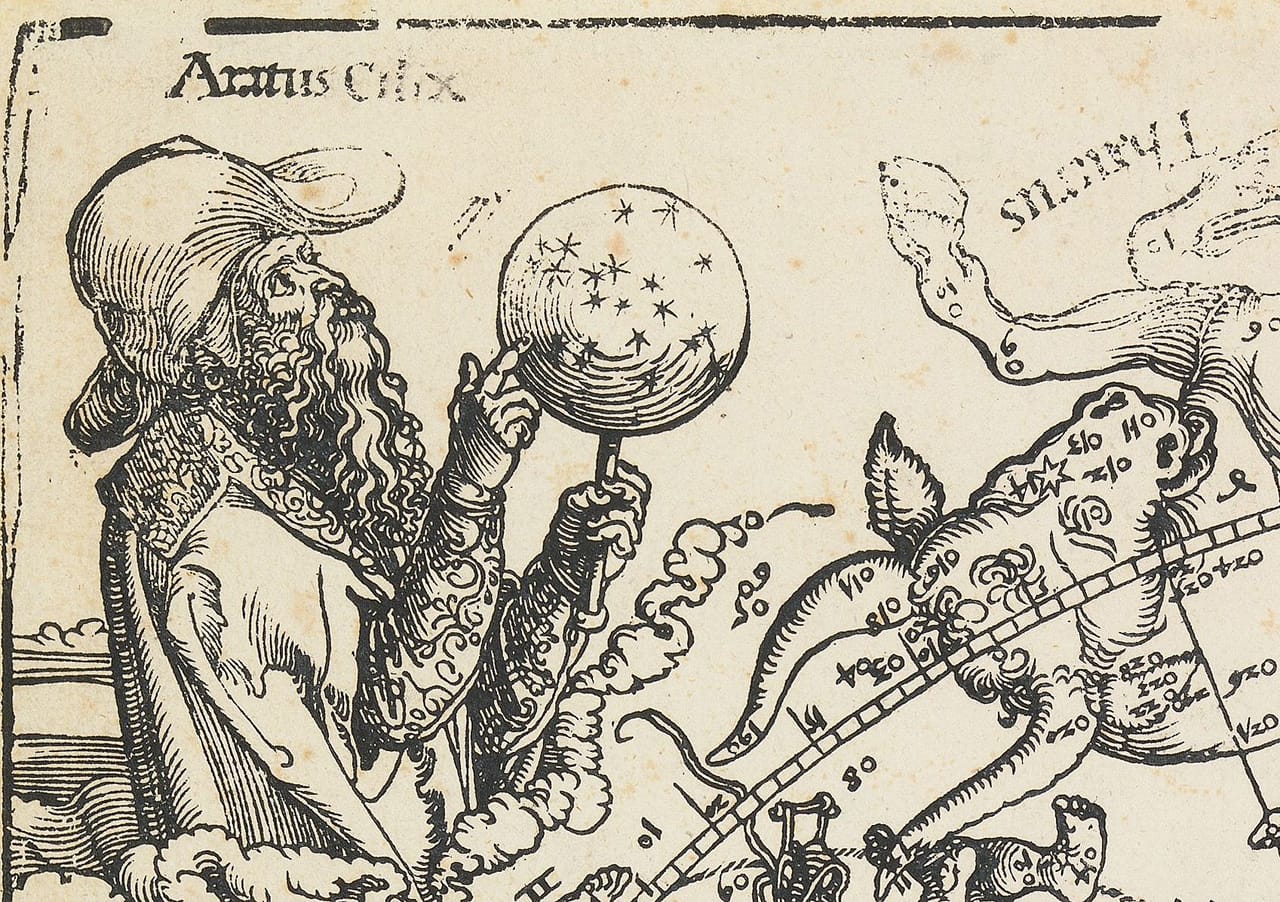
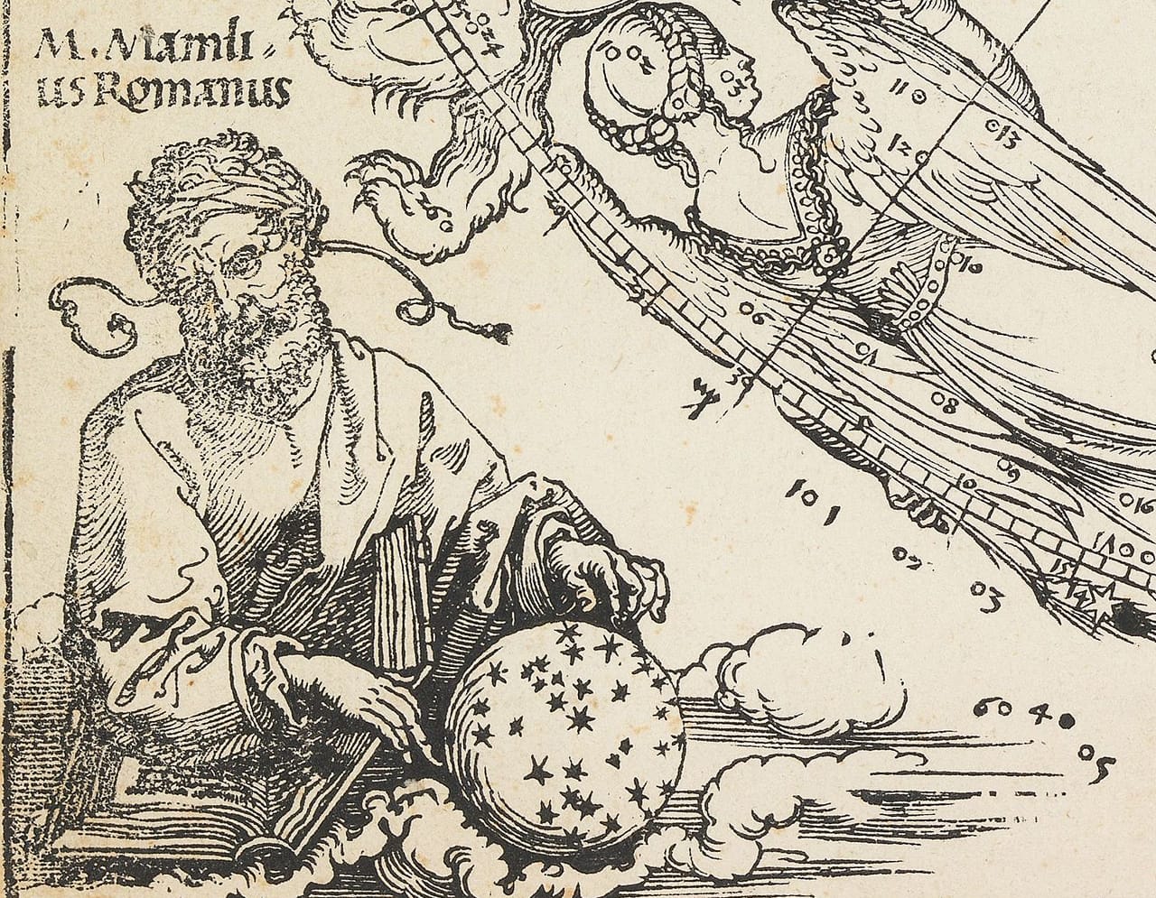
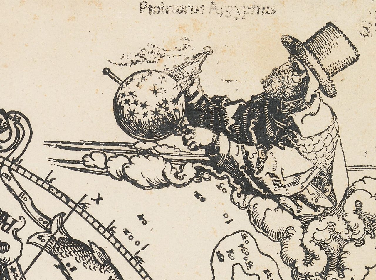
Throughout his career, Dürer was interested in the mass production and commercial possibilities of the developing publishing industry, recognizing it as a way to raise his profile while simultaneously disseminating information to a wider audience. Prior to 1515, all the European star charts were hand drawn. He wasn’t the first in the world to print a star chart — astronomer Su Song’s Xin yixiang fayao was printed in China in 1090. Yet Dürer was the first to combine the existing knowledge with captivating visualizations that would endure on star charts to the 19th century. And on the Northern Hemisphere chart, he calls out the great ancient astronomers and astrologers who paved the way, with Ptolemy, the Greek Aratus, the Persian Al-Sufi, and the Roman Marcus Manilius all considering and measuring celestial globes in its four corners.
The Nuremberg Sky: Dürer Star Maps of 1515 continues at Albrecht Dürer’s House (Albrecht-Dürer-Straße 39, Nuremberg, Germany) through December 20.