In the Arizona Desert, Artists Rediscover Relics of a Cold War Satellite Program
Julie Anand and Damon Sauer are photographing the x-shaped calibration markers from a once top-secret spying project by the US government.

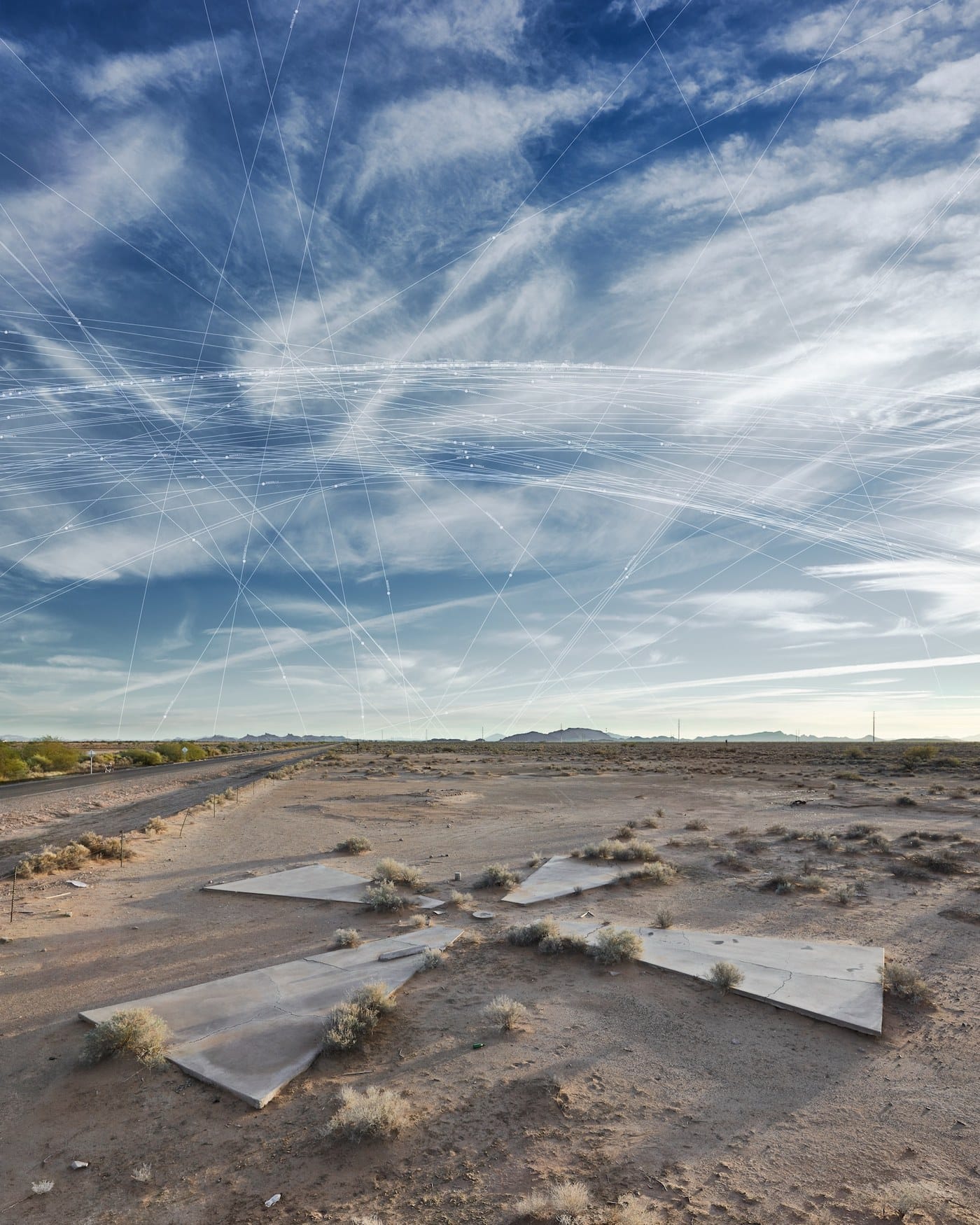
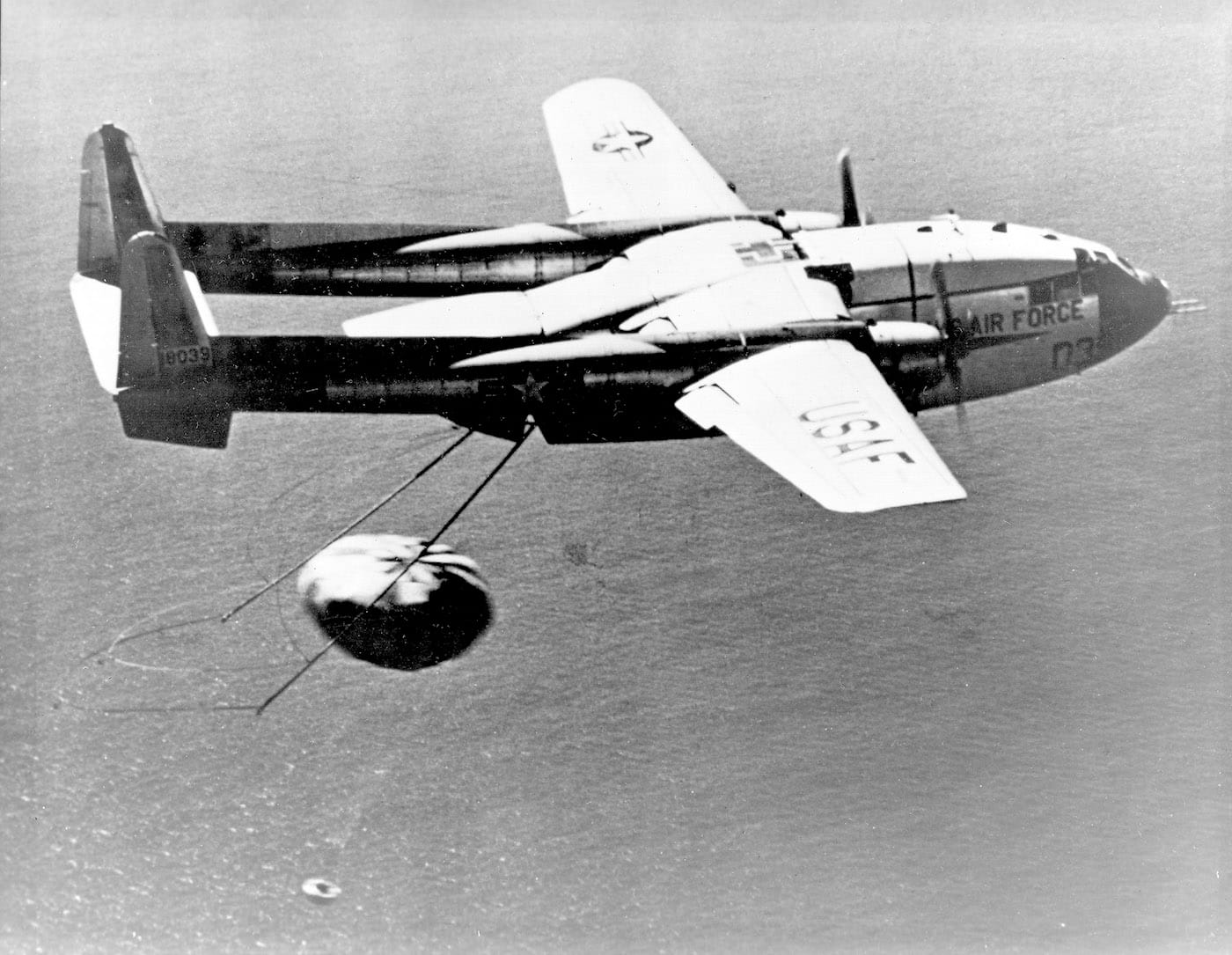
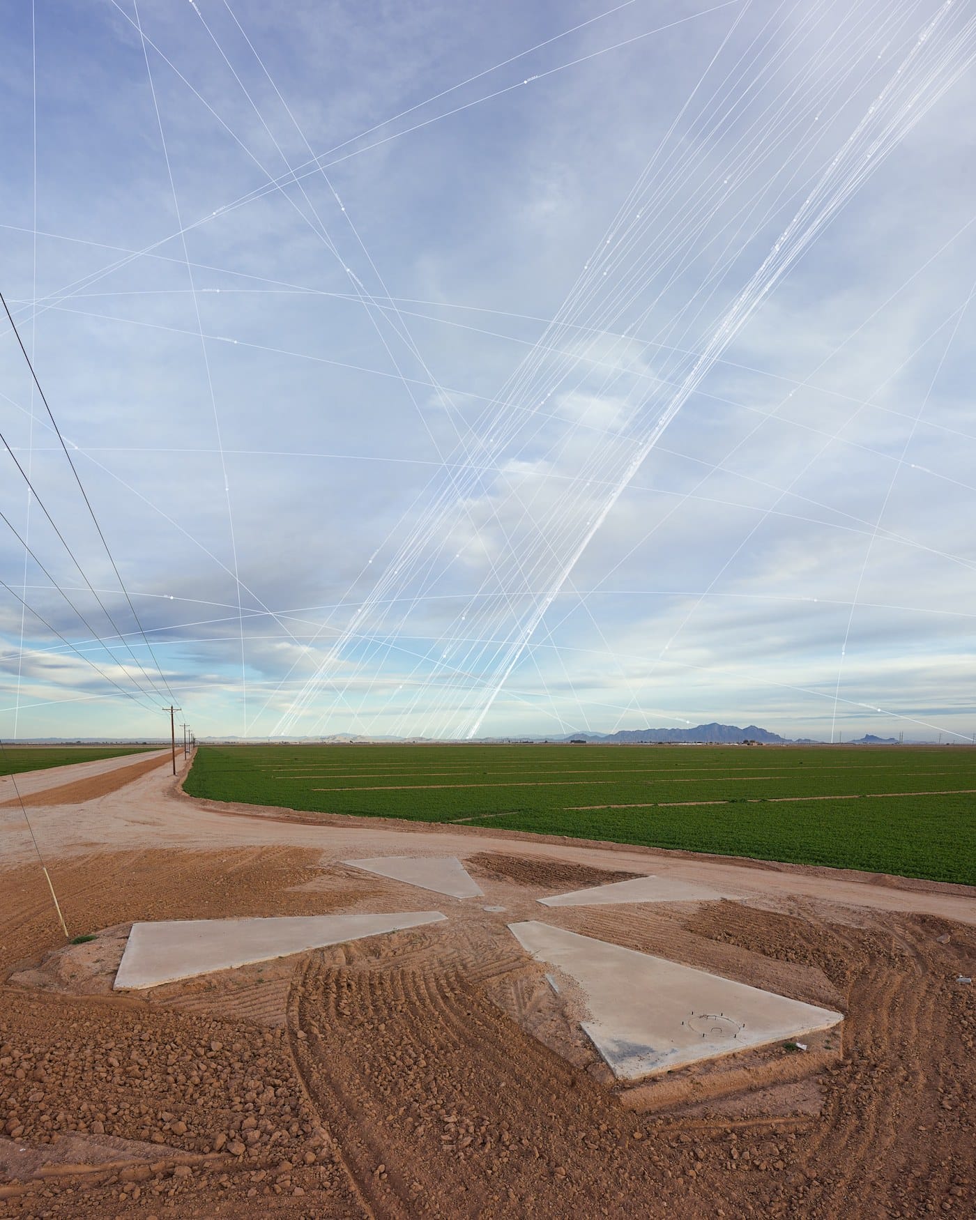
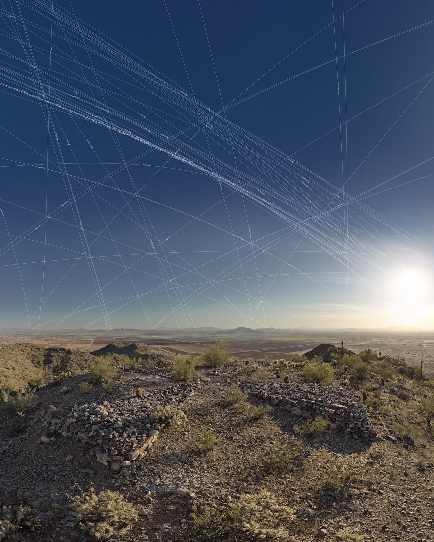
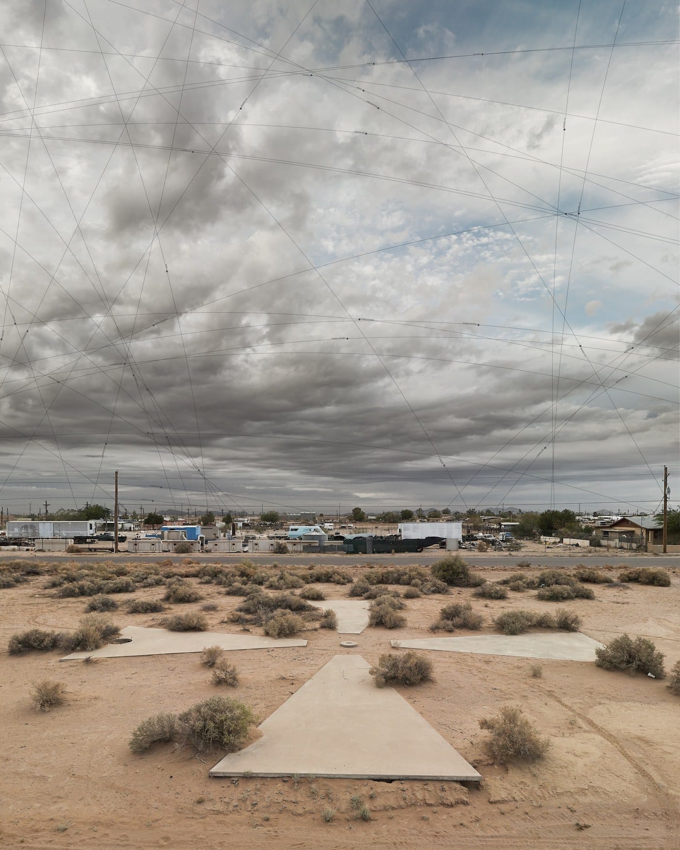
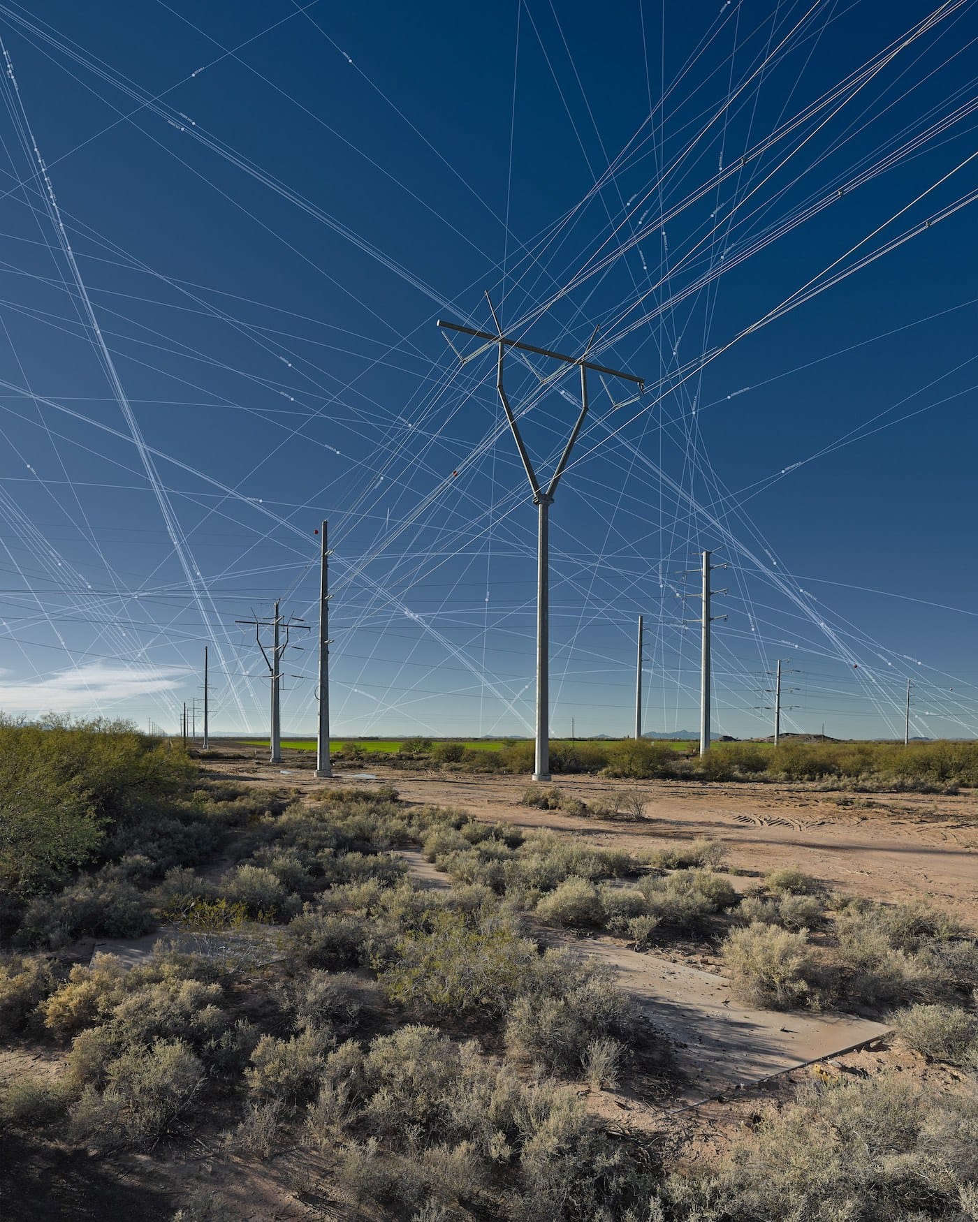
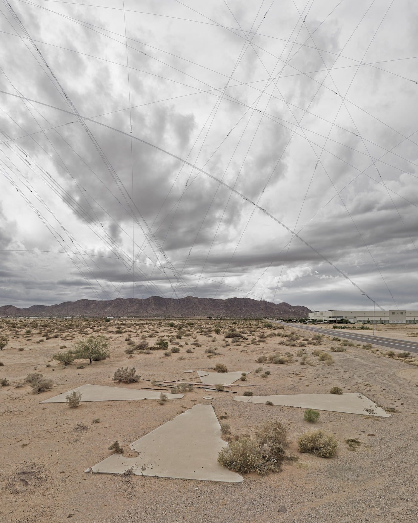
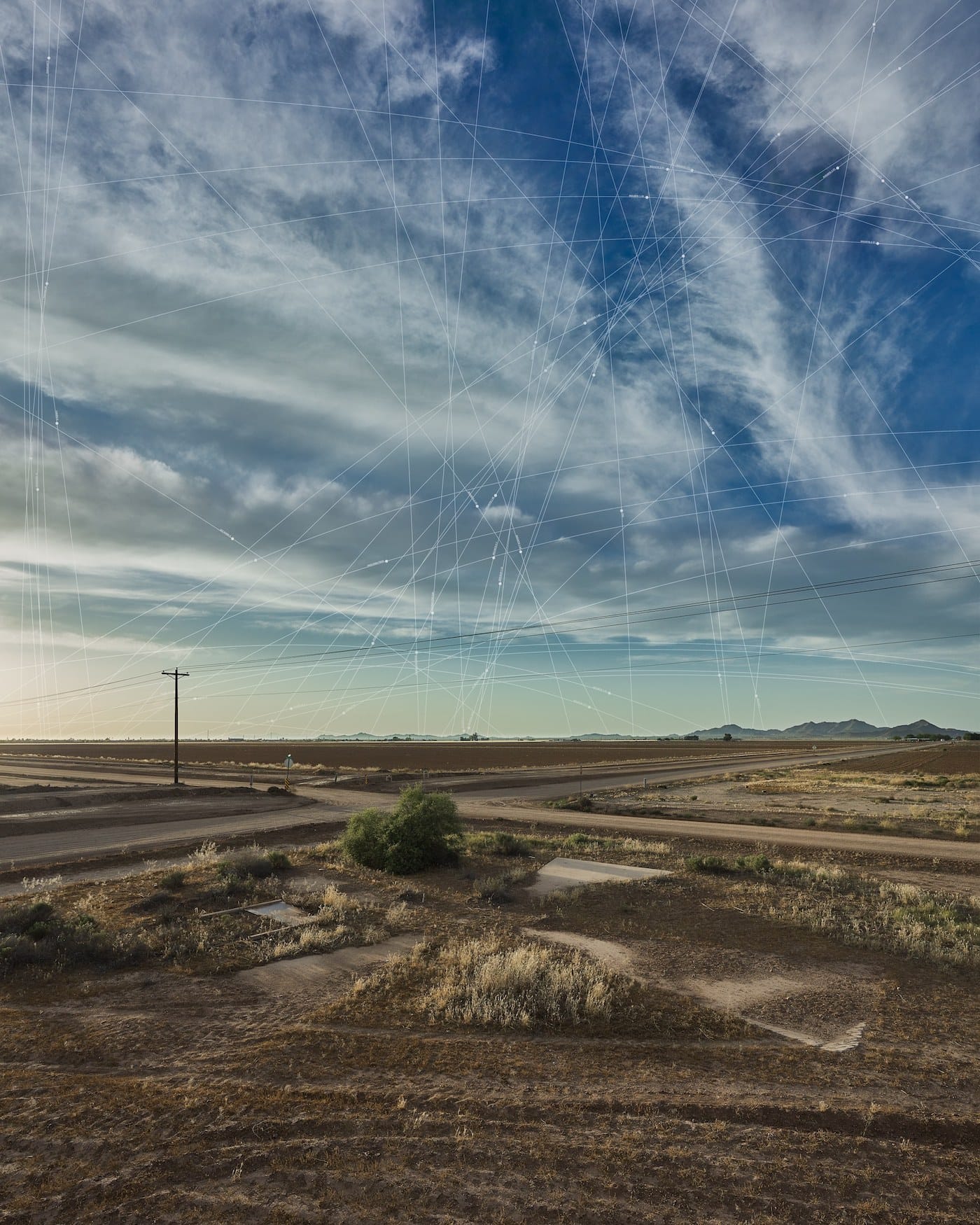
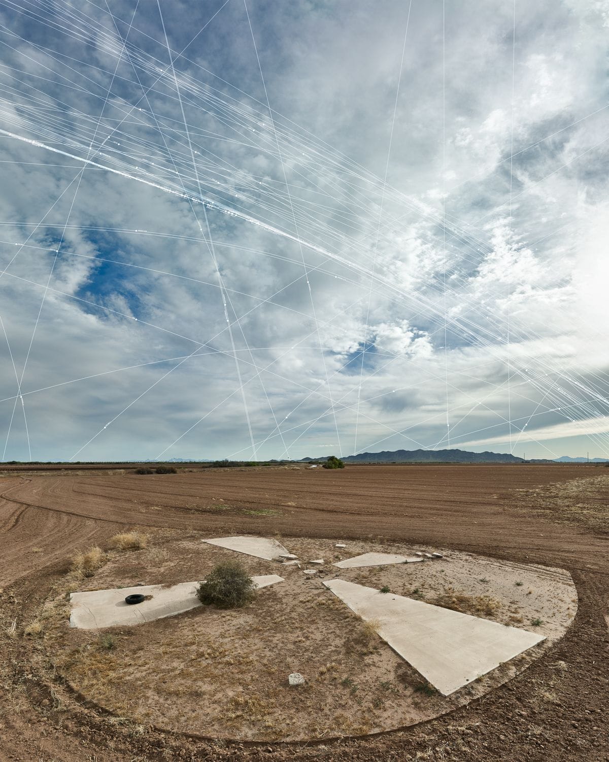
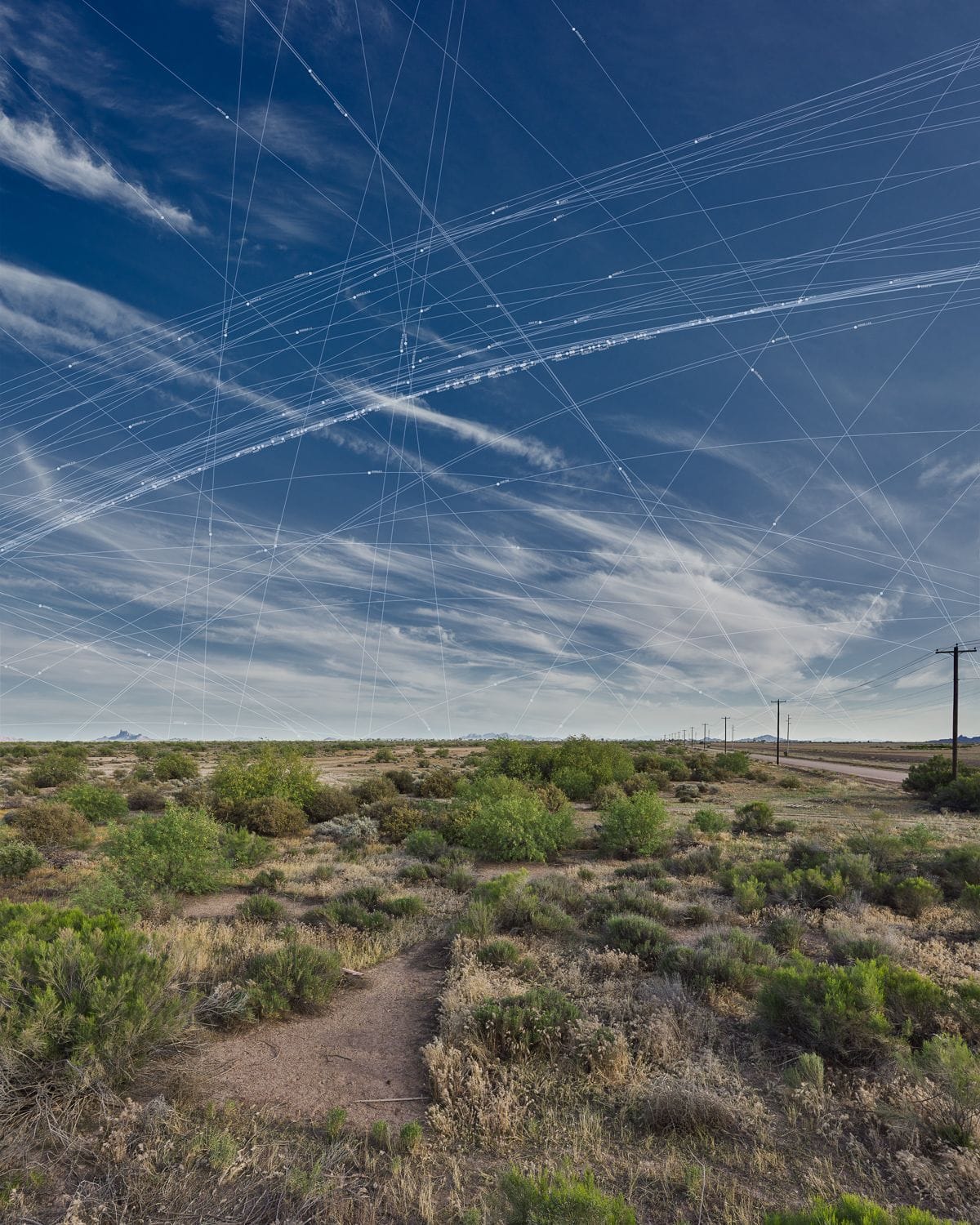
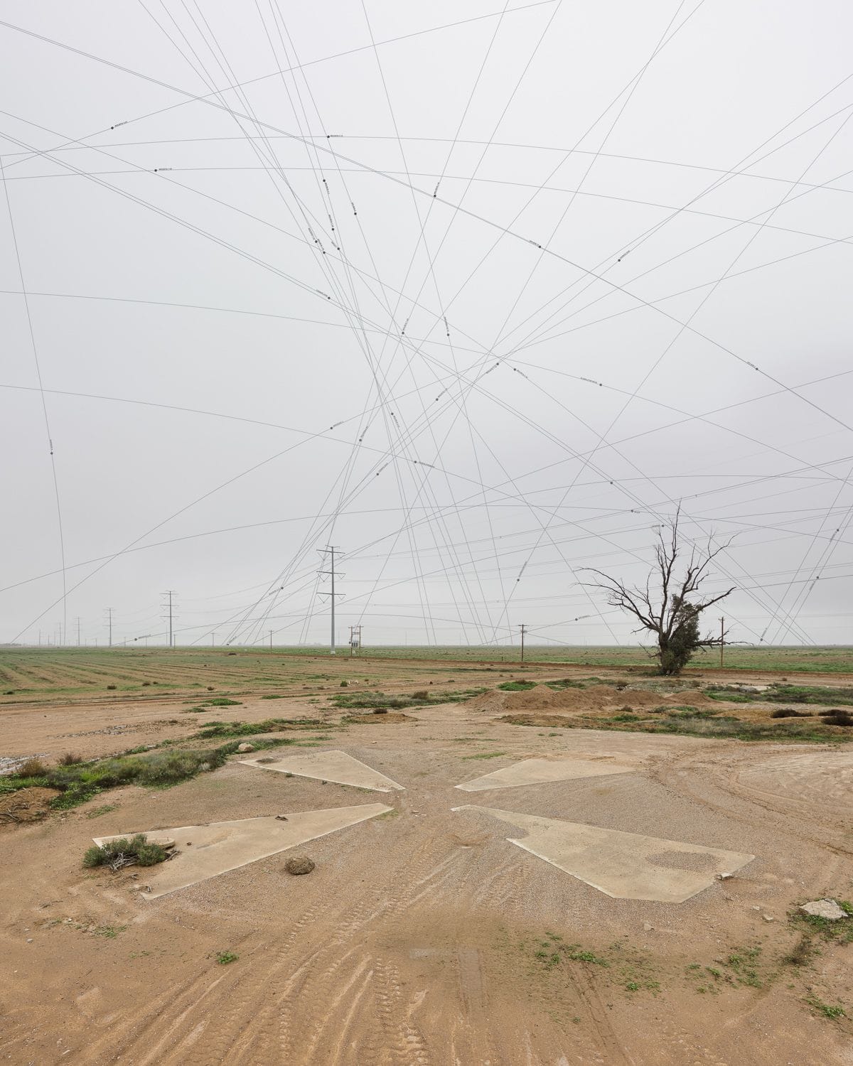
Strange colossal shapes dot the Sonoran Desert in Arizona, x-shaped relics of a once top-secret Cold War spying project. Known as the Corona program, the surveillance initiative by the CIA and US Air Force involved using satellites to take aerial photographs of the Soviet Union and the People’s Republic of China. The cameras on these satellites were calibrated with concrete crosses 60 feet in diameter. Their exposed 70mm film was later jettisoned in space, the parachuting capsules caught in mid-air by plane. The calibration markers helped assure that the film was in focus, and that there was a landscape measure to accurately assess the size of pictured objects.
Approximately 256 of these markers were placed on a 16-square-mile grid in Arizona, spaced a mile apart. Long after Corona’s end and its declassification in 1995, around 100 remain. Phoenix-based artists Julie Anand and Damon Sauer have spent three years tracking them down for a project called Ground Truth: Corona Landmarks.
“We were intrigued to discover that there was this massive system located in our backyards that was part of a historically significant program in the development of satellite technology,” the artists told Hyperallergic. “And we were attracted to the idea that these markers of space had become markers of time — a poignant geopolitical moment in the human desire to see from above.”
The Corona program produced what are recognized as the first maps of the Earth from space. Anand and Sauer photograph the markers with a heavy emphasis on the sky, to which they later add the paths of satellites that were passing by at the exact time of the picture. On their project site, you can zoom in on high-resolution photographs to see the names of the satellites, which are numerous, visualizing how ubiquitous they’ve become since the Corona program.
“By turning the sites into observatories of the contemporary proliferation of satellites, we feel we are bringing new meaning to the calibration markers,” the artists said. “We think of the images that we are creating as being simultaneously historic document, aesthetic artifact, and data map.”
The pair has also created an interactive map of the markers, each of which is represented by one of their pictures (they’ve shot over 40) or by a historical or recent aerial photograph. Some markers are barely detectable beneath dirt or grass, mostly crumbled away; others are strikingly preserved, adjacent to homes and roads. The Center for Land Use Interpretation notes that there are “dozens of aerial photo calibration targets across the USA,” most of them made in the midcentury and many still on restricted land. The Corona markers transmit a narrative about the past, even while they’re obsolete as technological devices. By juxtaposing the Cold War–era markers on the ground with contemporary satellite paths in the sky, Anand and Sauer encourage a new consideration of how we’re present within huge, sometimes invisible information networks.
Explore Julie Anand and Damon Sauer’s Ground Truth: Corona Landmarks online.
