See a 4,000-Year-Old 3D Map of France
Researchers believe the Bronze Age stone bears a crude map of an area in France’s Brittany region.

The kids these days find it hard to believe we ever had to make do with something as archaic as folding paper maps for wayfinding. But just wait until they hear about how it was done in the Bronze Age! A large slab of rock, measuring five by six and a half feet, is thought to be the world's oldest 3D map of Europe. We're going to need a bigger glove compartment!
The rock, known as the Saint-Bélec Slab, is from France and is believed to date from the early Bronze Age, between 1900 BCE and 1650 BCE. It was initially discovered during digs of a prehistoric burial ground in Finistère (western Brittany) by local archaeologist Paul du Chatellier in 1900 CE. After his death, the archaeologist's collection was donated to the National Archaeological Museum of Saint-Germain-en-Laye. The slab lay forgotten in its cellar until 2014 when several scholars studied du Chatellier's writings and went in search of the artifact in the museum's cellar.
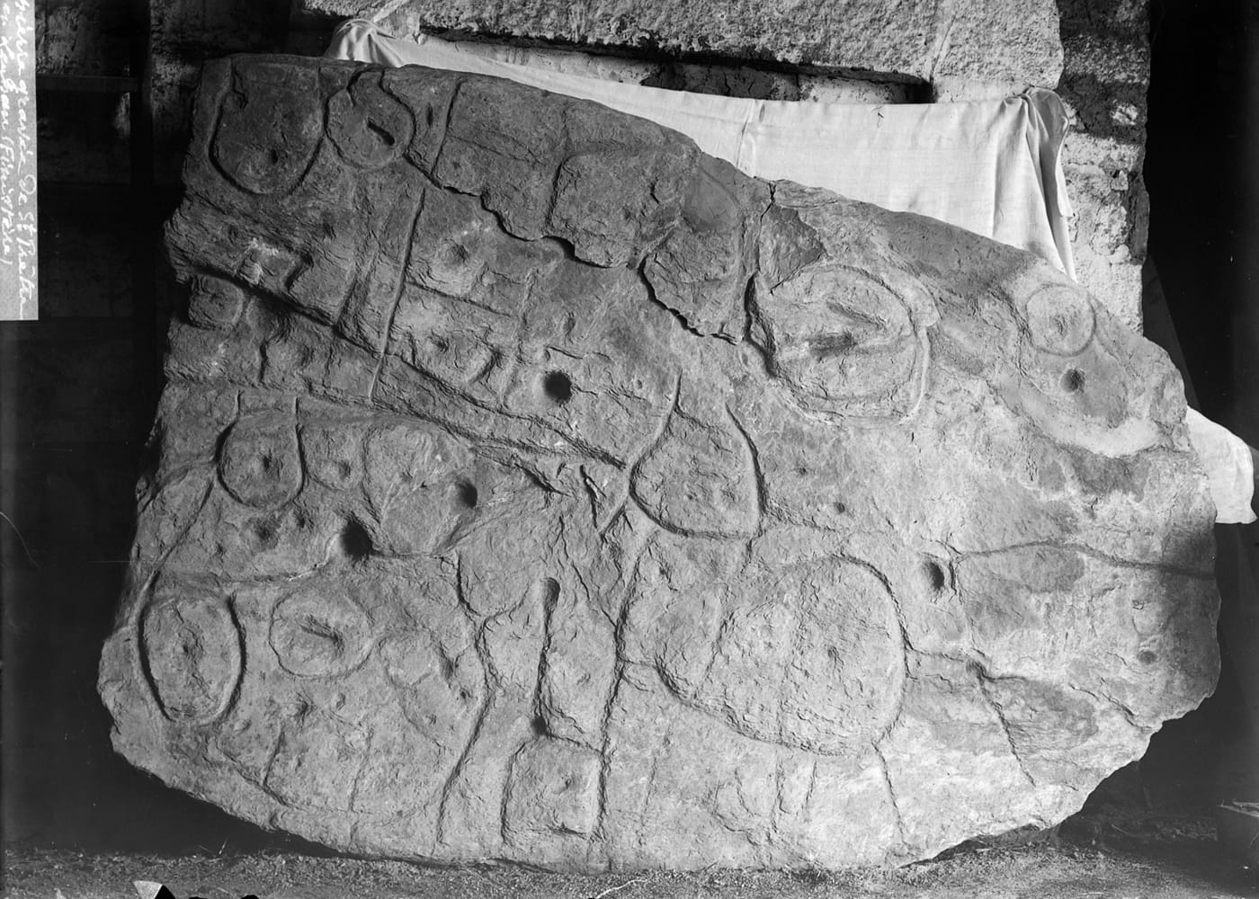
After being rediscovered, the Saint-Bélec Slab has been studied for the last seven years, and archaeologists now believe the 4,000-year-old stone bears a crude map of a region in western Brittany.
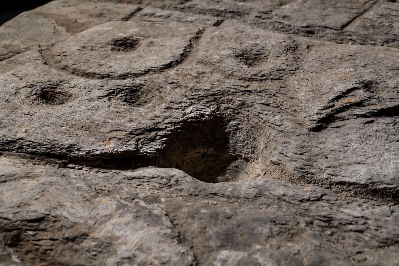
The "presence of repeated motifs joined by lines" on its surface suggested it depicted an area of Finistère, a study in the Bulletin of the French Prehistoric Society said, according to reporting by BBC News. Comparisons to contemporary topography indicate a rough but fairly accurate resemblance to an 18-mile area in the River Odet valley.
"This is probably the oldest map of a territory [in Europe] that has been identified," Clément Nicolas from Bournemouth University, one of the study's authors, told the BBC. Nicolas thinks the map may have been used to identify the landholdings of a particular prince or king of the time.
"We tend to underestimate the geographical knowledge of past societies. This slab is important as it highlights this cartographical knowledge," Nicolas continued. With this research, humanity's breadth and interest in cartography are once again affirmed — but we do have to give it up to millennials for rocking out options with greater portability.
Correction 4/15/2021 2:44pm: An earlier version of this article stated that the slab was discovered in du Chatellier's cellar in 2014. Instead, it was found in the cellar of the National Archaeological Museum of Saint-Germain-en-Laye, where the archaeologist's collection had been donated after his death.