Using Google Street View Data to Track Urban Trees
MIT's project Treepedia maps the protective green canopy of trees in cities around the world, and the places where this nature is missing.

The recently launched Treepedia from the Senseable City Lab at the Massachusetts Institute of Technology (MIT) visualizes the “green canopy” of street trees in cities around the world. Harnessing the existing data on Google Street View, the interactive site was created in partnership with the World Economic Forum’s Global Agenda Council on the Future of Cities and its Global Shapers Community.
Carlo Ratti, Senseable City Lab director, stated in a release that as “many cities experience warming temperatures, increased storm frequency, and continued air pollution, the well-being of our urban trees has never been more important.” Trees can help control rain water, cool urban heat spots, and absorb carbon dioxide pollution. Nevertheless, as Treepedia shows, many metropolitan areas are underserved by greenery.
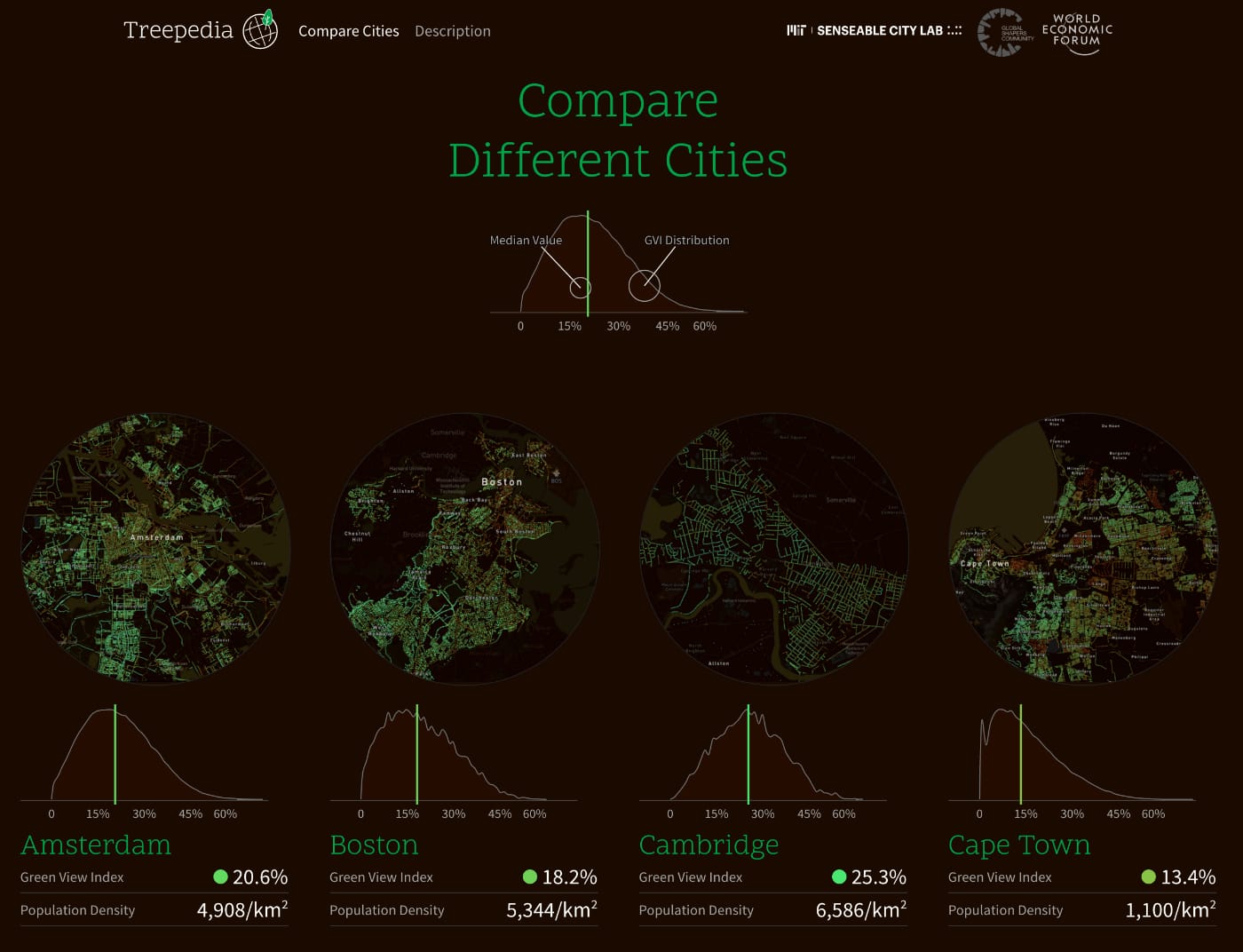
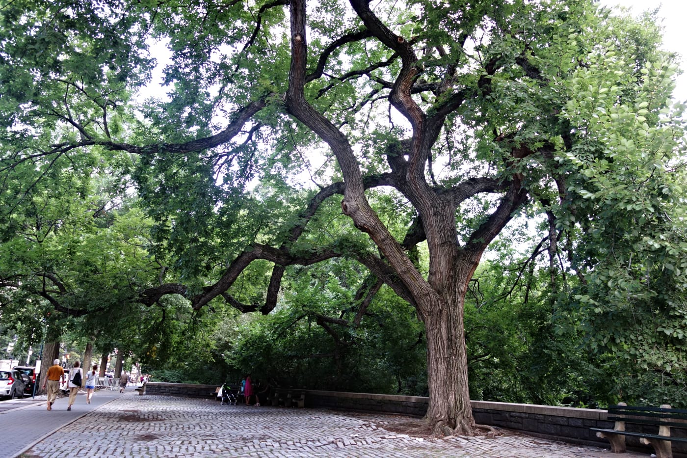
Notably, Treepedia does not map trees from arboretums, botanic gardens, or parks, as it’s accessing the photography of Google Street View. This might seem counterintuitive, but flourishing greenery on neighborhood roads and sidewalks is essential to a healthy city. The preliminary sample of cities includes Amsterdam, London, Cape Town, Tel Aviv, Los Angeles, Frankfurt, New York, Geneva, and both Boston and Cambridge in Massachusetts, where MIT is based. City maps have clickable dots in shades of green and red to indicate the street-level “Green View Index.” The MIT researchers go in-depth on this measure in a paper available for free, and explain it more succinctly on the project site:
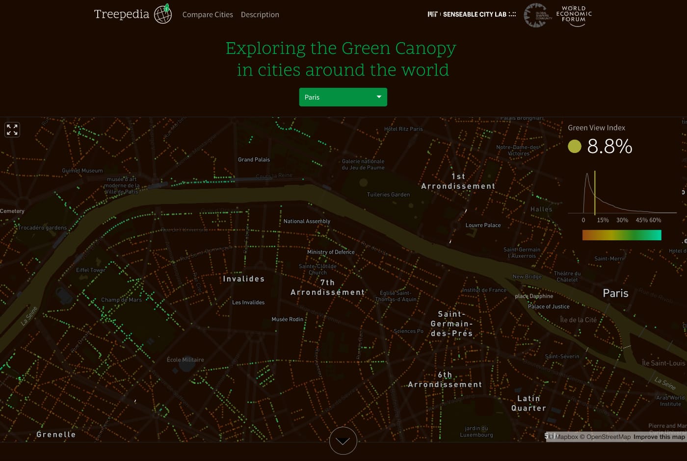
The Green View Index (GVI) was calculated using Google Street View (GSV) panoramas. This method considers the obstruction of tree canopies and classifies the images accordingly. By using GSV rather than satellite imagery, we represent human perception of the environment from the street level. The GVI presented here is on a scale of 0-100, showing the percentage of canopy coverage of a particular location.
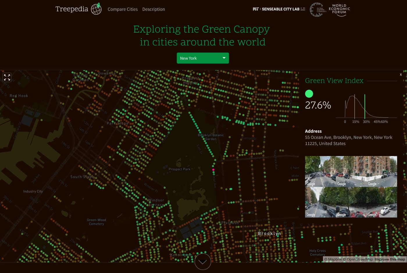
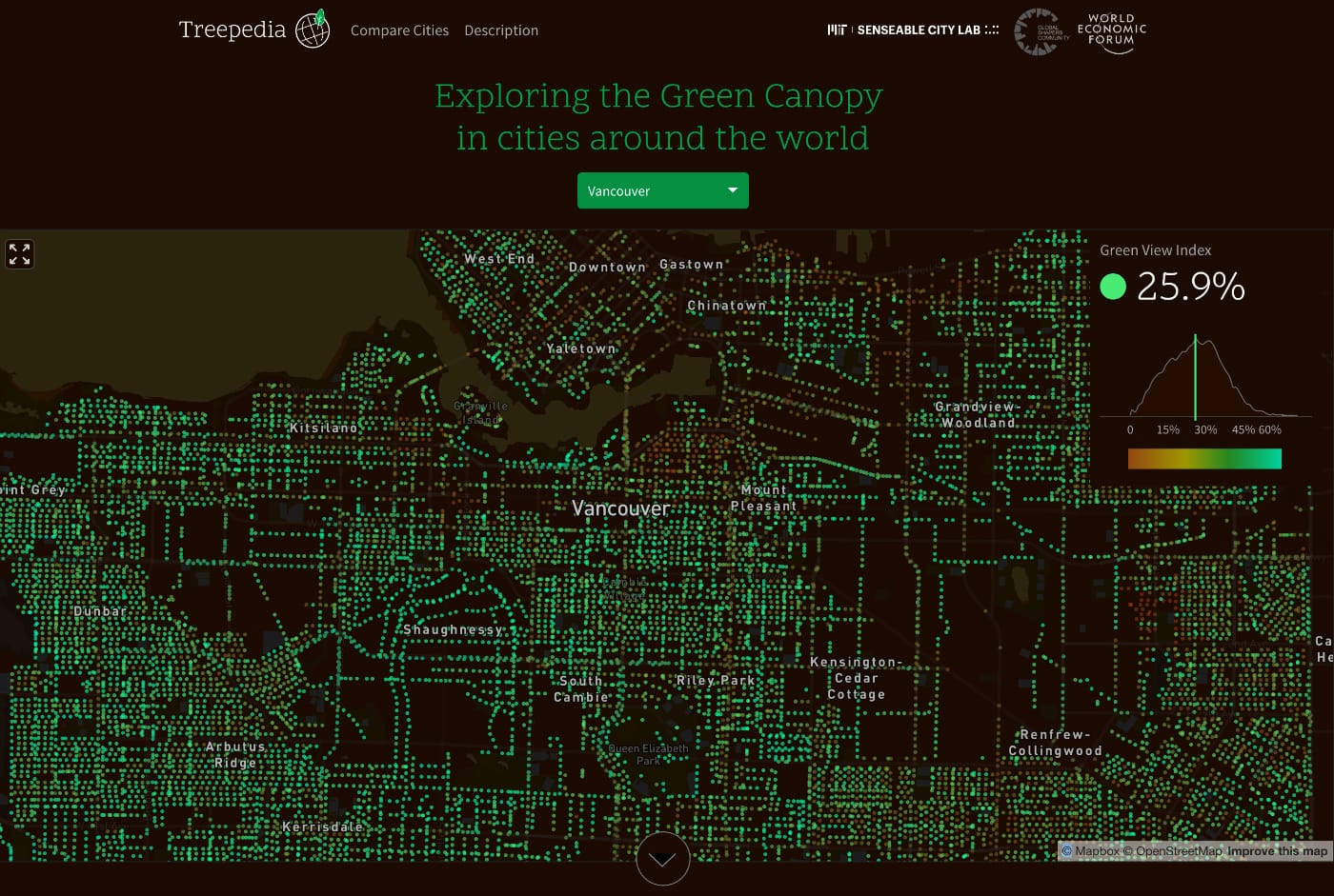
The highest GVI results include Vancouver at 25.9% and Singapore at 29.3%, while among the lowest are Paris at 8.8% and Quito at 10.8%. Navigating the map for New York, which is at 13.5%, there are visible tree voids in dense areas such as Midtown Manhattan, and around development in Williamsburg, where trees are often shrouded by scaffolding.
As an advocacy resource, Treepedia is probably best used as a complement to tools like the NYC Parks New York City Street Tree Map, which also tracks the care and ecological benefits of trees. Yet it’s intriguing as an experiment in visualizing available data in a different way, and in demonstrating how many major cities lack a beneficial tree canopy. Something Treepedia does not directly address is how the data could be used for tree preservation rather than new planting projects (like Million Trees NYC). For instance, Laura Bliss at CityLab reported this month on the loss of trees planted in midcentury Los Angeles suburbs to McMansions, and last month Alison Kinney wrote in the New Yorker on the care needed for even the hardy London plane tree, which thrives on the streets of New York. Recognizing and protecting existing trees is as important as encouraging new cultivation, and more accessible data can reinforce that need.
Access MIT Senseable City Lab’s Treepedia online.