Help the New York Public Library Geotag Enigmatic NYC Photos
The New York Public Library has thousands of historical photographs and illustrations of NYC that you can help geotag with a new tool called "Surveyor."

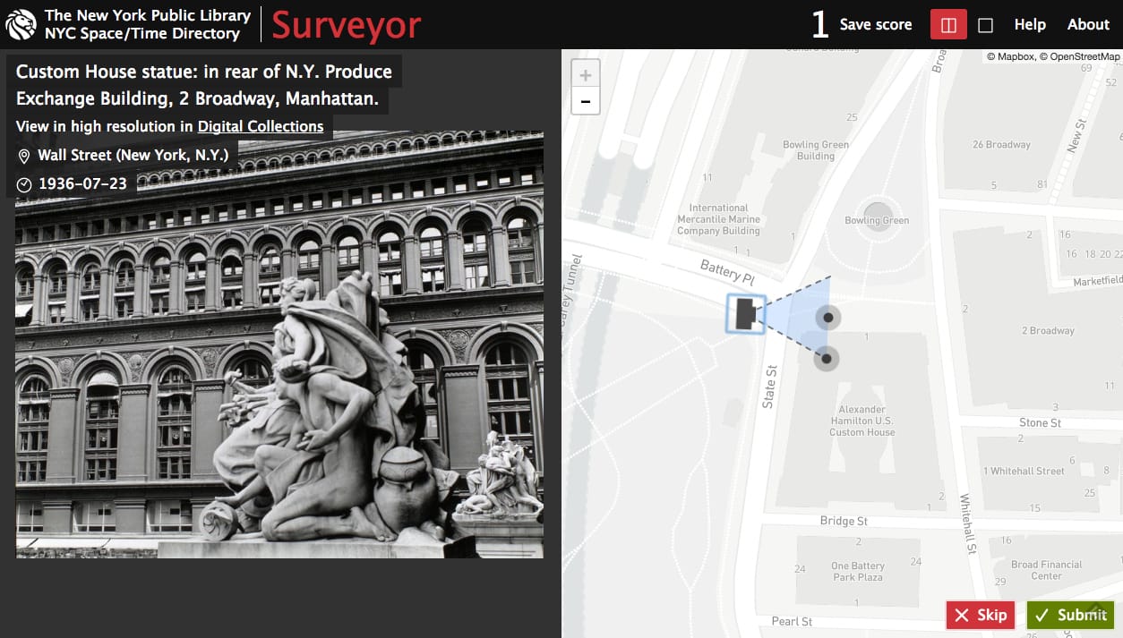
The New York Public Library (NYPL) has thousands of photographs and illustrations of New York City from across the decades, offering a visual timeline of the changing metropolis. Nevertheless, for a large number of these images, titles and descriptions feature no location information, or just the sparest of details, like “Brooklyn, N.Y.” for a photograph of an elevated train, or “New York City park in winter.” The NYC Space/Time Directory launched the Surveyor online tool this month to crowdsource those geotags, as well as deeper information such as the perspective from which a photograph was taken.
“Many of our photographs or drawings don’t really have that accurate information,” Bert Spaan, the Space/Time Directory engineer, told Hyperallergic. He added that he was inspired by Dan Vanderkam’s OldNYC, which used location metadata from titles and text on the backs of images to map thousands of New York City photographs. “We have so many more, and I was looking for ways into all of our photos,” Spaan explained.
As Hyperallergic reported earlier this year, the NYC Space/Time Directory is a two-year project that acts as a “digital time-travel service” for NYPL’s collections of maps and geospatial data. This April, the Space/Time Directory debuted Maps by Decade to plot 5,000 digitized New York City street maps, bringing together georectified maps from the Map Warper, and digitizations from the map collections. Each additional tool further links the NYPL’s materials through space and time, and Spaan said he anticipates ultimately having a way to search all the data through one platform.
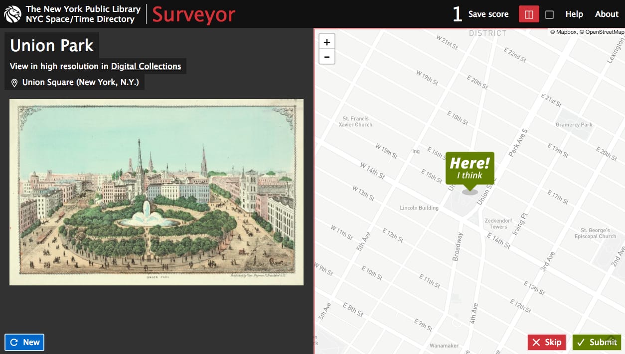
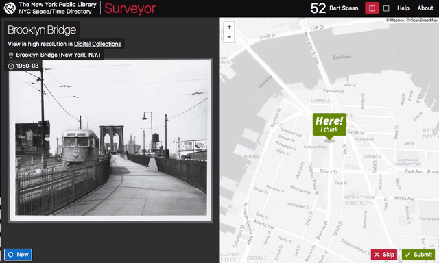
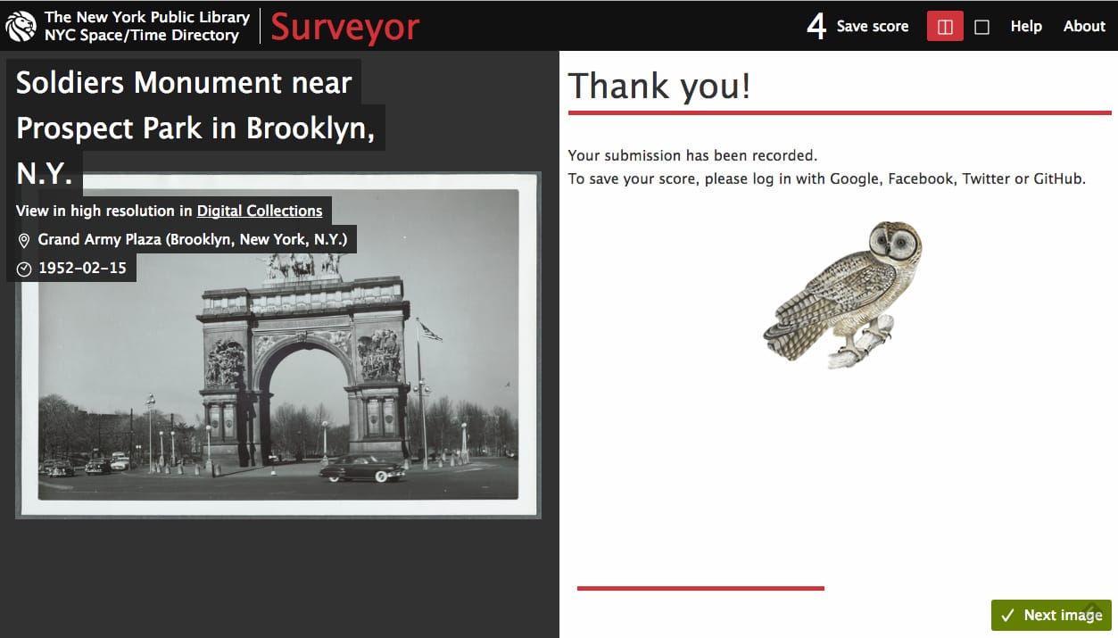
On launching Surveyor, users see a randomly selected image from an initial batch of 2,500 New York views. It’s a tool that’s probably most fun for city buffs, as some of the locales can be obscure or demolished; sometimes the very streets they’re on have been renamed or built over. However, it’s very satisfying to finally recognize a site, even in a decades-old photograph, and be able to match it to the city of the present. After placing a pin on the map, you can choose to adjust a camera for the perceived angle at which the image was captured. When the geotags are submitted, there’s a charming “thank you” from an animated animal sourced from NYPL’s Digital Collections.
Soon, NYPL plans to launch a Chrome extension for Surveyor, so users can see a new image each time they open a tab. Spaan stated that although, at the time of our call, NYPL had only debuted Surveyor a week prior, they already had “500 new locations.” Each location will be verified by several users, but eventually the data is planned to be released to the public, for anyone to use.
The New York Public Library’s Surveyor geotagging tool is available online from the NYPL Space/Time Directory.